geocat.ch
VECTOR25 Primärflächen
VECTOR25 Surfaces primaires
VECTOR25 Superfici primarie
VECTOR25 Primary surfaces
VECTOR25 Surfatschas primaras
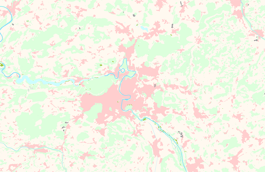
Die Ebene Primärflächen (Abkürzung pri) beschreibt die primäre topografische Bodenbedeckung. Die Flächenarten dieser Ebene schliessen sich gegenseitig aus (See und Wald) und bilden ein redundanzfreies, lückenloses Flächennetz. Im Gegensatz zur Landeskarte sind in den Primärflächen interpretierte Siedlungsgebiete enthalten. Einzelgebäude sind in der Ebene Gebäude verwaltet. Die linienförmigen Objekte dieser Ebene bilden die Grenzen zwischen den Flächen. Sie haben eigenständige Ob-jektarten, welche im Allgemeinen nicht aus den Flächen abgeleitet werden können (Flussufer links - Flussufer rechts, Waldrand - Waldrand offen).
La couche Surfaces primaires (abréviation pri) décrit la couverture du sol. Les différents types de surface de cette couche (lac et forêt) se délimitent réciproquement et forment un réseau de surfaces sans redondance et sans lacune. Contrairement à la Carte nationale, la couche Surfaces primaires présente les zones d'habitation sous la forme de surface (interprétée). Les bâtiments isolés sont proposés en tant que couche thématique séparée. Les objets-lignes de cette couche constituent les limites entre les surfaces. Ils ont des catégories d'objet indépendantes qui ne peuvent en principe pas être dérivés des surfaces (Rive gauche de la rivière, Rive droite de la rivière, Limite de forêt, Limite de forêt ouverte).
Il livello Superfici primarie (abbreviazione pri) descrive il rivestimento topografico primario del suolo. I tipi di superfici di questo livello si escludono vicendevolmente (lago e foresta) e costituiscono una rete di superfici privo di lacune e ridondanze. A differenza della Carta nazionale, nelle superfici primarie sono contenute aree di insediamento interpretate. Gli edifici isolati sono gestiti nel livello Edifici. Gli oggetti lineari di questo livello costituiscono i confini tra le singole superfici. Essi possiedono tipi di oggetti a sé stanti che in genere non possono essere derivati dalle superfici (riva sinistra del fiume - riva destra del fiume - margine della foresta - margine della foresta aperto).
The layer primary surfaces (abbreviation "pri") describes the soil coverage. The types of surfaces are mutually exclusive (lake and forest) and form an explicit and complete area network. As opposed to the National Map, the primary surfaces contain interpreted inhabited areas. Buildings are shown in a separate layer. The linear objects of this layer form the boundaries between the surfaces. They are an individual kind of object which can generally not be deducted from the surface ("river bank left" - "river bank right", "defined forest outline" - "undefined forest outline").
Il plaun Surfatschas primaras (abreviaziun pri) descriva la cuvrida primara dal terren. Ils differents tips da surfatscha da quest plaun s'excludan vicendaivlamain (lai e guaud) e furman ina rait da surfatschas senza redundanzas e senza largias. Cuntrari a la charta naziunala preschenta il plaun Surfatschas primaras ils territoris d'abitadi en furma da surfatschas (interpretadas). Ils edifizis singuls vegnan administrads en il plaun Edifizis. Ils objects en furma da lingias da quest plaun furman ils cunfins tranter las surfatschas. Els han atgnas categorias d'objects che na pon da princip betg vegnir deducidas da las surfatschas (riva dal flum a sanestra – riva dal flum a dretga, ur dal guaud – ur dal guaud avert).
Simple
-
Autre titreAltri nomi o acronimiAlternate titleAlternate titleAlternativtitel
-
Primärflächen VECTOR25
Surfaces primaires VECTOR25
Superfici primarie VECTOR25
Primary surfaces VECTOR25
Surfatschas primaras VECTOR25
-
Date (Publication)Data (Pubblicazione)Date (Publication)Date (Publication)Datum (Publikation)
- 2008-08-31
-
IdentifiantIdentificatoreIdentifierIdentifierKennung
- ch.swisstopo.vec25-primaerflaechen
-
Autres informations de référenceAltre informazioni di riferimentoOther citation detailsOther citation detailsWeitere Referenzinformationen
-
Teil des VECTOR25 Datensatzes
Fait partie du jeux de données VECTOR25
Part of the vECTOR25 Dataset
-
ÉtatStatoStatusStatusBearbeitungsstatus
-
TerminéCompletatoCompletedCompletedAbgeschlossen
Point de contact
Punto di contatto
Point of contact
Point of contact
Ansprechpartner
-
Type de représentation spatialeTipo di rappresentazione spazialeSpatial representation typeSpatial representation typeRäumliche Darstellungsart
-
vecteurVettorialeVectorVectorVektor
Résolution spatiale
Risoluzione spaziale
Spatial resolution
Spatial resolution
Räumliche Auflösung
Fraction représentative
Frazione rappresentativa
Equivalent scale
Equivalent scale
Vergleichsmassstab
-
DénominateurDenominatoreDenominatorDenominatorMassstabszahl
- 25000
-
Catégorie de thèmeCategoria ISOTopic categoryTopic categoryThematik
-
-
A Imagerie, cartes de base et occupation du solA Mappe di base con immagini della copertura terrestreA Imagery base maps earth coverA Imagery base maps earth coverA Oberflächenbeschreibung
-
Étendue
Estensione
Extent
Extent
Ausdehnung
Étendue
Estensione
Extent
Extent
Ausdehnung
-
DescriptionDescrizioneDescriptionDescriptionBeschreibung
-
National Map 1:25'000
Landeskarte 1:25'000
Carte nationale 1:25'000
Carta nazionale 1:25'000
-
Identifiant géographiqueIdentificatore geograficoGeographic identifierGeographic identifierGeografische Kennung
- NM25LK25CN25CN25CN25
))

-
Fréquence de mise à jourFrequenza di aggiornamentoMaintenance and update frequencyMaintenance and update frequencyWartungsintervall
-
Non planifiéeNon pianificatoNot plannedNot plannedNicht geplant
-
NiveauLivelloHierarchy levelHierarchy levelBezugsebene
-
Jeu de donnéesSet di datiDatasetDatasetDatenbestand
-
Remarque sur la mise à jourNota sull'aggiornamentoMaintenance noteMaintenance noteAnmerkung
-
Wird seit 2008 nicht mehr nachgeführt
N’est plus mis à jour depuis 2008
Since 2008 not updated anymore
Format de la ressource
Formato della risorsa
Resource format
Resource format
Format der Ressource
-
TitreTitoloTitleTitleTitel
-
ESRI ArcInfo coverage (COV)
-
DateDataDateDateDatum
- GEMET
-
-
établissement humain
insediamento umano
human settlement
-
bois
bosco
wood
-
végétation
vegetazione
vegetation
-
système d'information géographique
sistema informativo geografico
geographic information system
-
- GEMET - INSPIRE themes, version 1.0
-
-
Occupation des terres
Copertura del suolo
Land cover
-
- geocat.ch
-
-
surface primaire
superficie primaria
primary surface
-
e-geo.ch
e-geo.ch
e-geo.ch
-
SIG (Système d'Information Géographique)
SIG (Sistema Informativo Geografico)
GIS (Geographic Information System)
-
modèle du territoire
modello del territorio
landscape model
-
- geocat.ch
-
-
BGDI Bundesgeodaten-Infrastruktur
IFDG l’Infrastructure Fédérale de données géographiques
IFDG Infrastruttura federale dei dati geografici
FSDI Federal Spatial Data Infrastructure
-
Contraintes sur la ressource
Vincoli sulle risorse
Resource constraints
Resource constraints
Ressourcenbeschränkungen
-
Contraintes d'utilisationVincoli d'usoUse constraintsUse constraintsNutzungseinschränkungen
-
LicenceLicenzaLicenseLicenseLizenz
Ressource associée
Risorsa associata
Associated resource
Associated resource
Verlinkte Ressource
-
Type d'associationTipo di associazioneAssociation TypeAssociation TypeAssoziationstyp
-
Citation de travail plus largeCitazione di un'opera più ampiaReference to a master resource of which this one is a partReference to a master resource of which this one is a partÜbergeordneter Datenbestand
-
Metadata ReferenceRiferimento metadatiMetadata ReferenceMetadata ReferenceMetadatenreferenz
Ressource associée
Risorsa associata
Associated resource
Associated resource
Verlinkte Ressource
-
TitreTitoloTitleTitleTitel
-
VECTOR25 pri
-
Type d'associationTipo di associazioneAssociation TypeAssociation TypeAssoziationstyp
-
Citation de travail plus largeCitazione di un'opera più ampiaReference to a master resource of which this one is a partReference to a master resource of which this one is a partÜbergeordneter Datenbestand
-
LangueLinguaLanguageLanguageSprache
- Deutsch
-
Encodage de caractèresCodifica dei caratteriCharacter encodingCharacter encodingZeichenkodierung
-
Utf8UTF8UTF8UTF8Utf8
-
LangueLinguaLanguageLanguageSprache
- English
-
Encodage de caractèresCodifica dei caratteriCharacter encodingCharacter encodingZeichenkodierung
-
Utf8UTF8UTF8UTF8Utf8
-
Description de l'environnement de travailDescrizione dell'ambiente di lavoroEnvironment descriptionEnvironment descriptionBeschreibung der Arbeitsumgebung
-
ARC/INFO
ARC/INFO
-
Informations supplémentairesInformazioni supplementariSupplemental InformationSupplemental InformationZusätzliche Informationen
-
Die Ebenen Strassennetz, Eisenbahnnetz, Übriger Verkehr, Gewässernetz, Primärflächen, Gebäude, Hecken und Bäume, Anlagen und Einzelobjekte bilden zusammen den Datensatz VECTOR25.
Les couches Réseau routier, Réseau ferroviaire, Autres moyens de transport, Réseau hydrographique, Surfaces primaires, Bâtiments,Haies et arbres isolés, Surfaces aménagées et Objets isolés forment ensemble le jeu de données VECTOR25.
The layers Road network, Railway network, Other traffic, Hydrographic network, Primary surfaces, Buildings, Hedges and trees, Functional surfaces and Single objects build together the dataset VECTOR25.
-
Catégorie de sous-thèmeCategoria di sottotemaSubtopic CategorySubtopic CategoryThematische Unterkategorien
-
A1 Cartes de base, modèles de paysageA1 Mappe di base, modelli paesaggisticiA1 Base Maps, Landscape ModelsA1 Base Maps, Landscape ModelsA1 Basiskarten, Landschaftsmodelle
-
Conformité à ISO 19110Conformità alla norma ISO 19110Compliance codeCompliance codeKonformität mit ISO 19110
- 0
-
LangueLinguaLanguageLanguageSprache
- Deutsch
-
LangueLinguaLanguageLanguageSprache
- Français
-
Livré avec jeu de donnéesFornito con set di datiIncluded with datasetIncluded with datasetMit Datensatz geliefert
- 0
-
TitreTitoloTitleTitleTitel
-
VECTOR25 Das digitale Lanschaftsmodell der Schweiz : Produkteinformation
VECTOR25 Le modèle numérique du territoire de la Suisse : Information de produit
-
Date (Publication)Data (Pubblicazione)Date (Publication)Date (Publication)Datum (Publikation)
- 2007-06-01
-
Forme de la présentationForma della presentazionePresentation formPresentation formPräsentationsform
-
Document numériqueDocumento digitaleDigital documentDigital documentDigitales Dokument
-
Format de distributionFormato (codifica)Distribution formatDistribution formatAbgabeformat
-
-
AutoCAD DXF (DXF)
-
ESRI Shapefile (SHP)
-
Options de transfert numérique
Opzioni di trasferimento digitale
Digital transfer options
Digital transfer options
Optionen für die digitale Übertragung
-
Ressource en ligneRisorsa onlineOnLine resourceOnLine resourceOnline
-
Vorschau map.geo.admin.ch
Vorschau map.geo.admin.chAperçu map.geo.admin.chPrevisione map.geo.admin.chPreview map.geo.admin.ch
Options de transfert numérique
Opzioni di trasferimento digitale
Digital transfer options
Digital transfer options
Optionen für die digitale Übertragung
-
Ressource en ligneRisorsa onlineOnLine resourceOnLine resourceOnline
-
ch.swisstopo.vec25-primaerflaechen
WMS-BGDI Dienst, Layer "Primärflächen VECTOR25"Service WMS-IFDG, couche "Surfaces primaires VECTOR25"Servizio WMS-IFDG, strato "Superfici primarie VECTOR25"WMS-FSDI service, layer "Primary surfaces VECTOR25"WMS-BGDI Dienst, Layer "Primärflächen VECTOR25"
Options de transfert numérique
Opzioni di trasferimento digitale
Digital transfer options
Digital transfer options
Optionen für die digitale Übertragung
-
Ressource en ligneRisorsa onlineOnLine resourceOnLine resourceOnline
-
ch.swisstopo.vec25-primaerflaechen
WMTS-BGDI Dienst, Layer "Primärflächen VECTOR25"Service WMTS-IFDG, couche , Layer "Surfaces primaires VECTOR25"Servizio WMTS-IFDG, strato "Superfici primarie VECTOR25"WMTS-FSDI service, layer "Primary surfaces VECTOR25"WMTS-BGDI Dienst, Layer "Primärflächen VECTOR25"
Options de transfert numérique
Opzioni di trasferimento digitale
Digital transfer options
Digital transfer options
Optionen für die digitale Übertragung
Options de transfert numérique
Opzioni di trasferimento digitale
Digital transfer options
Digital transfer options
Optionen für die digitale Übertragung
-
Ressource en ligneRisorsa onlineOnLine resourceOnLine resourceOnline
-
RESTful API von geo.admin.ch
RESTful API von geo.admin.chRESTful API de geo.admin.chRESTful API da geo.admin.chRESTful API from geo.admin.chRESTful API dad geo.admin.ch
-
Généralités sur la provenanceInformazioni generali sulla provenienzaStatementStatementErklärung
-
Inhaltlich und geometrisch auf der Landeskarte 1:25'000 basiert. Lagegenauigkeit: 3-8 M.
Se base sur le contenu et la géométrie de la carte nationale suisse au 1:25'000. Précision de position : 3 - 8 m.
Content and geometry based on the swiss National Map 1:25'000. Geometric precision : 3-8 m.
-
NiveauLivelloHierarchy levelHierarchy levelBezugsebene
-
Jeu de donnéesSet di datiDatasetDatasetDatenbestand
-
Niveau de topologieLivello di topologiaTopology levelTopology levelTopologieebene
-
Topologie de réseau complèteGrafo planare completoFull planar graphFull planar graphVollständige Netzwerktopologie
-
Type d’objet géométriqueTipo di oggetto geometricoGeometric object typeGeometric object typeTyp des geometrischen Objekts
-
PolygoneSuperficieSurfaceSurfacesurface
-
Nombre d’objets géométriquesNumero di oggetti geometriciGeometric object countGeometric object countAnzahl geometrischer Objekte
- 690000
-
Type d’objet géométriqueTipo di oggetto geometricoGeometric object typeGeometric object typeTyp des geometrischen Objekts
-
LigneCurvaCurveCurvecurve
-
Nombre d’objets géométriquesNumero di oggetti geometriciGeometric object countGeometric object countAnzahl geometrischer Objekte
- 1330000
-
Nom du système de référenceNome del sistema di riferimentoReference system identifierReference system identifierName des Referenzsystems
- Content and geometry based on the swiss National Map 1:25'000. Geometric precision : 3-8 m.
-
Fréquence de mise à jourFrequenza di aggiornamentoMaintenance and update frequencyMaintenance and update frequencyWartungsintervall
-
Comme nécessaireSecondo necessitàAs neededAs neededBei Bedarf
Metadata
-
Identifiant des métadonnéesIdentificativo della schedaMetadata identifierMetadata identifierIdentifikator des Metadatensatzes
- fb4c7281-bd58-4aae-b86a-3a73ba82e0aa
-
LangueLinguaLanguageLanguageSprache
- Deutsch
-
Encodage de caractèresCodifica dei caratteriCharacter encodingCharacter encodingZeichenkodierung
-
Utf8UTF8UTF8UTF8Utf8
-
LangueLinguaLanguageLanguageSprache
- Français
-
Encodage de caractèresCodifica dei caratteriCharacter encodingCharacter encodingZeichenkodierung
-
Utf8UTF8UTF8UTF8Utf8
-
LangueLinguaLanguageLanguageSprache
- Italiano
-
Encodage de caractèresCodifica dei caratteriCharacter encodingCharacter encodingZeichenkodierung
-
Utf8UTF8UTF8UTF8Utf8
-
LangueLinguaLanguageLanguageSprache
- English
-
Encodage de caractèresCodifica dei caratteriCharacter encodingCharacter encodingZeichenkodierung
-
Utf8UTF8UTF8UTF8Utf8
-
LangueLinguaLanguageLanguageSprache
- Rumantsch
-
Encodage de caractèresCodifica dei caratteriCharacter encodingCharacter encodingZeichenkodierung
-
Utf8UTF8UTF8UTF8Utf8
Point de contact
Punto di contatto
Point of contact
Point of contact
Ansprechpartner
-
Heures de serviceOrario di servizioHours of serviceHours of serviceBetriebszeiten
-
08h30 - 11h00 / 14h00 - 16h00 GMT+1
Type de ressource
Tipo di risorsa
Type of resource
Type of resource
Anwendungsbereich der Metadaten
-
Domaine d'application de la ressourceAmbito di applicazione della risorsaResource scopeResource scopeDomäne der Ressourcenanwendung
-
Jeu de donnéesSet di datiDatasetDatasetDatenbestand
-
NomNomeNameNameName
-
Layer
-
Lien vers la métadonnéeCollegamento ai metadatiMetadata linkageMetadata linkageLink zu den Metadaten
-
Informations de date (Création)Informazioni sulla data (Creazione)Date info (Creation)Date info (Creation)Datumsangaben (Erstellung)
- 2007-12-17T12:00:00Z
-
Informations de date (Révision)Informazioni sulla data (Revisione)Date info (Revision)Date info (Revision)Datumsangaben (Aktualisierung)
- 2026-04-13T09:17:41.399639Z
Norme des métadonnées
Standard dei metadati
Metadata standard
Metadata standard
Metadatenstandard
-
TitreTitoloTitleTitleTitel
-
eCH-0271