geocat.ch
swisstopo Web Access Terrain 3D Service
swisstopo Web Access Terrain 3D Service
swisstopo Web Access Terrain 3D Service
swisstopo Web Access Terrain 3D Service
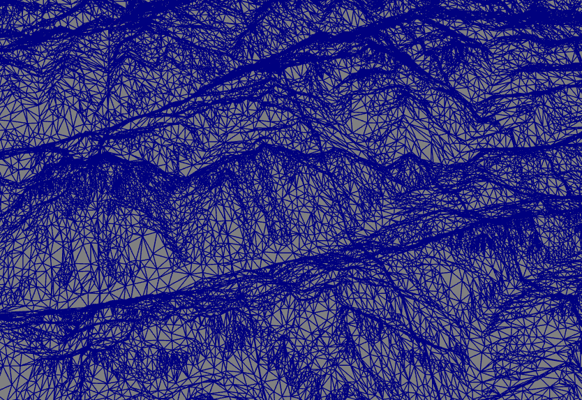
swisstopo Web Access Terrain 3D Service fournit une représentation 3D de la topographie de la Suisse et de ses zones limitrophes sans la végétation et les constructions hors sol. Il est issu de la combinaison de differentes données (swissALTI3D, swissTLM3D et swissALTIRegio).
swisstopo Web Access Terrain 3D Service stellt eine 3D-Darstellung der Topografie der Schweiz sowie des grenznahen Auslandes ohne Vegetation und Bebauung zur Verfügung. Er setzt sich durch die Kombination verschiedener Datensätze zusammen (swissALTI3D, swissTLM3D et swissALTIRegio).
swisstopo Web Access Terrain 3D Service fornisce una rappresentazione in 3D della topografia della Svizzera e delle sue zone limitrofe. Si tratta di una rappresentazione senza vegetazione e senza costruzioni che viene estrapolata dalla combinazione di diversi dati (swissALTI3D, swissTLM3d e swissALTIRegio).
swisstopo Web Access Terrain 3D Service provides a 3D representation of the topography of Switzerland as well as of the bordering countries without vegetation and built-up areas. It is composed by combining different data sets (swissALTI3D, swissTLM3D et swissALTIRegio).
Simple
-
AlternativtitelAltri nomi o acronimiAlternate titleAutre titre
-
Relief en 3D
Relief in 3D
Rilievo in 3D
Relief in 3D
-
Datum (Erstellung)Data (Creazione)Date (Creation)Date (Création)
- 2015-10-30
-
Datum (Aktualisierung)Data (Revisione)Date (Revision)Date (Révision)
- 2025-05-01
-
KennungIdentificatoreIdentifierIdentifiant
- ch.swisstopo.terrain.3d
Ansprechpartner
Punto di contatto
Point of contact
Point de contact
Verteiler
Distributore
Distributor
Distributeur
Ausdehnung
Estensione
Extent
Étendue
Ausdehnung
Estensione
Extent
Étendue
-
Geografische KennungIdentificatore geograficoGeographic identifierIdentifiant géographique
- MNT

-
WartungsintervallFrequenza di aggiornamentoMaintenance and update frequencyFréquence de mise à jour
-
UnbekanntSconosciutoUnknownInconnue
- GEMET
-
-
INSPIRE
INSPIRE
Infrastructure for spatial information in Europe
-
- GEMET
-
-
Online-Dienst
servizi online
on-line service
-
- geocat.ch
-
-
3D Simulation
simulazione 3D
3D simulation
-
BGDI Bundesgeodaten-Infrastruktur
IFDG Infrastruttura federale dei dati geografici
FSDI Federal Spatial Data Infrastructure
-
Geobasisdaten
geodati di base
official geodata
-
3D Visualisierung
visualizzazione 3D
3D visualisation
-
Geobasisdienst
geoservizio di base
official geoservice
-
opendata.swiss
opendata.swiss
opendata.swiss
-
Ressourcenbeschränkungen
Vincoli sulle risorse
Resource constraints
Contraintes sur la ressource
-
Andere EinschränkungenAltri vincoliOther constraintsAutres contraintes
- Opendata BY: Utilisation libre. Obligation d’indiquer la source.Opendata BY: Freie Nutzung. Quellenangabe ist Pflicht.Opendata BY: Libero utilizzo. Indicazione della fonte obbligatoria.Opendata BY: Open use. Must provide the source.
Verlinkte Ressource
Risorsa associata
Associated resource
Ressource associée
-
AssoziationstypTipo di associazioneAssociation TypeType d'association
-
Übergeordneter DatenbestandCitazione di un'opera più ampiaReference to a master resource of which this one is a partCitation de travail plus large
-
MetadatenreferenzRiferimento metadatiMetadata ReferenceMetadata Reference
Verlinkte Ressource
Risorsa associata
Associated resource
Ressource associée
-
TitelTitoloTitleTitre
-
Données altimétriques (mensuration nationale)
Höhendaten (Landesvermessung)
Dati altimetrici (misurazione nazionale)
Height data (national survey)
-
AssoziationstypTipo di associazioneAssociation TypeType d'association
-
Übergeordneter DatenbestandCitazione di un'opera più ampiaReference to a master resource of which this one is a partCitation de travail plus large
-
Version des DienstesVersione del tipo di servizioService VersionVersion du type de service
-
1.0
-
KopplungstypTipo di accoppiamentoCoupling TypeType de couplage
-
FestStrettoTightReserré
Operationen
Operazioni
Contains Operations
Opérations
-
Name der OperationNome dell'operazioneOperation NameNom de l’opération
-
GetCapabilities
-
DistributionsplattformPiattaforme di calcolo distribuiteDistributed computing platform (DCP)Plateformes de calcul distribuées
-
WebdienstServizi WebWebServicesWebServices
Operationen
Operazioni
Contains Operations
Opérations
-
Name der OperationNome dell'operazioneOperation NameNom de l’opération
-
Metadata Service
-
DistributionsplattformPiattaforme di calcolo distribuiteDistributed computing platform (DCP)Plateformes de calcul distribuées
-
WebdienstServizi WebWebServicesWebServices
-
AbgabeformatFormato (codifica)Distribution formatFormat de distribution
-
-
quantized-mesh
-
Optionen für die digitale Übertragung
Opzioni di trasferimento digitale
Digital transfer options
Options de transfert numérique
-
OnlineRisorsa onlineOnLine resourceRessource en ligne
-
Aperçu map.geo.admin.ch
Aperçu map.geo.admin.chVorschau map.geo.admin.chPrevisione map.geo.admin.chPreview map.geo.admin.ch
Optionen für die digitale Übertragung
Opzioni di trasferimento digitale
Digital transfer options
Options de transfert numérique
-
OnlineRisorsa onlineOnLine resourceRessource en ligne
-
Description
Optionen für die digitale Übertragung
Opzioni di trasferimento digitale
Digital transfer options
Options de transfert numérique
-
OnlineRisorsa onlineOnLine resourceRessource en ligne
-
Name des ReferenzsystemsNome del sistema di riferimentoReference system identifierNom du système de référence
- http://www.opengis.net/def/crs/EPSG/0/4326
Metadata
-
Identifikator des MetadatensatzesIdentificativo della schedaMetadata identifierIdentifiant des métadonnées
- d92cac20-8741-49f5-b7d0-86f8db506e55
-
SpracheLinguaLanguageLangue
- Français
-
ZeichenkodierungCodifica dei caratteriCharacter encodingEncodage de caractères
-
Utf8UTF8UTF8Utf8
-
SpracheLinguaLanguageLangue
- Deutsch
-
ZeichenkodierungCodifica dei caratteriCharacter encodingEncodage de caractères
-
Utf8UTF8UTF8Utf8
-
SpracheLinguaLanguageLangue
- Italiano
-
ZeichenkodierungCodifica dei caratteriCharacter encodingEncodage de caractères
-
Utf8UTF8UTF8Utf8
-
SpracheLinguaLanguageLangue
- English
-
ZeichenkodierungCodifica dei caratteriCharacter encodingEncodage de caractères
-
Utf8UTF8UTF8Utf8
Ansprechpartner
Punto di contatto
Point of contact
Point de contact
-
BetriebszeitenOrario di servizioHours of serviceHeures de service
-
08h30 - 11h00 / 14h00 - 16h00 GMT+1
Anwendungsbereich der Metadaten
Tipo di risorsa
Type of resource
Type de ressource
-
Domäne der RessourcenanwendungAmbito di applicazione della risorsaResource scopeDomaine d'application de la ressource
-
DienstServizioServiceService
-
NameNomeNameNom
-
Service
-
Link zu den MetadatenCollegamento ai metadatiMetadata linkageLien vers la métadonnée
-
https://www.geocat.ch/geonetwork/srv/api/records/d92cac20-8741-49f5-b7d0-86f8db506e55
-
Datumsangaben (Erstellung)Informazioni sulla data (Creazione)Date info (Creation)Informations de date (Création)
- 2021-07-05T14:13:48Z
-
Datumsangaben (Aktualisierung)Informazioni sulla data (Revisione)Date info (Revision)Informations de date (Révision)
- 2026-04-13T09:17:45.504639Z
Metadatenstandard
Standard dei metadati
Metadata standard
Norme des métadonnées
-
TitelTitoloTitleTitre
-
GM03_2
-
AusgabeEdizioneEditionÉdition
-
1.0