geocat.ch
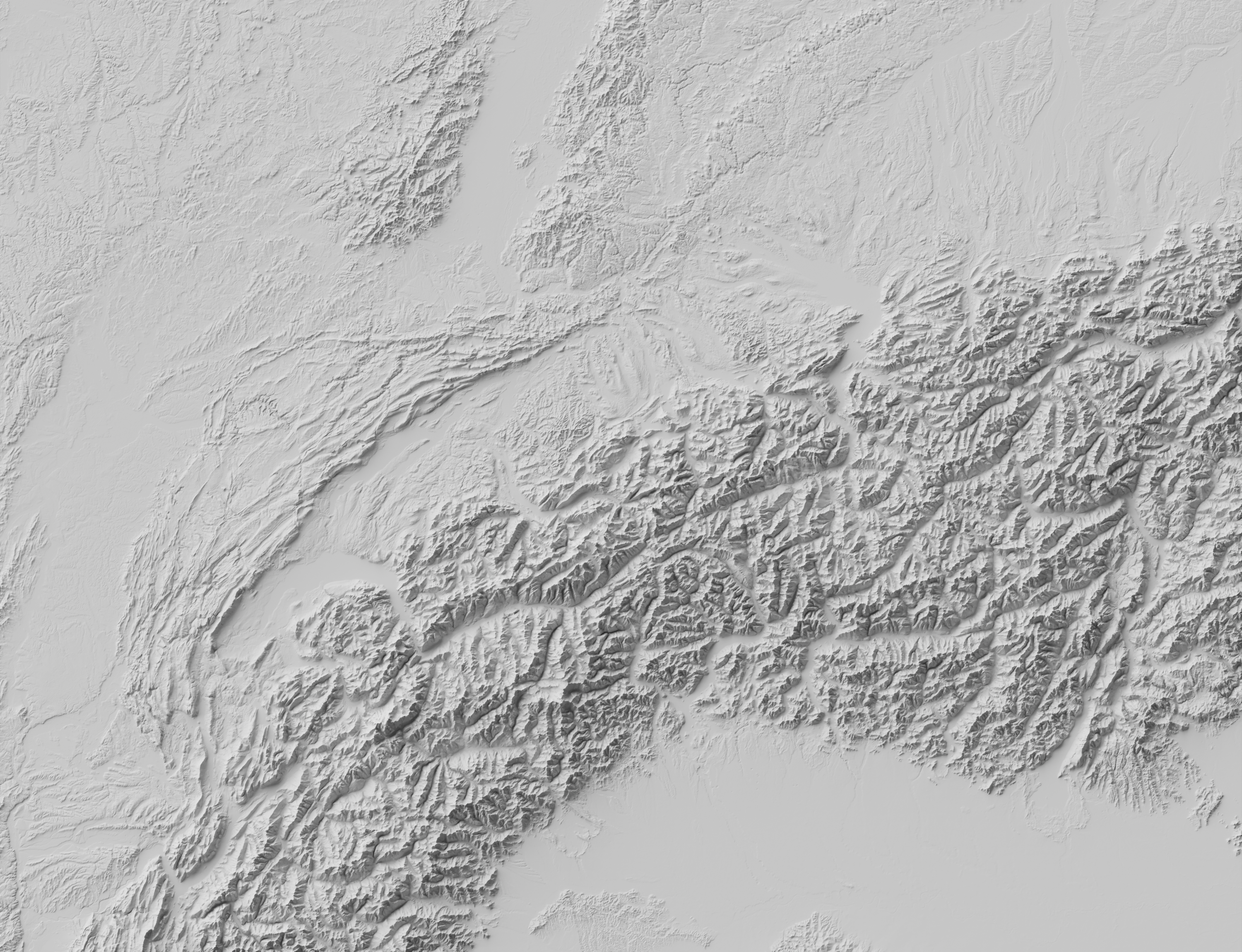
swissALTIRegio
swissALTIRegio is a medium-resolution digital terrain model (10m). It describes the surface without vegetation and buildings. Switzerland and the Principality of Liechtenstein, as well as parts of the neighbouring countries of France, Italy, Austria and Germany are included in the data set. Updates within Switzerland and the Principality of Liechtenstein are carried out annually, while the other areas are updated when source data is available.
Simple
- Date (Creation)
- 2023-11-30T12:00:00+02:00
- Date (Revision)
- 2023-11-30T12:01:00+02:00
- Identifier
- ??
Point of contact
Owner
- Spatial representation type
- Grid
Spatial resolution
- Spatial resolution
- 10 m
- Topic category
-
- C Elevation
Extent
Extent
- Description
-
swissALTIRegio
))

- Maintenance and update frequency
- Annually
- Maintenance note
-
The data within the Swiss national border is updated annually with the latest version of swissALTI3D. In neighbouring countries, updates are carried out when new elevation data of uniform quality is available over a sufficiently large area.
- Duration of Conservation
- 275
- Appraisal of Archival Value
- A
- Reason for Archiving Value
- Evidence of business practice
- GEMET
-
-
laser
-
geographic information system
-
digital land model
-
- geocat.ch
-
-
LIDAR (Light Detection And Ranging)
-
DEM (digital elevation model)
-
3D visualisation
-
3D simulation
-
GIS (Geographic Information System)
-
official geodata
-
laserscanning
-
FSDI Federal Spatial Data Infrastructure
-
opendata.swiss
-
Conservation and archiving planning AAP - Confederation
-
Resource constraints
- Other constraints
- Opendata BY: Open use. Must provide the source.
Associated resource
- Title
-
Höhendaten (Landesvermessung)
- Association Type
- Reference to a master resource of which this one is a part
- Language
- Deutsch
- Character encoding
- UTF8
- Language
- English
- Character encoding
- UTF8
- Basic Geodata
- true
- Basic Geodata ID
-
41.6
- Basic Geodata Legal Level
- Federal
- Basic Geodata Type
- Reference Geodata
- Distribution format
-
-
GeoTIFF (GEOTIFF)
-
GRID ASCII (XYZ)
-
Digital transfer options
- OnLine resource
-
swissALTIRegio
Product information and download
Digital transfer options
- OnLine resource
-
map.geo.admin.ch
Digital transfer options
- OnLine resource
- Hierarchy level
- Dataset
- Hierarchy level
- Dataset
- Number of dimensions
- 3
- Cell geometry
- Point
- Transformation parameter availability
- 1
- Reference system identifier
- EPSG:2056
Metadata
- Metadata identifier
- f7f058e9-288b-4c55-8f4e-6360880dbb59
- Language
- Deutsch
- Character encoding
- UTF8
- Language
- Français
- Character encoding
- UTF8
- Language
- Italiano
- Character encoding
- UTF8
- Language
- English
- Character encoding
- UTF8
Point of contact
Type of resource
- Resource scope
- Dataset
- Metadata linkage
-
https://www.geocat.ch/geonetwork/srv/api/records/f7f058e9-288b-4c55-8f4e-6360880dbb59
- Date info (Creation)
- 2023-10-23T13:47:55.012Z
- Date info (Revision)
- 2026-04-13T09:25:18.409189Z
Metadata standard
- Title
-
GM03 2+