geocat.ch
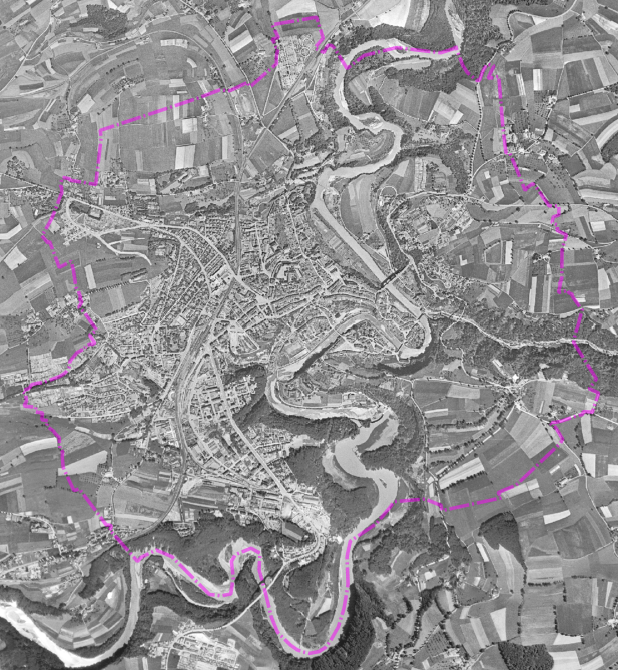
Orthophoto SWISSIMAGE HIST 1946 - Ville de Fribourg
Cette orthophoto historique, issue d'un survol aérien réalisé par les forces américaines en 1946, est mise à disposition par swisstopo via un service WMS.
Elle offre une vue précieuse du territoire à cette époque.
Simple
- Date (Creation)
- 2025-04-28
Owner
- Topic category
-
- A Imagery base maps earth cover
Extent
Extent
- Description
-
Fribourg
N
S
E
W
))

- Maintenance and update frequency
- Unknown
- geocat.ch
-
-
WMS
-
orthophoto
-
- Language
- Français
- Subtopic Category
- A3 Aerial and Satellite Imagery
- Distribution format
-
-
nan
-
Digital transfer options
- OnLine resource
-
Guichet cartographique de la Ville de Fribourg
Digital transfer options
- OnLine resource
-
Guichet intranet de la Ville de Fribourg
Accès privé
- Reference system identifier
- CH1903+/MN95
Metadata
- Metadata identifier
- f7c9a0f5-a1a2-4795-9fdf-a9f85b11d517
- Language
- Français
- Language
- Deutsch
Point of contact
- Metadata linkage
-
https://www.geocat.ch/geonetwork/srv/api/records/f7c9a0f5-a1a2-4795-9fdf-a9f85b11d517
- Date info (Creation)
- 2025-04-28T05:10:45.39Z
- Date info (Revision)
- 2026-06-08T11:11:55.828705Z
Metadata standard
- Title
-
ISO 19115-3