 geocat.ch
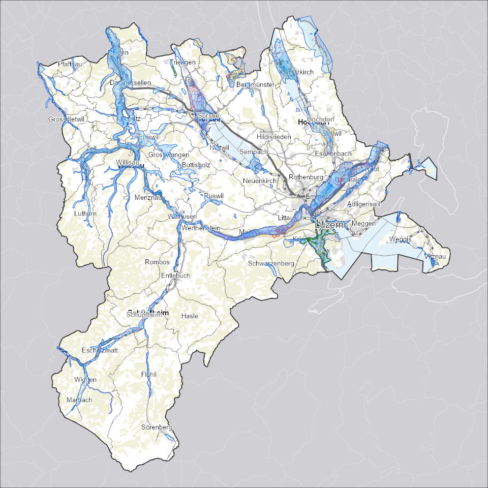
Grundwasservorkommen
zeigt die nutzbaren Grundwasservorkommen, die oberirdischen Gewässer und Uferbereiche, die mittleren Grundwasserspiegel und die Mächtigkeit des Grundwassers.
Simple
- Alternate title
-
GRWASXXX_COL
- Date (Creation)
- 2025-08-14
- Presentation form
- Digital map
- Purpose
-
Im Reusstal, zwischen Emmenbrücke und der Grenze zum Kanton Aargau, befindet sich das bedeutendste Grundwasservorkommen des Kantons Luzern. Hier werden jährlich 18 Mio. Kubikmeter Wasser zu Trink- und Brauchwasserzwecken gefördert. Das Grundwasservorkommen im Wigger- und Lutherntal ist das zweitgrösste im Kanton Luzern. Jährlich werden dort 1.8 Mio. Kubikmeter Wasser gefördert.Im Tal der Kleinen Emme werden jährlich 4.6 Mio. Kubikmeter Grundwasser zu Trink- und Brauchwasserzwecken gefördert, über die Hälfte davon von der Stadt Luzern und rund 20 Prozent von der Industrie.
- Status
- On going
Publisher
Owner
- Spatial representation type
- undefined
- Topic category
-
- I Inland waters
Extent
Extent
- Description
-
Kanton Luzern
))
- Maintenance and update frequency
- As needed
- geocat.ch
-
-
opendata.swiss
-
Gewässerschutz
-
Grundwasser
-
Hydrologie
-
Resource constraints
- Access constraints
- none
- Use constraints
- Copyright
Resource constraints
- Use limitation
-
öffentlich zugängliche Geobasisdaten
Resource constraints
- Access constraints
- none
- Use constraints
- none
Resource constraints
- Use limitation
-
Freie Nutzung. Quellenangabe ist Pflicht
Associated resource
- Association Type
- Reference to a master resource of which this one is a part
- Metadata Reference
Associated resource
- Association Type
- Reference to a master resource of which this one is a part
- Metadata Reference
Associated resource
- Association Type
- Reference to a master resource of which this one is a part
- Metadata Reference
Associated resource
- Association Type
- Reference to a master resource of which this one is a part
- Metadata Reference
Associated resource
- Association Type
- Reference to a master resource of which this one is a part
- Metadata Reference
Associated resource
- Association Type
- Reference to a master resource of which this one is a part
- Metadata Reference
Associated resource
- Association Type
- Reference to a master resource of which this one is a part
- Metadata Reference
Associated resource
- Association Type
- Reference to a master resource of which this one is a part
- Metadata Reference
Associated resource
- Association Type
- Reference to a master resource of which this one is a part
- Metadata Reference
Associated resource
- Association Type
- Reference to a master resource of which this one is a part
- Metadata Reference
- Distribution format
-
-
ESRI Geodatabase (.gdb)
-
ESRI Shapefile (.shp)
-
OGC GeoPackage (.gpkg)
-
Point of contact
Digital transfer options
- OnLine resource
-
Datenshop
Produktansicht Geodatenshop
- Statement
-
unbekannt
- Reference system identifier
- EPSG:2056
- Maintenance and update frequency
- As needed
Metadata
- Metadata identifier
- f5abeba3-b87f-4914-a895-e41f63b46ef3
- Language
- Deutsch
- Character encoding
- UTF-8
Point of contact
Type of resource
- Resource scope
- Dataset
- Metadata linkage
-
https://www.geocat.ch/geonetwork/srv/api/records/f5abeba3-b87f-4914-a895-e41f63b46ef3
- Date info (Creation)
- 2024-04-18
- Date info (Revision)
- 2026-06-19T03:29:19.446428Z
Metadata standard
- Title
-
ISO19115.3-2018.che
)))