geocat.ch
swissTLMRegio Hydrography
swissTLMRegio Hydrography
Idrologia swissTLMRegio
swissTLMRegio Hydrography
swissTLMRegio Hydrography
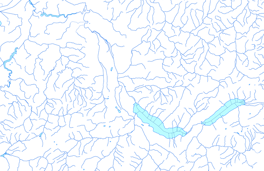
Der Topic Hydrography beschreibt die verschiedenen Elemente der Gewässer. Er besteht aus 6 Feature Classes und einer Tabelle. Die Linien von "FlowingWater" und "StagnantWater" und die Punkte von "GWK_FW_Node" sind durch eine so genannte Kanten-Knoten Struktur topologisch miteinander verknüpft. Kanten (Linien) sind durch Knoten (Punkte) miteinander verbunden. Jede Kante hat somit genau zwei Knoten an den Endpunkten. Kanten und Knoten bauen zusammen ein geometrisches Netzwerk. In Zusammenarbeit mit dem Bundesamt für Umwelt (BAFU) wurden die Knoten und Kanten auf dem Gebiet der Schweiz gemäss GEWISS (Gewässerinformationssystem der Schweiz) strukturiert und adressiert. Zu diesem Zweck wurden die so genannten GEWISS-Attribute eingeführt In diesem Topic ist eine Feature Class mit Informationen über Wasserfälle, Schleusen und weitere Objekte integriert.
Le Topic Hydrography contient les différents éléments en rapport avec les eaux. Il comprend six feature classes et une table. Les lignes de "FlowingWater" et "StagnantWater" et les points de "GWK_FW_Node" sont liés topologiquement selon une structure de type arcs – noeuds, dans laquelle les arcs (lignes) sont reliés entre eux par des noeuds (points). Chaque arc a ainsi exactement deux noeuds, un par extrémité. Les arcs et les noeuds forment ensemble un réseau géométrique. En collaboration avec l'Office fédéral de l’environnement (OFEV), les noeuds et les arcs situés en Suisse ont été structurés et adressés selon GEWISS (système d'information suisse des eaux). A cette fin, les ainsi nommés Attributs-GEWISS ont été intégrés. Une feature class de point contenant des informations sur les chutes d’eau, les écluses et divers autres objets situés le long des cours d’eau est intégrée dans ce topic.
Il topic Hydrography descrive i diversi elementi relativi ai corsi d'acqua. È composto da 6 feature class e da una tabella. Le linee di "FlowingWater" e "StagnantWater" e i punti di "GWK_FW_Node" sono collegate topologicamente tra loro attraverso una cosiddetta struttura di tipo archi - nodi, in cui gli archi (linee) sono legati tra loro da nodi (punti). Ogni arco possiede dunque esattamente due nodi alle proprie estremità. Archi e nodi compongono insieme una rete geometrica. In collaborazione con l'Ufficio federale dell'ambiente, i nodi e gli archi sono stati strutturati e indirizzati secondo GEWISS (Sistema d'informazione sulle acque in Svizzera) per tutto il territorio svizzero. A questo scopo sono stati introdotti i cosiddetti attributi GEWISS. In questo topic è integrata una feature class con informazioni relative a cascate, chiuse e altri oggetti.
The topic Hydrography contains the different features connected to water. It consists of 6 feature classes and one table. The lines of "FlowingWater" and "StagnantWater" and the points of "GWK_FW_Node" are connected with each other according to a so called edge-node structure. Edges (lines) are connected to each other with nodes (points). Every edge has therefore exactly two nodes at its end. Edges and Nodes together build a geometric network. In collaboration with the Federal Office for Water and Geology (BWG), the edges and nodes in Switzerland were structured and addressed according to GEWISS (the Swiss Water Information System). For this reason, the so called GEWISS-Attributes were integrated. A Feature Class with information on waterfalls, locks and other objects was integrated into this topic.
Il topic Hydrography cuntegna ils differents elements da las auas. El consista da 6 feature classes e d'ina tabella. Las lingias da "FlowingWater" e da "StagnantWater" ed ils puncts da "GWK_FW_Node" èn colliads topologicamain in cun l'auter tenor ina structura d'artgs e nufs, en la quala ils artgs (lingias) èn liads in cun l'auter tras nufs (puncts). Mintga artg ha pia exactamain dus nufs a sias fins. Ils artgs ed ils nufs furman ensemen ina rait geometrica. En collavuraziun cun l'Uffizi federal d'ambient (UFAM) èn ils nufs ed ils artgs en Svizra vegnids structurads ed adressads tenor GEWISS (sistem d'infurmaziun svizzer da las auas). Per quest intent èn vegnids introducids ils uschenumnads attributs GEWISS. Ina feature class che cuntegna infurmaziuns davart las cascadas, las sclusas ed ulteriurs objects è integrada en quest topic.
Simple
-
Autre titreAltri nomi o acronimiAlternate titleAlternate titleAlternativtitel
-
Gewässernetz swissTLMRegio
Hydrologie swissTLMRegio
Idrologia swissTLMRegio
Hydrology swissTLMRegio
Idrologia swissTLMRegio
-
Date (Publication)Data (Pubblicazione)Date (Publication)Date (Publication)Datum (Publikation)
- 2012-02-24
-
Date (Révision)Data (Revisione)Date (Revision)Date (Revision)Datum (Aktualisierung)
- 2025-12-02
-
IdentifiantIdentificatoreIdentifierIdentifierKennung
- ch.swisstopo.vec200-hydrography
-
Autres informations de référenceAltre informazioni di riferimentoOther citation detailsOther citation detailsWeitere Referenzinformationen
-
Teil des swissTLMRegio Datensatzes
Fait partie du jeu de données swissTLMRegio
Part of the swissTLMRegio dataset
-
ÉtatStatoStatusStatusBearbeitungsstatus
-
TerminéCompletatoCompletedCompletedAbgeschlossen
Point de contact
Punto di contatto
Point of contact
Point of contact
Ansprechpartner
-
Type de représentation spatialeTipo di rappresentazione spazialeSpatial representation typeSpatial representation typeRäumliche Darstellungsart
-
vecteurVettorialeVectorVectorVektor
Résolution spatiale
Risoluzione spaziale
Spatial resolution
Spatial resolution
Räumliche Auflösung
Fraction représentative
Frazione rappresentativa
Equivalent scale
Equivalent scale
Vergleichsmassstab
-
DénominateurDenominatoreDenominatorDenominatorMassstabszahl
- 200000
-
Catégorie de thèmeCategoria ISOTopic categoryTopic categoryThematik
-
-
I Eaux intérieuresI Acque interneI Inland watersI Inland watersI Binnengewässer
-
Étendue
Estensione
Extent
Extent
Ausdehnung
Étendue
Estensione
Extent
Extent
Ausdehnung
-
DescriptionDescrizioneDescriptionDescriptionBeschreibung
-
swissTLMRegio
swissTLMRegio
swissTLMRegio
swissTLMRegio
Identifiant
Identificativo
Identifier
Identifier
Identifikator
-
CodeCodiceCodeCodeCode
))

-
Fréquence de mise à jourFrequenza di aggiornamentoMaintenance and update frequencyMaintenance and update frequencyWartungsintervall
-
AnnuelleAnnualmenteAnnuallyAnnuallyJährlich
-
NiveauLivelloHierarchy levelHierarchy levelBezugsebene
-
Jeu de donnéesSet di datiDatasetDatasetDatenbestand
- geocat.ch
-
-
SIG (Système d'Information Géographique)
SIG (Sistema Informativo Geografico)
GIS (Geographic Information System)
-
- geocat.ch
-
-
rivière
fiume
river
-
- geocat.ch
-
-
modèle du territoire
modello del territorio
landscape model
-
- geocat.ch
-
-
opendata.swiss
opendata.swiss
opendata.swiss
opendata.swiss
-
- GEMET - INSPIRE themes, version 1.0
-
-
Hydrographie
Idrografia
Hydrography
-
Dénominations géographiques
Nomi geografici
Geographical names
-
- GEMET
-
-
eaux (géographie)
acque (geografia)
water (geographic)
-
berge
argine
bank (land)
-
- GEMET
-
-
système d'information géographique
sistema informativo geografico
geographic information system
-
- GEMET
-
-
lac
lago
lake
-
- GEMET
-
-
ruisseau
ruscello
brook
-
- geocat.ch
-
-
BGDI Bundesgeodaten-Infrastruktur
IFDG l’Infrastructure Fédérale de données géographiques
IFDG Infrastruttura federale dei dati geografici
FSDI Federal Spatial Data Infrastructure
-
- GEMET
-
-
Nomenklatur
nomenclature
nomenclatura
nomenclature
-
Ressource associée
Risorsa associata
Associated resource
Associated resource
Verlinkte Ressource
-
Type d'associationTipo di associazioneAssociation TypeAssociation TypeAssoziationstyp
-
Citation de travail plus largeCitazione di un'opera più ampiaReference to a master resource of which this one is a partReference to a master resource of which this one is a partÜbergeordneter Datenbestand
-
Metadata ReferenceRiferimento metadatiMetadata ReferenceMetadata ReferenceMetadatenreferenz
Ressource associée
Risorsa associata
Associated resource
Associated resource
Verlinkte Ressource
-
TitreTitoloTitleTitleTitel
-
Topografisches Landschaftsmodell (Landesvermessung)
Modèle topographique du paysage (mensuration nationale)
Modello topografico del paesaggio (misurazione nazionale)
-
Type d'associationTipo di associazioneAssociation TypeAssociation TypeAssoziationstyp
-
Citation de travail plus largeCitazione di un'opera più ampiaReference to a master resource of which this one is a partReference to a master resource of which this one is a partÜbergeordneter Datenbestand
-
LangueLinguaLanguageLanguageSprache
- English
-
Encodage de caractèresCodifica dei caratteriCharacter encodingCharacter encodingZeichenkodierung
-
Utf8UTF8UTF8UTF8Utf8
-
LangueLinguaLanguageLanguageSprache
- Deutsch
-
Encodage de caractèresCodifica dei caratteriCharacter encodingCharacter encodingZeichenkodierung
-
Utf8UTF8UTF8UTF8Utf8
-
Informations supplémentairesInformazioni supplementariSupplemental InformationSupplemental InformationZusätzliche Informationen
-
Die Topics Transportation, Hydrography, Landcover, Buildings, Miscellaneous, Names und Administrative boundaries bilden zusammen den Datensatz swissTLMRegio .
Les topics Transportation, Hydrography, Landcover, Buildings, Miscellaneous, Names et Administrative boundaries forment ensemble le jeu de données swissTLMRegio .
The topics Transportation, Hydrography, Landcover, Buildings, Miscellaneous, Names and Administrative boundaries collectively form the dataset swissTLMRegio .
-
Géodonnées de baseGeodati di baseBasic GeodataBasic GeodataGeobasisdaten
- true
-
Identifiant Géodonnées de baseIdentificativo dei geodati di baseBasic Geodata IDBasic Geodata IDIdentifikator des Geobasisdatensatzes
-
38.13
-
Niveau des géodonnées de baseLivello legale dei geodati di baseBasic Geodata Legal LevelBasic Geodata Legal LevelGeobasisdatenebene
-
FédéralFederaleFederalFederalNational
-
Format de distributionFormato (codifica)Distribution formatDistribution formatAbgabeformat
-
-
ESRI Personal Geodatabase (Personal-GDB)
-
AutoCAD DXF (DXF)
-
ESRI Shapefile (SHP)
-
INTERLIS 2 (XTF)
-
OGC Geopackage (GPKG)
-
Point de contact
Punto di contatto
Point of contact
Point of contact
Ansprechpartner
-
TitreTitoloTitleTitleTitel
-
INTERLIS 2 (XTF)
-
DateDataDateDateDatum
Options de transfert numérique
Opzioni di trasferimento digitale
Digital transfer options
Digital transfer options
Optionen für die digitale Übertragung
-
Ressource en ligneRisorsa onlineOnLine resourceOnLine resourceOnline
-
Vorschau map.geo.admin.ch
Vorschau map.geo.admin.chAperçu map.geo.admin.chPrevisione map.geo.admin.chPreview map.geo.admin.ch
Options de transfert numérique
Opzioni di trasferimento digitale
Digital transfer options
Digital transfer options
Optionen für die digitale Übertragung
-
Ressource en ligneRisorsa onlineOnLine resourceOnLine resourceOnline
-
ch.swisstopo.vec200-hydrography
WMS-BGDI Dienst, Layer "Gewässernetz swissTLMRegio"Service WMS-IFDG, couche "Hydrologie swissTLMRegio"Servizio WMS-IFDG, strato "Idrologia swissTLMRegio"WMS-FSDI service, layer "Hydrology swissTLMRegio"WMS-BGDI Dienst, Layer "Gewässernetz swissTLMRegio"
Options de transfert numérique
Opzioni di trasferimento digitale
Digital transfer options
Digital transfer options
Optionen für die digitale Übertragung
-
Ressource en ligneRisorsa onlineOnLine resourceOnLine resourceOnline
-
ch.swisstopo.vec200-hydrography
WMTS-BGDI Dienst, Layer "Gewässernetz swissTLMRegio"Service WMTS-IFDG, couche , Layer "Hydrologie swissTLMRegio"Servizio WMTS-IFDG, strato "Idrologia swissTLMRegio"WMTS-FSDI service, layer "Hydrology swissTLMRegio"WMTS-BGDI Dienst, Layer "Gewässernetz swissTLMRegio"
Options de transfert numérique
Opzioni di trasferimento digitale
Digital transfer options
Digital transfer options
Optionen für die digitale Übertragung
Options de transfert numérique
Opzioni di trasferimento digitale
Digital transfer options
Digital transfer options
Optionen für die digitale Übertragung
Options de transfert numérique
Opzioni di trasferimento digitale
Digital transfer options
Digital transfer options
Optionen für die digitale Übertragung
Options de transfert numérique
Opzioni di trasferimento digitale
Digital transfer options
Digital transfer options
Optionen für die digitale Übertragung
-
Ressource en ligneRisorsa onlineOnLine resourceOnLine resourceOnline
-
RESTful API von geo.admin.ch
RESTful API von geo.admin.chRESTful API de geo.admin.chRESTful API da geo.admin.chRESTful API from geo.admin.chRESTful API dad geo.admin.ch
-
Généralités sur la provenanceInformazioni generali sulla provenienzaStatementStatementErklärung
-
Auf einem 1:200 000 Massstab basierend. Lagegenauigkeit: 20-60 m.
Se base sur une échelle au 1:200 000. Précision de position: 20-60 m.
Based on a 1:200 000 scale. Geometric precision: 20-60 m.
-
NiveauLivelloHierarchy levelHierarchy levelBezugsebene
-
Jeu de donnéesSet di datiDatasetDatasetDatenbestand
-
Niveau de topologieLivello di topologiaTopology levelTopology levelTopologieebene
-
Topologie de réseau complèteGrafo planare completoFull planar graphFull planar graphVollständige Netzwerktopologie
-
Type d’objet géométriqueTipo di oggetto geometricoGeometric object typeGeometric object typeTyp des geometrischen Objekts
-
PointPuntoPointPointpoint
-
Nombre d’objets géométriquesNumero di oggetti geometriciGeometric object countGeometric object countAnzahl geometrischer Objekte
- 12780
-
Type d’objet géométriqueTipo di oggetto geometricoGeometric object typeGeometric object typeTyp des geometrischen Objekts
-
LigneCurvaCurveCurvecurve
-
Nombre d’objets géométriquesNumero di oggetti geometriciGeometric object countGeometric object countAnzahl geometrischer Objekte
- 31595
-
Type d’objet géométriqueTipo di oggetto geometricoGeometric object typeGeometric object typeTyp des geometrischen Objekts
-
PolygoneSuperficieSurfaceSurfacesurface
-
Nombre d’objets géométriquesNumero di oggetti geometriciGeometric object countGeometric object countAnzahl geometrischer Objekte
- 2504
-
Nom du système de référenceNome del sistema di riferimentoReference system identifierReference system identifierName des Referenzsystems
- EPSG:21781
-
Nom du système de référenceNome del sistema di riferimentoReference system identifierReference system identifierName des Referenzsystems
- EPSG:2056
-
Fréquence de mise à jourFrequenza di aggiornamentoMaintenance and update frequencyMaintenance and update frequencyWartungsintervall
-
AnnuelleAnnualmenteAnnuallyAnnuallyJährlich
-
DateDataDateDateDatum
- 2026-10-15
-
Type de dateTipo di dataDate typeDate typeDatumsart
-
nextUpdatenextUpdatenextUpdatenextUpdatenextUpdate
Metadata
-
Identifiant des métadonnéesIdentificativo della schedaMetadata identifierMetadata identifierIdentifikator des Metadatensatzes
- f22843ce-ee17-43b3-adc8-ad7015043984
-
LangueLinguaLanguageLanguageSprache
- Deutsch
-
Encodage de caractèresCodifica dei caratteriCharacter encodingCharacter encodingZeichenkodierung
-
Utf8UTF8UTF8UTF8Utf8
-
LangueLinguaLanguageLanguageSprache
- Français
-
Encodage de caractèresCodifica dei caratteriCharacter encodingCharacter encodingZeichenkodierung
-
Utf8UTF8UTF8UTF8Utf8
-
LangueLinguaLanguageLanguageSprache
- Italiano
-
Encodage de caractèresCodifica dei caratteriCharacter encodingCharacter encodingZeichenkodierung
-
Utf8UTF8UTF8UTF8Utf8
-
LangueLinguaLanguageLanguageSprache
- English
-
Encodage de caractèresCodifica dei caratteriCharacter encodingCharacter encodingZeichenkodierung
-
Utf8UTF8UTF8UTF8Utf8
-
LangueLinguaLanguageLanguageSprache
- Rumantsch
-
Encodage de caractèresCodifica dei caratteriCharacter encodingCharacter encodingZeichenkodierung
-
Utf8UTF8UTF8UTF8Utf8
Point de contact
Punto di contatto
Point of contact
Point of contact
Ansprechpartner
-
Heures de serviceOrario di servizioHours of serviceHours of serviceBetriebszeiten
-
08h30 - 11h00 / 14h00 - 16h00 GMT+1
Type de ressource
Tipo di risorsa
Type of resource
Type of resource
Anwendungsbereich der Metadaten
-
Domaine d'application de la ressourceAmbito di applicazione della risorsaResource scopeResource scopeDomäne der Ressourcenanwendung
-
MosaïqueTesseraTileTileKachel
-
NomNomeNameNameName
-
Topic
-
Lien vers la métadonnéeCollegamento ai metadatiMetadata linkageMetadata linkageLink zu den Metadaten
-
Informations de date (Création)Informazioni sulla data (Creazione)Date info (Creation)Date info (Creation)Datumsangaben (Erstellung)
- 2008-04-23T12:00:00Z
-
Informations de date (Révision)Informazioni sulla data (Revisione)Date info (Revision)Date info (Revision)Datumsangaben (Aktualisierung)
- 2026-04-13T09:15:49.835854Z
Norme des métadonnées
Standard dei metadati
Metadata standard
Metadata standard
Metadatenstandard
-
TitreTitoloTitleTitleTitel
-
eCH-0271