 geocat.ch
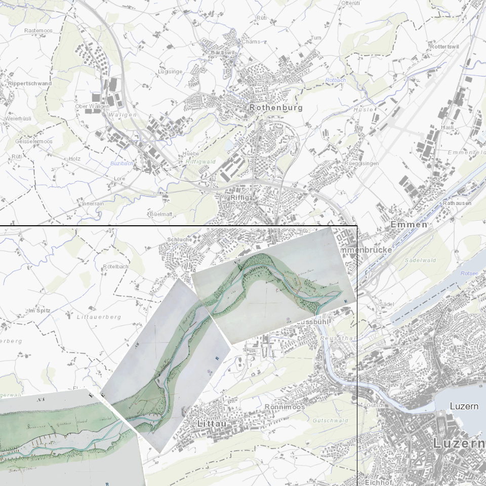
Gewässerkarte Kleine Emme 1784 (Hess)
Historische Gewässerkarte Kleine Emme (Hess 1784); Werthenstein bis Einfluss in die Reuss
Simple
- Alternate title
-
GWKKEM84_DS
- Date (Creation)
- 1784-01-01
- Presentation form
- Digital map
- Purpose
-
Kartierung der Kleinen Emme
- Status
- Completed
Publisher
Owner
- Spatial representation type
- Grid
Spatial resolution
Equivalent scale
- Denominator
- 25000
- Topic category
-
- I Inland waters
Extent
Extent
- Description
-
Kanton Luzern
N
S
E
W
))
- Maintenance and update frequency
- Not planned
- geocat.ch
-
-
opendata.swiss
-
Basiskarte
-
Fliessgewässer
-
Oberflächengewässer
-
Topographie
-
Resource constraints
- Access constraints
- none
- Use constraints
- Copyright
Resource constraints
- Use limitation
-
öffentlich zugängliche Geobasisdaten
Resource constraints
- Access constraints
- none
- Use constraints
- none
Resource constraints
- Use limitation
-
Freie Nutzung. Quellenangabe ist Pflicht
- Distribution format
-
-
Tagged Image File Format (.tif)
-
Point of contact
Digital transfer options
- OnLine resource
-
Datenshop
Produktansicht Geodatenshop
- Statement
-
Grundlagen: Felderhebung
- Reference system identifier
- EPSG:2056
- Maintenance and update frequency
- Not planned
Metadata
- Metadata identifier
- ec6bf4e1-a9ec-4617-a41f-4bd614c8989b
- Language
- Deutsch
- Character encoding
- UTF-8
Point of contact
Type of resource
- Resource scope
- Dataset
- Metadata linkage
-
https://www.geocat.ch/geonetwork/srv/api/records/ec6bf4e1-a9ec-4617-a41f-4bd614c8989b
- Date info (Creation)
- 2017-06-19
- Date info (Revision)
- 2026-06-19T03:29:02.655026Z
Metadata standard
- Title
-
ISO19115.3-2018.che
)))