geocat.ch
Leitungskataster
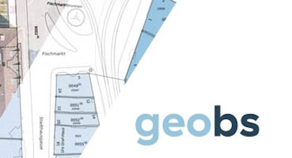
Der Leitungskataster Basel-Stadt ist ein Übersichtsplan der Ver- und Entsorgungsleitungen, die den unterirdischen Raum belegen. Er unterscheidet sich vom Werkplan und bildet lediglich Lage, Art und Grösse von Leitungen und deren ober- und unterirdischen baulichen Anlagen ab. Der Fokus liegt auf der Darstellung der Ver- und Entsorgungsinfrastruktur im öffentlichen Raum, um eine ganzheitliche Planung und Verwaltung der kantonalen Infrastruktur zu ermöglichen. Die Daten des Leitungskatasters werden ununterbrochen nachgeführt.
Die Datengrundlage des Leitungskatasters dient der räumlichen Koordination bei Planung, Bau und Unterhalt der unterirdischen und oberirdischen Versorgungs- und Verkehrsinfrastruktur. Der Nutzen des Leitungskatasters liegt in seiner Fähigkeit, potenzielle Konflikte mit bestehenden Leitungen frühzeitig zu erkennen und zu vermeiden. Dies trägt dazu bei, Bauverzögerungen, Kostenüberschreitungen und Sicherheitsrisiken zu minimieren. Darüber hinaus unterstützt der Leitungskataster die langfristige Erhaltung und Optimierung der Infrastruktur, indem es eine bessere Planung von Wartungs- und Renovierungsarbeiten ermöglicht. Für Stadt und Gemeindeverwaltungen bietet der Leitungskataster eine effektive Möglichkeit, den öffentlichen Raum zu verwalten und die Zusammenarbeit zwischen verschiedenen Behörden und Unternehmen zu erleichtern. Es ermöglicht eine koordinierte Entwicklung von Infrastrukturprojekten und fördert eine nachhaltige Kantonsentwicklung. Insgesamt trägt das Leitungskataster dazu bei, die Effizienz, Sicherheit und Nachhaltigkeit von kantonalen Infrastrukturen zu verbessern und ist daher eine unverzichtbare Ressource für die moderne Planung und Entwicklung.
Simple
- Date (Creation)
- 2017-11-07
- Date (Publication)
- 2017-11-07
Distributor
- Topic category
-
- Q Utilities communication
Extent
Extent
- Description
-
Kanton Basel-Stadt
))

- Maintenance and update frequency
- Daily
- Keywords
-
-
Entsorgung
-
- Keywords
-
-
Kataster
-
- Keywords
-
-
Leitungen
-
- Keywords
-
-
LKBS
-
- Keywords
-
-
Rohre
-
- Keywords
-
-
Rohrleitungen
-
- Keywords
-
-
Versorgung
-
Resource constraints
- Use constraints
- Other restrictions
- Other constraints
-
Die Geodaten sind beschränkt öffentlich zugänglich. Es gelten die Nutzungsbedingungen für Geodaten des Kantons Basel-Stadt. ( http://www.geo.bs.ch/agb)
Associated resource
- Association Type
- Reference to resources that are parts of this resource
- Metadata Reference
Associated resource
- Association Type
- Reference to resources that are parts of this resource
- Metadata Reference
Associated resource
- Association Type
- Reference to resources that are parts of this resource
- Metadata Reference
Associated resource
- Association Type
- Reference to resources that are parts of this resource
- Metadata Reference
Associated resource
- Association Type
- Reference to resources that are parts of this resource
- Metadata Reference
Associated resource
- Association Type
- Reference to resources that are parts of this resource
- Metadata Reference
Associated resource
- Association Type
- Reference to resources that are parts of this resource
- Metadata Reference
Associated resource
- Association Type
- Reference to resources that are parts of this resource
- Metadata Reference
Associated resource
- Association Type
- Reference to resources that are parts of this resource
- Metadata Reference
Associated resource
- Association Type
- Reference to resources that are parts of this resource
- Metadata Reference
Associated resource
- Association Type
- Reference to resources that are parts of this resource
- Metadata Reference
Associated resource
- Association Type
- Reference to resources that are parts of this resource
- Metadata Reference
Associated resource
- Association Type
- Reference to resources that are parts of this resource
- Metadata Reference
Associated resource
- Association Type
- Reference to resources that are parts of this resource
- Metadata Reference
Associated resource
- Association Type
- Reference to resources that are parts of this resource
- Metadata Reference
Associated resource
- Association Type
- Reference to resources that are parts of this resource
- Metadata Reference
Associated resource
- Association Type
- Reference to resources that are parts of this resource
- Metadata Reference
Associated resource
- Association Type
- Reference to resources that are parts of this resource
- Metadata Reference
Associated resource
- Association Type
- Reference to resources that are parts of this resource
- Metadata Reference
Associated resource
- Association Type
- Reference to resources that are parts of this resource
- Metadata Reference
Associated resource
- Association Type
- Reference to resources that are parts of this resource
- Metadata Reference
Associated resource
- Association Type
- Reference to resources that are parts of this resource
- Metadata Reference
Associated resource
- Association Type
- Reference to resources that are parts of this resource
- Metadata Reference
Associated resource
- Association Type
- Reference to resources that are parts of this resource
- Metadata Reference
Associated resource
- Association Type
- Reference to resources that are parts of this resource
- Metadata Reference
Associated resource
- Association Type
- Reference to resources that are parts of this resource
- Metadata Reference
Associated resource
- Association Type
- Reference to resources that are parts of this resource
- Metadata Reference
Associated resource
- Association Type
- Reference to resources that are parts of this resource
- Metadata Reference
- Language
- Deutsch
- Character encoding
- UTF8
- Basic Geodata
- true
- Basic Geodata ID
-
5-BS
- Basic Geodata Access Level
- B
Distributor
Digital transfer options
- OnLine resource
-
Geoportal Kanton Basel-Stadt
Geoportal Kanton Basel-Stadt
- Reference system identifier
- LV95 EPSG:2056
Metadata
- Metadata identifier
- eaadfc97-7c74-4f3a-ac05-f821f3f1ed4a
- Language
- Deutsch
- Character encoding
- UTF8
Distributor
Type of resource
- Resource scope
- Dataset
- Metadata linkage
-
https://www.geocat.ch/geonetwork/srv/api/records/eaadfc97-7c74-4f3a-ac05-f821f3f1ed4a
- Date info (Creation)
- 2026-07-21T13:05:41.701672Z
- Date info (Revision)
- 2026-08-21T07:41:39.402739Z
Metadata standard
- Title
-
eCH-0271