 geocat.ch
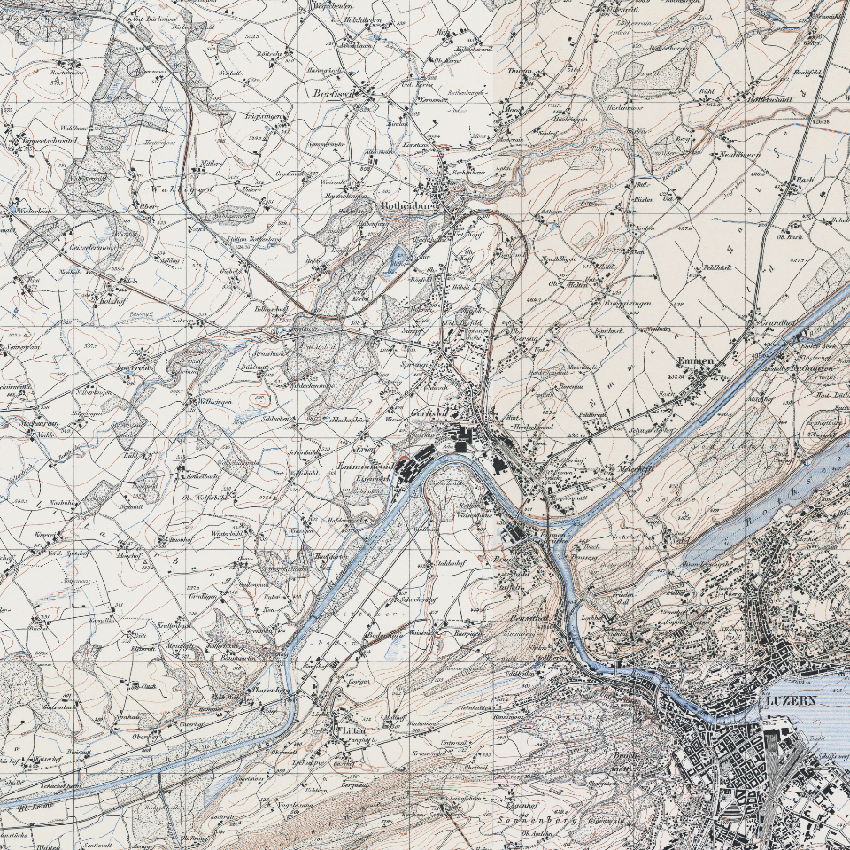
Siegfriedkarte 1:25'000/1:50'000 (1940)
Von 1870 bis 1926 wurde der Topographische Atlas der Schweiz veröffentlicht.
Simple
- Alternate title
-
SFKR1940_DS
- Date (Creation)
- 1940-01-01
- Presentation form
- Digital map
- Purpose
-
Topographischer Atlas der Schweiz. Historische Kartenblätter als Basis für Studien in Landschaftsentwicklung und Geschichtsforschung.Es handelt sich um das erste detaillierte Gesamtwerk für die Schweiz in den Mst. 1:25'000 (Mittalland, Jura, Tessin) sowie 1:50'000 (Alpen). Periodische Fortführung bis 1949.
- Status
- Completed
Publisher
Owner
- Spatial representation type
- Grid
Spatial resolution
Equivalent scale
- Denominator
- 25000
- Topic category
-
- A Imagery base maps earth cover
Extent
Extent
- Description
-
Kanton Luzern
))
- Maintenance and update frequency
- Not planned
- geocat.ch
-
-
opendata.swiss
-
Basiskarte
-
Topographie
-
Kartenwerk
-
Resource constraints
- Access constraints
- none
- Use constraints
- Copyright
Resource constraints
- Use limitation
-
öffentlich zugängliche Geobasisdaten
Resource constraints
- Access constraints
- none
- Use constraints
- none
Resource constraints
- Use limitation
-
Freie Nutzung. Quellenangabe ist Pflicht
- Distribution format
-
-
Tagged Image File Format (.tif)
-
Point of contact
Digital transfer options
- OnLine resource
-
Datenshop
Produktansicht Geodatenshop
- Statement
-
Grundlagen: Landesvermessung
- Reference system identifier
- EPSG:2056
- Maintenance and update frequency
- Not planned
Metadata
- Metadata identifier
- ea22d5be-fdc1-4be9-94e6-4e3400b95549
- Language
- Deutsch
- Character encoding
- UTF-8
Point of contact
Type of resource
- Resource scope
- Dataset
- Metadata linkage
-
https://www.geocat.ch/geonetwork/srv/api/records/ea22d5be-fdc1-4be9-94e6-4e3400b95549
- Date info (Creation)
- 2017-06-19
- Date info (Revision)
- 2026-06-20T03:34:44.927801Z
Metadata standard
- Title
-
ISO19115.3-2018.che
)))