geocat.ch
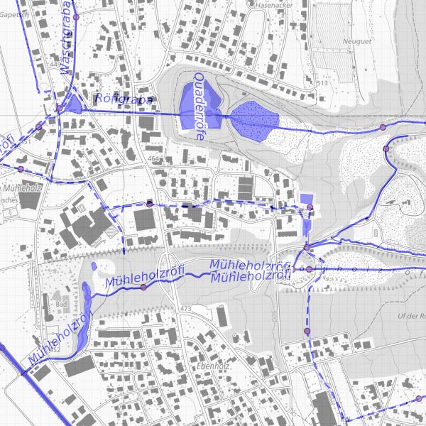
Watercourse register Liechtenstein
The watercourse cadastre contains information on the watercourse network, the kilometres of watercourses and their catchment areas.
Simple
- Alternate title
-
Watercourse cadastre and catchment areas
- Date (Publication)
- 2010-12-09
- Identifier
- https://metadata.geo.llv.li/e8921b7f-137c-4c6b-b610-1061319c0ff2
- Purpose
-
Information for authorities and the public
- Status
- Completed
Publisher
- Hours of service
-
8:00-11:30 und 13:30-17:00
Owner
- Hours of service
-
8:00-11:30 und 13:30-17:00
- Spatial representation type
- Vector
Spatial resolution
- Spatial resolution
- 0.1 m
- Topic category
-
- I Inland waters
Extent
Extent
- Description
-
Liechtenstein
))

- Maintenance and update frequency
- As needed
Resource format
- Title
-
INTERLIS 1 (ITF)
- Date
- GEMET - INSPIRE themes, version 1.0
-
-
Hydrography
-
- GEMET
-
-
water (geographic)
-
flowing water
-
- geocat.ch
-
-
INSPIRE
-
OpenData
-
- Räumlicher Anwendungsbereich
-
-
National
-
Resource constraints
- Use limitation
-
keine
- Access constraints
- Other restrictions
- Use constraints
- Other restrictions
- Other constraints
- No limitations to public access
Resource constraints
- Access constraints
- Other restrictions
- Use constraints
- Other restrictions
- Other constraints
- No conditions to access and use
- Other constraints
- Opendata BY: Open use. Must provide the source.
- Language
- Deutsch
- Character encoding
- UTF8
- Language
- Deutsch
- Included with dataset
- 0
- Title
-
Datenmodell Fliessgewässer
- Date (Creation)
- 2010-12-09
- Distribution format
-
-
INTERLIS 1 (ITF)
-
ESRI Shapefile (SHP)
-
AutoCAD DXF (DXF)
-
Point of contact
- Hours of service
-
8:00-11:30 und 13:30-17:00
Digital transfer options
- OnLine resource
-
llv.au.wa.gewaesser_abschnitt
Public OGC-WMS Service of the National Administration
Digital transfer options
- OnLine resource
-
Zip Download über das Geodatenportal
Zip download via the geodata portal
- Hierarchy level
- Dataset
Report
Result
- Title
-
VERORDNUNG (EG) Nr. 1089/2010 DER KOMMISSION vom 23. November 2010 zur Durchführung der Richtlinie 2007/2/EG des Europäischen Parlaments und des Rates hinsichtlich der Interoperabilität von Geodatensätzen und -diensten
- Date (Publication)
- 2010-12-08
- Explanation
-
Gemäss INSPIRE Bestandteil des Themas Gewässernetz
- Pass
- false
- Statement
-
Konstruktion auf Grundkage der Amtlichen Vermesung
- Hierarchy level
- Dataset
- Topology level
- Full planar graph
- Geometric object type
- Surface
- Geometric object count
- 200
- Reference system identifier
- http://www.opengis.net/def/crs/EPSG/0/2056
- Reference system identifier
- http://www.opengis.net/def/crs/EPSG/0/4936
- Maintenance and update frequency
- As needed
Metadata
- Metadata identifier
- e8921b7f-137c-4c6b-b610-1061319c0ff2
- Language
- Deutsch
- Character encoding
- UTF8
- Language
- Français
- Character encoding
- UTF8
- Language
- Italiano
- Character encoding
- UTF8
- Language
- English
- Character encoding
- UTF8
Point of contact
- Hours of service
-
8:00-11:30 und 13:30-17:00
Type of resource
- Resource scope
- Dataset
- Metadata linkage
-
https://www.geocat.ch/geonetwork/srv/api/records/e8921b7f-137c-4c6b-b610-1061319c0ff2
- Date info (Creation)
- 2010-12-09T16:01:58Z
- Date info (Revision)
- 2026-04-13T09:16:11.015343Z
Metadata standard
- Title
-
eCH-0271