 geocat.ch
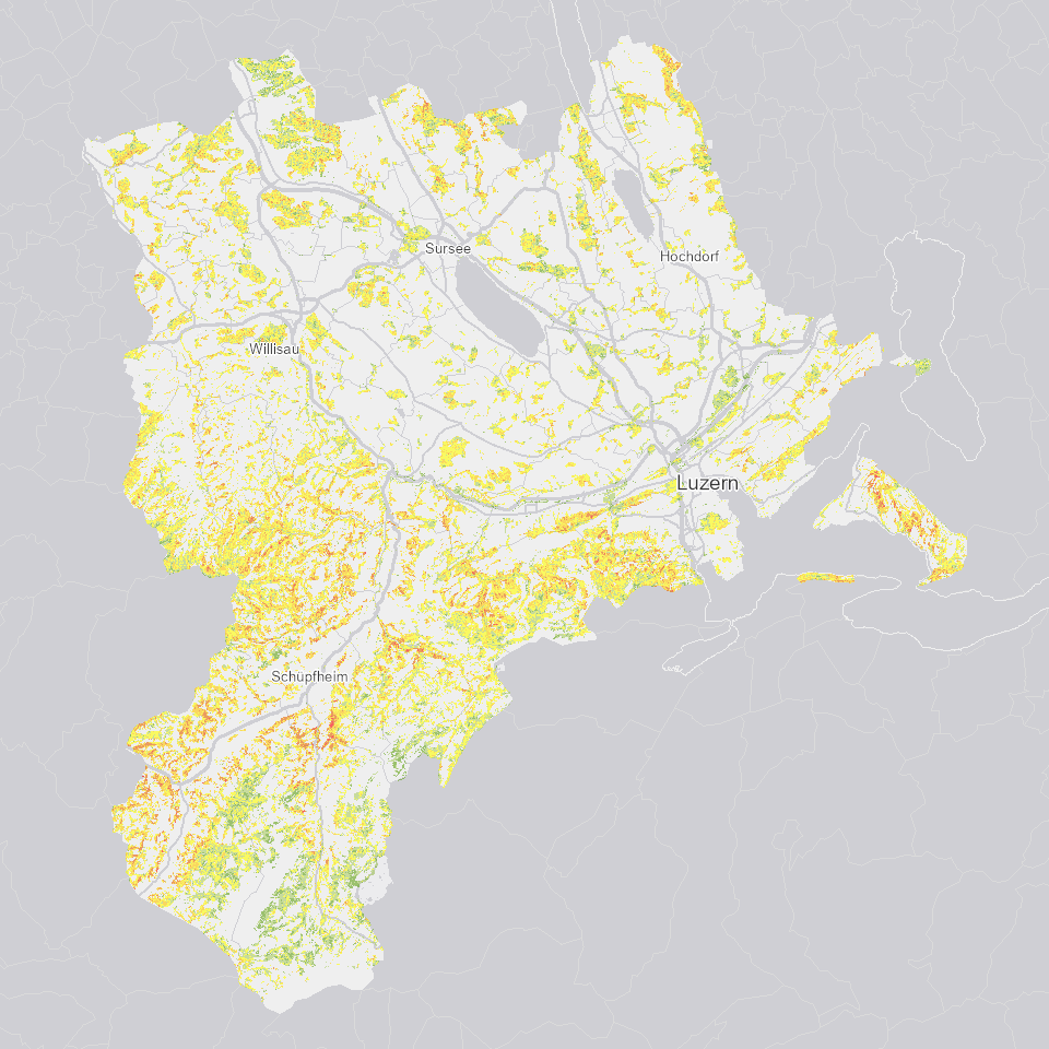
Vegetationshöhe Wald 2018, 0.25m-Raster
Vegetationshöhe im Wald nach Höhenklassen der Bestandeskartierung. Differenz zwischen Terrain- und Oberflächenmodell von 2018 des Kantons Luzern.
Simple
- Alternate title
-
WVEGHO18_DS
- Date (Creation)
- 2018-09-01
- Presentation form
- Digital map
- Purpose
-
Die Vegetationshöhe dient als Grundlage für die Ausscheidung und Nachführung der Bestandeskarte im Luzerner Wald.
- Status
- Completed
Publisher
Owner
- Spatial representation type
- Grid
- Topic category
-
- G Biota
Extent
Extent
- Description
-
Kanton Luzern
))
- Maintenance and update frequency
- Not planned
- geocat.ch
-
-
opendata.swiss
-
Fernerkundung
-
Forstwirtschaft
-
Oberflächenmodell
-
Vegetation
-
Wald
-
Resource constraints
- Access constraints
- none
- Use constraints
- Copyright
Resource constraints
- Use limitation
-
öffentlich zugängliche Geobasisdaten
Resource constraints
- Access constraints
- none
- Use constraints
- none
Resource constraints
- Use limitation
-
Freie Nutzung. Quellenangabe ist Pflicht
- Distribution format
-
-
Tagged Image File Format (.tif)
-
Point of contact
Digital transfer options
- OnLine resource
-
Datenshop
Produktansicht Geodatenshop
- Statement
-
Abgeleitet von: Digitales Oberflächenmodell (DOM) 2018, Punktwolke und Digitales Terrainmodell (DTM) 2018, Punktwolke
- Statement
-
Grundlagen: Digitales Oberflächenmodell (DOM) 2018, Punktwolke und Digitales Terrainmodell (DTM) 2018, Punktwolke
- Reference system identifier
- EPSG:2056
- Maintenance and update frequency
- As needed
Metadata
- Metadata identifier
- e6e3534d-5273-49c5-990b-0b8cee45f459
- Language
- Deutsch
- Character encoding
- UTF-8
Point of contact
Type of resource
- Resource scope
- Dataset
- Metadata linkage
-
https://www.geocat.ch/geonetwork/srv/api/records/e6e3534d-5273-49c5-990b-0b8cee45f459
- Date info (Creation)
- 2019-04-11
- Date info (Revision)
- 2026-06-20T03:13:29.420628Z
Metadata standard
- Title
-
ISO19115.3-2018.che
)))