geocat.ch
PAZ
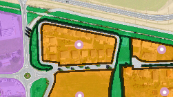
OGC Web Map Service (WMS) sur la thématique "Plans d'affectation des zones" contenant les couches:
- Affectations primaires
- Zones superposées
- Contenu linéaire
- Contenu ponctuel
- Périmètres superposés
- Périmètres dossiers juridiques
- Zones contestées
- Zones réservées
Simple
- Date (Creation)
- 2026-08-05
Resource provider
Custodian
- Topic category
-
- E Planning cadastre
Extent
Extent
))
- Maintenance and update frequency
- Continual
- geocat.ch
-
-
service de consultation
-
- GEMET
-
-
affectation
-
zone constructible
-
occupation du sol
-
développement du territoire
-
territoire
-
zonage
-
- geocat.ch
-
-
opendata.swiss
-
géodonnées de base
-
aménagement local
-
Resource constraints
- Access constraints
- Other restrictions
- Other constraints
-
Géodonnées accessibles au public (niveau A selon l'OGéo)
- Other constraints
-
Les conditions générales d'utilisation des géodonnées du Canton du Valais font foi ( https://www.vs.ch/fr/web/guest/information-legale).
- Service Version
-
1.3.0
- Coupling Type
- Tight
Contains Operations
Contains Operations
Contains Operations
- Distribution format
-
-
OGC Web Map Service (WMS)
-
Distributor
Digital transfer options
- OnLine resource
-
0
Affectations primaires
- OnLine resource
-
1
Zones superposées
- OnLine resource
-
2
Contenu linéaire
- OnLine resource
-
3
Contenu ponctuel
- OnLine resource
-
4
Périmètres superposés
- OnLine resource
-
5
Périmètres dossiers juridiques
- OnLine resource
-
6
Zones contestées
- OnLine resource
-
7
Zones réservées
- Reference system identifier
- EPSG:2056/CH1903+_LV95
- Reference system identifier
- EPSG:4326/WGS_1984
- Reference system identifier
- EPSG:3857/WGS_1984_Web_Mercator
Metadata
- Metadata identifier
- e4dc28ab-4c1f-4cfb-afae-7850a307d960
- Language
- Français
- Character encoding
- UTF8
- Language
- Deutsch
- Character encoding
- UTF8
Distributor
Type of resource
- Resource scope
- Service
- Name
-
Service
- Metadata linkage
-
https://www.geocat.ch/geonetwork/srv/api/records/e4dc28ab-4c1f-4cfb-afae-7850a307d960
- Date info (Creation)
- 2026-08-05T00:00:00
- Date info (Revision)
- 2026-08-12T11:46:38.380681Z
Metadata standard
- Title
-
ISO19115-3.2018.che (eCH-0271)
)))