geocat.ch
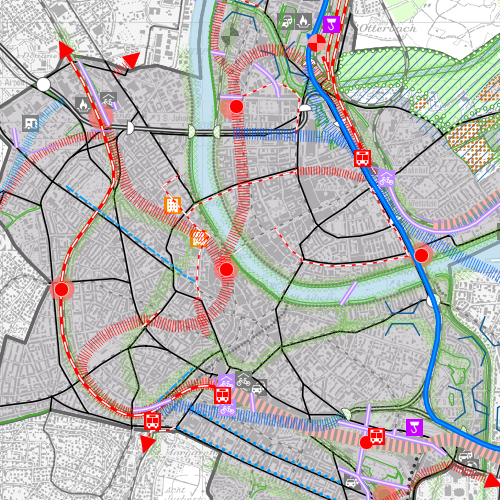
Richtplankarte
Der behördenverbindliche kantonale Richtplan dient als strategisches Planungsinstrument des Regierungsrates dazu, die raumwirksamen Tätigkeiten des Kantons aufeinander abzustimmen. Der Kantonale Richtplan ist nicht parzellenscharf.
Semplice
- Data (Creazione)
- 2008-01-31
- Stato
- Completato
Proprietario
- Tipo di rappresentazione spaziale
- Vettoriale
- Categoria ISO
-
- E Catasto urbanistico
Estensione
Estensione
- Descrizione
-
Cantone di Basilea Città (BS)
))

- Frequenza di aggiornamento
- Secondo necessità
- geocat.ch
-
-
mobilità
-
piano direttore
-
- GEMET
-
-
insediamento umano
-
- GEMET
-
-
paesaggio
-
- geocat.ch
-
-
natura
-
Vincoli sulle risorse
- Altri vincoli
-
Die Geodaten sind öffentlich zugänglich. (Zugangsberechtigungsstufe [A] = öffentlich)
- Altri vincoli
-
Es gelten die Nutzungsbedingungen für Geodaten des Kantons Basel-Stadt. ( http://www.geo.bs.ch/agb)
Risorsa associata
- Titolo
-
Kantonaler Richtplan
- Tipo di associazione
- Citazione di un'opera più ampia
- Lingua
- Deutsch
- Codifica dei caratteri
- UTF8
- Categoria di sottotema
- E1 Pianificazione territoriale, sviluppo territoriale
- Geodati di base
- false
- Tipo di geodati di base
- openData
- Formato (codifica)
-
-
ESRI Shapefile (SHP)
-
ESRI File Geodatabase FileGDB (GDB)
-
TEXT, comma separated (CSV)
-
FlatGeobuf
-
OGC Geopackage (GPKG)
-
GeoParquet
-
GeoJSON (GEOJSON)
-
Distributore
- Orario di servizio
-
Mo - Do: 8:00 bis 12:00, 13:30 bis 16:30, Fr: 8:00 bis 12:00, 13:30 bis 16:00
Opzioni di trasferimento digitale
- Risorsa online
-
MapBS
Verwaltungsinterner Darstellungsdienst des Kantons Basel-Stadt
Opzioni di trasferimento digitale
- Risorsa online
-
WMS BS
Die derzeit im WMS BS verfügbaren Datenebenen entsprechen, bis auf wenige Ausnahmen, den Geodaten, welche auch in MapBS dargestellt sind. Der WMS BS ist kostenlos nutzbar und bietet Zugriff auf öffentliche sowie beschränkt öffentliche Geodaten, wobei gegebenenfalls Benutzername und Passwort benötigt werden (Zugangsdaten von MapBS).
- Nome del sistema di riferimento
- CH1903+ / LV95/EPSG: 2056
Metadati
- Identificativo della scheda
- e246b578-b7ea-4db8-90d4-7cfd9aef77c5
- Lingua
- Deutsch
- Codifica dei caratteri
- UTF8
- Lingua
- Français
- Codifica dei caratteri
- UTF8
- Lingua
- Italiano
- Codifica dei caratteri
- UTF8
- Lingua
- English
- Codifica dei caratteri
- UTF8
Custode
Tipo di risorsa
- Ambito di applicazione della risorsa
- Set di dati
- Collegamento ai metadati
-
https://www.geocat.ch/geonetwork/srv/api/records/e246b578-b7ea-4db8-90d4-7cfd9aef77c5
- Informazioni sulla data (Creazione)
- 2011-08-08T10:11:10Z
- Informazioni sulla data (Revisione)
- 2026-04-13T09:41:00.187195Z
Standard dei metadati
- Titolo
-
eCH-0271