geocat.ch
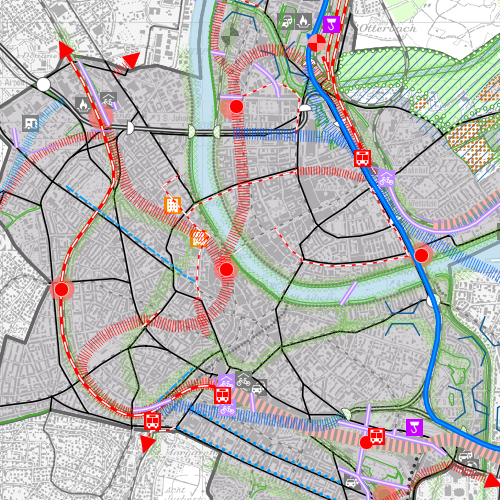
Richtplankarte
Der behördenverbindliche kantonale Richtplan dient als strategisches Planungsinstrument des Regierungsrates dazu, die raumwirksamen Tätigkeiten des Kantons aufeinander abzustimmen. Der Kantonale Richtplan ist nicht parzellenscharf.
Simple
- Date (Creation)
- 2008-01-31
- Status
- Completed
Owner
- Spatial representation type
- Vector
- Topic category
-
- E Planning cadastre
Extent
Extent
- Description
-
Canton of Basel-Stadt (BS)
))

- Maintenance and update frequency
- As needed
- geocat.ch
-
-
mobility
-
structure plan
-
- GEMET
-
-
human settlement
-
- GEMET
-
-
landscape
-
- geocat.ch
-
-
nature
-
Resource constraints
- Other constraints
-
Die Geodaten sind öffentlich zugänglich. (Zugangsberechtigungsstufe [A] = öffentlich)
- Other constraints
-
Es gelten die Nutzungsbedingungen für Geodaten des Kantons Basel-Stadt. ( http://www.geo.bs.ch/agb)
Associated resource
- Title
-
Kantonaler Richtplan
- Association Type
- Reference to a master resource of which this one is a part
- Language
- Deutsch
- Character encoding
- UTF8
- Subtopic Category
- E1 Spatial Planning, Spatial Development
- Basic Geodata
- false
- Basic Geodata Type
- openData
- Distribution format
-
-
ESRI Shapefile (SHP)
-
ESRI File Geodatabase FileGDB (GDB)
-
TEXT, comma separated (CSV)
-
FlatGeobuf
-
OGC Geopackage (GPKG)
-
GeoParquet
-
GeoJSON (GEOJSON)
-
Distributor
- Hours of service
-
Mo - Do: 8:00 bis 12:00, 13:30 bis 16:30, Fr: 8:00 bis 12:00, 13:30 bis 16:00
Digital transfer options
- OnLine resource
-
MapBS
Verwaltungsinterner Darstellungsdienst des Kantons Basel-Stadt
Digital transfer options
- OnLine resource
-
WMS BS
Die derzeit im WMS BS verfügbaren Datenebenen entsprechen, bis auf wenige Ausnahmen, den Geodaten, welche auch in MapBS dargestellt sind. Der WMS BS ist kostenlos nutzbar und bietet Zugriff auf öffentliche sowie beschränkt öffentliche Geodaten, wobei gegebenenfalls Benutzername und Passwort benötigt werden (Zugangsdaten von MapBS).
- Reference system identifier
- CH1903+ / LV95/EPSG: 2056
Metadata
- Metadata identifier
- e246b578-b7ea-4db8-90d4-7cfd9aef77c5
- Language
- Deutsch
- Character encoding
- UTF8
- Language
- Français
- Character encoding
- UTF8
- Language
- Italiano
- Character encoding
- UTF8
- Language
- English
- Character encoding
- UTF8
Custodian
Type of resource
- Resource scope
- Dataset
- Metadata linkage
-
https://www.geocat.ch/geonetwork/srv/api/records/e246b578-b7ea-4db8-90d4-7cfd9aef77c5
- Date info (Creation)
- 2011-08-08T10:11:10Z
- Date info (Revision)
- 2026-04-13T09:41:00.187195Z
Metadata standard
- Title
-
eCH-0271