geocat.ch
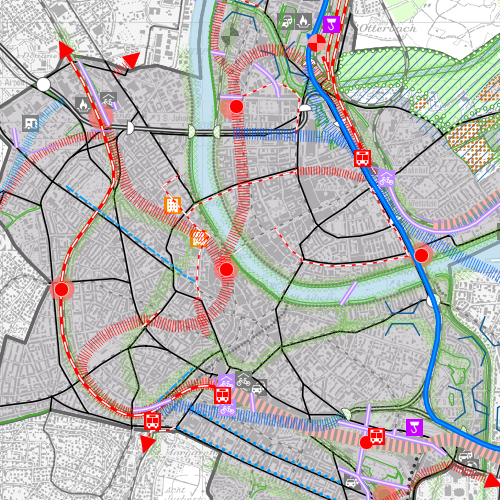
Richtplankarte
Der behördenverbindliche kantonale Richtplan dient als strategisches Planungsinstrument des Regierungsrates dazu, die raumwirksamen Tätigkeiten des Kantons aufeinander abzustimmen. Der Kantonale Richtplan ist nicht parzellenscharf.
Simple
-
Date (Création)Data (Creazione)Date (Creation)Datum (Erstellung)
- 2008-01-31
-
ÉtatStatoStatusBearbeitungsstatus
-
TerminéCompletatoCompletedAbgeschlossen
Propriétaire
Proprietario
Owner
Eigentümer
-
Type de représentation spatialeTipo di rappresentazione spazialeSpatial representation typeRäumliche Darstellungsart
-
vecteurVettorialeVectorVektor
-
Catégorie de thèmeCategoria ISOTopic categoryThematik
-
-
E Planification et cadastreE Catasto urbanisticoE Planning cadastreE Planungsunterlagen und Kataster
-
Étendue
Estensione
Extent
Ausdehnung
Étendue
Estensione
Extent
Ausdehnung
-
DescriptionDescrizioneDescriptionBeschreibung
-
Canton of Basel-Stadt (BS)
Kanton Basel-Stadt (BS)
Canton de Bâle-Ville (BS)
Cantone di Basilea Città (BS)
))

-
Fréquence de mise à jourFrequenza di aggiornamentoMaintenance and update frequencyWartungsintervall
-
Comme nécessaireSecondo necessitàAs neededBei Bedarf
- geocat.ch
-
-
mobilité
mobilità
mobility
-
plan directeur
piano direttore
structure plan
-
- GEMET
-
-
établissement humain
insediamento umano
human settlement
-
- GEMET
-
-
Landschaft
paysage
paesaggio
landscape
-
- geocat.ch
-
-
Natur
nature
natura
nature
-
Contraintes sur la ressource
Vincoli sulle risorse
Resource constraints
Ressourcenbeschränkungen
-
Autres contraintesAltri vincoliOther constraintsAndere Einschränkungen
-
Die Geodaten sind öffentlich zugänglich. (Zugangsberechtigungsstufe [A] = öffentlich)
-
Autres contraintesAltri vincoliOther constraintsAndere Einschränkungen
-
Es gelten die Nutzungsbedingungen für Geodaten des Kantons Basel-Stadt. ( http://www.geo.bs.ch/agb)
Ressource associée
Risorsa associata
Associated resource
Verlinkte Ressource
-
TitreTitoloTitleTitel
-
Kantonaler Richtplan
-
Type d'associationTipo di associazioneAssociation TypeAssoziationstyp
-
Citation de travail plus largeCitazione di un'opera più ampiaReference to a master resource of which this one is a partÜbergeordneter Datenbestand
-
LangueLinguaLanguageSprache
- Deutsch
-
Encodage de caractèresCodifica dei caratteriCharacter encodingZeichenkodierung
-
Utf8UTF8UTF8Utf8
-
Catégorie de sous-thèmeCategoria di sottotemaSubtopic CategoryThematische Unterkategorien
-
E1 Aménagement du territoire, développement spatialE1 Pianificazione territoriale, sviluppo territorialeE1 Spatial Planning, Spatial DevelopmentE1 Raumplanung, Raumentwicklung
-
Géodonnées de baseGeodati di baseBasic GeodataGeobasisdaten
- false
-
Type de géodonnées de baseTipo di geodati di baseBasic Geodata TypeGeobasisdatentyp
-
openDataopenDataopenDataopenData
-
Format de distributionFormato (codifica)Distribution formatAbgabeformat
-
-
ESRI Shapefile (SHP)
-
ESRI File Geodatabase FileGDB (GDB)
-
TEXT, comma separated (CSV)
-
FlatGeobuf
-
OGC Geopackage (GPKG)
-
GeoParquet
-
GeoJSON (GEOJSON)
-
Distributeur
Distributore
Distributor
Verteiler
-
Heures de serviceOrario di servizioHours of serviceBetriebszeiten
-
Mo - Do: 8:00 bis 12:00, 13:30 bis 16:30, Fr: 8:00 bis 12:00, 13:30 bis 16:00
Options de transfert numérique
Opzioni di trasferimento digitale
Digital transfer options
Optionen für die digitale Übertragung
-
Ressource en ligneRisorsa onlineOnLine resourceOnline
-
MapBS
Verwaltungsinterner Darstellungsdienst des Kantons Basel-Stadt
Options de transfert numérique
Opzioni di trasferimento digitale
Digital transfer options
Optionen für die digitale Übertragung
-
Ressource en ligneRisorsa onlineOnLine resourceOnline
-
WMS BS
Die derzeit im WMS BS verfügbaren Datenebenen entsprechen, bis auf wenige Ausnahmen, den Geodaten, welche auch in MapBS dargestellt sind. Der WMS BS ist kostenlos nutzbar und bietet Zugriff auf öffentliche sowie beschränkt öffentliche Geodaten, wobei gegebenenfalls Benutzername und Passwort benötigt werden (Zugangsdaten von MapBS).
-
Nom du système de référenceNome del sistema di riferimentoReference system identifierName des Referenzsystems
- CH1903+ / LV95/EPSG: 2056
Metadata
-
Identifiant des métadonnéesIdentificativo della schedaMetadata identifierIdentifikator des Metadatensatzes
- e246b578-b7ea-4db8-90d4-7cfd9aef77c5
-
LangueLinguaLanguageSprache
- Deutsch
-
Encodage de caractèresCodifica dei caratteriCharacter encodingZeichenkodierung
-
Utf8UTF8UTF8Utf8
-
LangueLinguaLanguageSprache
- Français
-
Encodage de caractèresCodifica dei caratteriCharacter encodingZeichenkodierung
-
Utf8UTF8UTF8Utf8
-
LangueLinguaLanguageSprache
- Italiano
-
Encodage de caractèresCodifica dei caratteriCharacter encodingZeichenkodierung
-
Utf8UTF8UTF8Utf8
-
LangueLinguaLanguageSprache
- English
-
Encodage de caractèresCodifica dei caratteriCharacter encodingZeichenkodierung
-
Utf8UTF8UTF8Utf8
Dépositaire
Custode
Custodian
Verwalter
Type de ressource
Tipo di risorsa
Type of resource
Anwendungsbereich der Metadaten
-
Domaine d'application de la ressourceAmbito di applicazione della risorsaResource scopeDomäne der Ressourcenanwendung
-
Jeu de donnéesSet di datiDatasetDatenbestand
-
Informations de date (Création)Informazioni sulla data (Creazione)Date info (Creation)Datumsangaben (Erstellung)
- 2011-08-08T10:11:10Z
-
Informations de date (Révision)Informazioni sulla data (Revisione)Date info (Revision)Datumsangaben (Aktualisierung)
- 2026-04-13T09:41:00.187195Z
Norme des métadonnées
Standard dei metadati
Metadata standard
Metadatenstandard
-
TitreTitoloTitleTitel
-
eCH-0271