geocat.ch
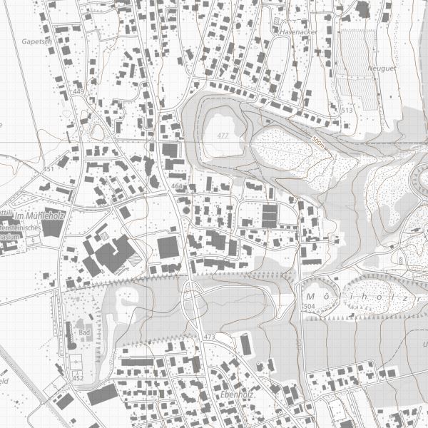
elevation curves Overview Map
Overview elevation curves over the whole of Liechtenstein, generated from the Digital Terrain Model DTM 2001/2002. The equidistance is 5 m in the building area and 10 m in the mountain area. In addition, there are a few intermediate curves of 2.5 m in flat areas.
Simple
- Alternate title
-
elevation curves Overview Map
- Date (Creation)
- 2002-02-01
- Identifier
- https://metadata.geo.llv.li/dc42da62-699d-4551-96be-0c4d93d9fa42
- Purpose
-
Basis for maps and general plans
- Status
- Completed
Publisher
- Hours of service
-
8:00-11:30 und 13:30-17:00
- Spatial representation type
- Vector
Spatial resolution
- Spatial resolution
- 2 m
- Topic category
-
- C Elevation
Extent
Extent
- Description
-
Liechtenstein
))

- Maintenance and update frequency
- Unknown
Resource format
- Title
-
INTERLIS 1 (ITF)
- Date
- geocat.ch
-
-
contour line
-
survey plan
-
spot elevation
-
- GEMET - INSPIRE themes, version 1.0
-
-
Elevation
-
Resource constraints
- Use limitation
-
no conditions appsy
- Access constraints
- Other restrictions
- Use constraints
- Other restrictions
- Other constraints
- No limitations to public access
Resource constraints
- Access constraints
- Other restrictions
- Use constraints
- Other restrictions
- Other constraints
- No conditions to access and use
- Other constraints
- Opendata BY: Open use. Must provide the source.
- Language
- Deutsch
- Character encoding
- UTF8
- Language
- Deutsch
- Included with dataset
- 0
- Title
-
DM01AVBE04
- Date (Creation)
- 2006-01-20
- Distribution format
-
-
INTERLIS 1 (ITF)
-
AutoCAD DXF (DXF)
-
ESRI Shapefile (SHP)
-
Point of contact
- Hours of service
-
8:00-11:30 und 13:30-17:00
Digital transfer options
- OnLine resource
-
Geodatenportal der Liechtensteinischen Landesverwaltung
Geodatenportal der Liechtensteinischen Landesverwaltung
- Hierarchy level
- Dataset
Report
Result
- Title
-
VERORDNUNG (EG) Nr. 1089/2010 DER KOMMISSION vom 23. November 2010 zur Durchführung der Richtlinie 2007/2/EG des Europäischen Parlaments und des Rates hinsichtlich der Interoperabilität von Geodatensätzen und -diensten
- Date (Creation)
- 2010-05-19
- Explanation
-
nicht geprüft
- Pass
- false
- Statement
-
Erzeugt aus dem Digitalen Terrainmodell DTM 2001/2002
- Hierarchy level
- Dataset
- Topology level
- Topology 1D
- Geometric object type
- Curve
- Geometric object count
- 274000
- Reference system identifier
- http://www.opengis.net/def/crs/EPSG/0/2056
- Maintenance and update frequency
- As needed
Metadata
- Metadata identifier
- dc42da62-699d-4551-96be-0c4d93d9fa42
- Language
- Deutsch
- Character encoding
- UTF8
- Language
- Français
- Character encoding
- UTF8
- Language
- Italiano
- Character encoding
- UTF8
- Language
- English
- Character encoding
- UTF8
Point of contact
- Hours of service
-
8:00-11:30 und 13:30-17:00
Type of resource
- Resource scope
- Dataset
- Metadata linkage
-
https://www.geocat.ch/geonetwork/srv/api/records/dc42da62-699d-4551-96be-0c4d93d9fa42
- Date info (Creation)
- 2010-05-26T11:01:46Z
- Date info (Revision)
- 2026-04-13T09:34:23.793775Z
Metadata standard
- Title
-
eCH-0271