geocat.ch
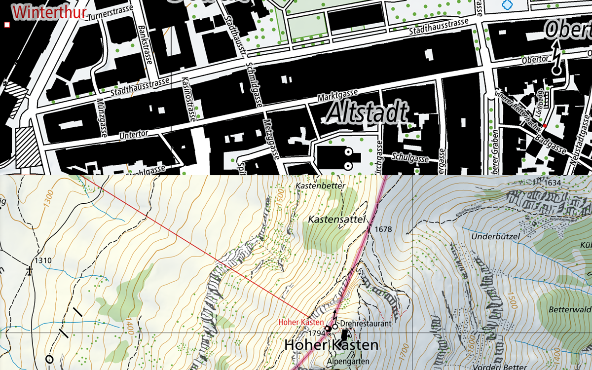
National Map 1:10'000 (color)
The 1:10,000 national map is swisstopo’s largest scale topographic map. It stands out for its detailed representation of traffic, settlements, terrain and vegetation as well as its thorough labelling. The contents are supplemented by rock hachures and relief. The perimeter of the map covers the national territory of both Switzerland and the Principality of Liechtenstein. Updates are made every year based on the latest version of swisstopo’s topographic landscape model (TLM). The 1:10,000 national map is produced in digital form in colour and greyscale. Both of these versions of the map form the basis for Switzerland’s geo data viewer (map.geo.admin.ch) in the first four zoom levels. The 1:10,000 map is also available as “Swiss Map Raster 10” in the form of geo-referenced TIF data and as "Swiss Map Vector 10" for individual sections of the perimeter.
Simple
- Alternate title
-
National Map 1:10'000 (color) | NM10
- Date (Creation)
- 2016-06-01
- Date (Revision)
- 2025-05-01
- Identifier
- ch.swisstopo.landeskarte-farbe-10
- Presentation form
- Digital map
- Purpose
-
Georeferenzdaten des Bundesrechts
- Status
- On going
Point of contact
Owner
- Spatial representation type
- paperMap
- Spatial representation type
- Grid
- Spatial representation type
- Vector
Spatial resolution
Equivalent scale
- Denominator
- 10000
- Topic category
-
- A Imagery base maps earth cover
Extent
Extent
- Description
-
Switzerland
))

Extent
Extent
- Description
-
Liechtenstein
))

- Maintenance and update frequency
- Unknown
Resource format
- Title
-
Tagged Image File Format (TIFF)
- Date
- GEMET
-
-
cartography
-
border
-
water (geographic)
-
vegetation
-
relief (land)
-
- geocat.ch
-
-
traffic network
-
national map
-
terrain representation
-
opendata.swiss
-
- GEMET - INSPIRE themes, version 1.0
-
-
Hydrography
-
Buildings
-
Transport networks
-
Elevation
-
Orthoimagery
-
Land cover
-
- geocat.ch
-
-
FSDI Federal Spatial Data Infrastructure
-
- geocat.ch
-
-
topography
-
- GEMET
-
-
map chart
-
Resource constraints
- Other constraints
- Opendata BY: Open use. Must provide the source.
Associated resource
- Title
-
National Maps 1:10'000 - 1:1 mio.
- Association Type
- Reference to a master resource of which this one is a part
- Language
- Deutsch
- Character encoding
- UTF8
- Language
- Français
- Character encoding
- UTF8
- Language
- Italiano
- Character encoding
- UTF8
- Language
- Rumantsch
- Character encoding
- UTF8
- Subtopic Category
- A1 Base Maps, Landscape Models
- Basic Geodata
- true
- Basic Geodata ID
-
42.15
- Basic Geodata Legal Level
- Federal
- Basic Geodata Type
- Reference Geodata
- Distribution format
-
-
Cloud Optimized GeoTIFF (TIFF / TIF)
-
Point of contact
- Title
-
Tagged Image File Format (TIFF)
- Date
Digital transfer options
- OnLine resource
-
Vorschau map.geo.admin.ch
Preview map.geo.admin.ch
Digital transfer options
- OnLine resource
-
ch.swisstopo.landeskarte-farbe-10
WMS-FSDI service, layer "National Map 1:10`000 (color)"
Digital transfer options
- OnLine resource
-
ch.swisstopo.landeskarte-farbe-10
WMTS-FSDI service, layer "National Map 1:10'000 (color)"
Digital transfer options
- Statement
-
Database: Topographical landscape model swissTLM3D; Digital cartographic model 1: 25,000 (DKM25)
- Hierarchy level
- Dataset
- Reference system identifier
- CH1903+
Metadata
- Metadata identifier
- cb0f8401-c49a-4bdf-aff6-40a7015ba43a
- Language
- Deutsch
- Character encoding
- UTF8
- Language
- Français
- Character encoding
- UTF8
- Language
- Italiano
- Character encoding
- UTF8
- Language
- English
- Character encoding
- UTF8
- Language
- Rumantsch
- Character encoding
- UTF8
Point of contact
Type of resource
- Resource scope
- Dataset
- Metadata linkage
-
https://www.geocat.ch/geonetwork/srv/api/records/cb0f8401-c49a-4bdf-aff6-40a7015ba43a
- Date info (Creation)
- 2016-01-11T12:38:41Z
- Date info (Revision)
- 2026-04-13T09:14:52.817591Z
Metadata standard
- Title
-
eCH-0271