 geocat.ch
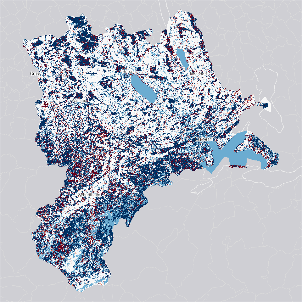
Differenz digitales Oberflächenmodell (DOM) 2024 zu 2018
Differenz zwischen Oberflächenmodell 2024 (0.25x0.25m Raster) und dem Oberflächenmodell 2018 (0.25x0.25m Raster). Das DOM bildet die Topografie der Erdoberfläche mit Bewuchs und Bebauung ab.
Simple
- Alternate title
-
DOM24DIF_DS
- Date (Creation)
- 2025-03-17
- Presentation form
- Digital map
- Purpose
-
Die Differenz zwischen den DOM von 2024 und 2018 kann Veränderungen der Objekte auf der Oberfläche (Gebäude, Infrastruktur, Vegetation, etc.) aufzeigen. Zu beachten ist allerdings die unterschiedliche Qualität der Datensätze von 2018 und 2024, insbesondere die Höhengenauigkeit.
- Status
- Under development
Publisher
Owner
- Spatial representation type
- Grid
- Topic category
-
- C Elevation
Extent
Extent
- Description
-
Kanton Luzern
))
- Maintenance and update frequency
- Not planned
- geocat.ch
-
-
opendata.swiss
-
Amtliche Vermessung/AV
-
Oberflächenmodell
-
Referenzsystem
-
Topographie
-
Resource constraints
- Access constraints
- none
- Use constraints
- Copyright
Resource constraints
- Use limitation
-
öffentlich zugängliche Geobasisdaten
Resource constraints
- Access constraints
- none
- Use constraints
- none
Resource constraints
- Use limitation
-
Freie Nutzung. Quellenangabe ist Pflicht
- Distribution format
-
-
Tagged Image File Format (.tif)
-
Point of contact
Digital transfer options
- OnLine resource
-
Datenshop
Produktansicht Geodatenshop
- Statement
-
Abgeleitet von: Digitales Oberflächenmodell (DOM) 2018
- Reference system identifier
- EPSG:2056
- Maintenance and update frequency
- Not planned
Metadata
- Metadata identifier
- b2c49303-f1d4-46d2-b455-7566419d30cf
- Language
- Deutsch
- Character encoding
- UTF-8
Point of contact
Type of resource
- Resource scope
- Dataset
- Metadata linkage
-
https://www.geocat.ch/geonetwork/srv/api/records/b2c49303-f1d4-46d2-b455-7566419d30cf
- Date info (Creation)
- 2025-03-13
- Date info (Revision)
- 2026-06-19T03:20:45.794429Z
Metadata standard
- Title
-
ISO19115.3-2018.che
)))