geocat.ch
MNT, MNS et orthophotos Val d'Hérens
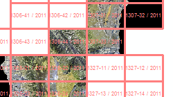
Vol LIDAR du val d'Hérens sur une surface de 450 km2. Les données brutes ont permis de générer un MNT (grille 50cm), un MNS (grille de 50cm) et des orthophotos (10cm/25cm).
Simple
- Alternate title
-
MNT, MNS et orthophotos Val d'Hérens
- Date (Creation)
- 2011-09-01
- Identifier
- 325, 416
- Purpose
-
Analyse des peuplements forestiers et des dangers naturels.
- Status
- Completed
Custodian
- Spatial representation type
- Grid
Spatial resolution
- Spatial resolution
- 0.5 m
- Topic category
-
- C Elevation
- A Imagery base maps earth cover
Extent
Extent
- Description
-
Val d'Hérens
- Geographic identifier
- VS_Herens
))

- Maintenance and update frequency
- Not planned
Resource format
- Title
-
ESRI ASCII Grid (.grd/.asc)
- Date
- Edition
-
2.3
Resource format
- Title
-
Tagged Image File Format (TIFF)
- Date
Resource format
- Title
-
ASPRS LASer (LAS)
- Date
- geocat.ch
-
-
LIDAR (Light Detection And Ranging)
-
DSM (digital surface model)
-
orthophoto
-
laserscanning
-
digital terrain model DTM
-
official geodata
-
- GEMET
-
-
altitude
-
laser
-
- GEMET - INSPIRE themes, version 1.0
-
-
Orthoimagery
-
Resource constraints
- Use limitation
-
aucune
Resource constraints
- Access constraints
- Other restrictions
- Other constraints
-
Géodonnées accessibles au public (niveau A selon l'OGéo)
- Other constraints
-
Les conditions générales d'utilisation des géodonnées du Canton du Valais font foi ( https://www.vs.ch/fr/web/guest/information-legale).
- Language
- Français
- Character encoding
- UTF8
- Environment description
-
Z:\MEDIA\GEO02\Geodonnees_archivees\C Altimétrie\MNT\Vol LIDAR Hérens 2011-2012 S:\Géodonnées VS\A3 Images\Orthophotos specifiques\Val d'Hérens_2011\25cm S:\Géodonnées VS\A3 Images\Val d'Hérens 2011 Index.lyr
- Supplemental Information
-
Données brutes (.las), MNS et orthophotos 10cm sur disque dur.
- Subtopic Category
- A3 Aerial and Satellite Imagery
- Basic Geodata
- false
- Basic Geodata Legal Level
- Cantonal
- Basic Geodata Type
- Reference Geodata
- Distribution format
-
-
GeoTIFF (GEOTIFF)
-
Cloud Optimized GeoTIFF (TIFF / TIF)
-
Distributor
- Statement
-
Vol LIDAR effectué par hélicoptère durant la période de végétation. Densité : 8 pt/m2. Précision altimétrique : <0.2m. Précision planimétrique : 30cm.
- Hierarchy level
- Dataset
- Description
-
Vol LIDAR et produits dérivés
- Geometric object type
- Composite
- Reference system identifier
- EPSG:2056/CH1903+_MN95
Metadata
- Metadata identifier
- b02ea3a1-63cb-49c4-a01e-8898d30b9230
- Language
- Français
- Character encoding
- UTF8
- Language
- Deutsch
- Character encoding
- UTF8
- Language
- Italiano
- Character encoding
- UTF8
- Language
- English
- Character encoding
- UTF8
- Language
- Rumantsch
- Character encoding
- UTF8
Distributor
Type of resource
- Resource scope
- Dataset
- Metadata linkage
-
https://www.geocat.ch/geonetwork/srv/api/records/b02ea3a1-63cb-49c4-a01e-8898d30b9230
- Date info (Creation)
- 2017-04-11T16:41:22Z
- Date info (Revision)
- 2026-05-18T11:36:27.731234Z
Metadata standard
- Title
-
eCH-0271