geocat.ch
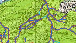
Espace réservé aux eaux de surface (ERE) - Cours d'eau latéraux et plans d'eau
Espace minimal autour des eaux de surface selon la loi révisée sur la protection des eaux entrée en vigueur en 2011. Il s’agit là d’un corridor comprenant le lit de la rivière et une bande de terrain de chaque côté, sur les berges, qui s’étend en fonction de la largeur du cours d’eau. Pour les plans d'eau, il s'agit d'une bande riveraine de 15m au minimum.
Simple
- Alternate title
-
Espace réservé aux eaux (ERE)
- Date (Creation)
- 2014-11-01
- Date (Revision)
- 2025-09-18
- Identifier
- 427
- Purpose
-
Cet espace est nécessaire afin de garantir à long terme les fonctions naturelles des eaux, la protection contre les crues et l'utilisation des eaux.
- Status
- On going
Custodian
- Spatial representation type
- Vector
Spatial resolution
Equivalent scale
- Denominator
- 10000
- Topic category
-
- I Inland waters
- F Geoscientific information
Extent
Extent
- Description
-
Canton of Valais (VS)
))

- Maintenance and update frequency
- Irregular
Resource format
- Title
-
ESRI Enterprise Geodatabase
- Date
- GEMET themes
-
-
natural dynamics
-
water
-
space
-
natural areas, landscape, ecosystems
-
- GEMET - INSPIRE themes, version 1.0
-
-
Hydrography
-
Area management/restriction/regulation zones and reporting units
-
- GEMET
-
-
protected area
-
flood protection
-
water utilisation
-
natural area
-
- geocat.ch
-
-
opendata.swiss
-
official geodata
-
Resource constraints
- Use limitation
-
Aucunes
Resource constraints
- Access constraints
- Other restrictions
- Other constraints
-
Géodonnées accessibles au public (niveau A selon l'OGéo)
- Other constraints
-
Les conditions générales d'utilisation des géodonnées du Canton du Valais font foi ( https://www.vs.ch/fr/web/guest/information-legale).
Associated resource
- Association Type
- Reference from one resource to another
- Metadata Reference
- Language
- Français
- Character encoding
- UTF8
- Environment description
-
S:\Géodonnées VS\E1 Développement territorial\Espace réservé aux eaux (ERE).lyr
- Subtopic Category
- F3 Natural Hazards
- Basic Geodata
- true
- Basic Geodata ID
-
190>A.1
- Basic Geodata Legal Level
- Communal
- Basic Geodata Type
- basicGeodata oerebRegister
- Included with dataset
- 0
- Title
-
ESPACE RESERVE AUX EAUX - Modèle sémantique (Catalogue des objets)
- Date (Creation)
- 2019-09-27
- Included with dataset
- 0
- Title
-
ESPACE RESERVE AUX EAUX - Modèle conceptuel
- Date (Creation)
- 2019-09-27
- Distribution format
-
-
ESRI Shapefile (SHP)
-
autres formats sur demande / andere Formate auf Anfrage
-
ArcGIS REST Feature Service
-
Distributor
Digital transfer options
- OnLine resource
-
Géoportail du Canton du Valais
Géoportail du Canton du Valais
Digital transfer options
- OnLine resource
-
OpenData Valais
OpenData Valais - Site de téléchargement de géodonnées à l'Etat du Valais : multiformat et WebMercator
Digital transfer options
- OnLine resource
-
Landing Page
Landing Page pour opendata
Digital transfer options
- OnLine resource
-
Permalink opendata.swiss
Permalink opendata.swiss
Digital transfer options
- OnLine resource
-
ERE_espace_reserve_eaux
Espace réservé aux eaux (ERE)
Digital transfer options
- OnLine resource
-
ERE_communes
Espace réservé aux eaux (ERE) communes
Digital transfer options
- OnLine resource
-
ERE_transitoire
Espace réservé aux eaux (ERE) transitoires
Digital transfer options
- OnLine resource
-
Consultation_ERE_Cours_eaux_lateraux
Espace réservé aux eaux (ERE) en consultation
Digital transfer options
- OnLine resource
-
Cours_eau_reconnus
Cours d'eau reconnus
Digital transfer options
- OnLine resource
-
Plans_eau_reconnus
Plans d'eau reconnus
- Statement
-
Collecte de géodonnées auprès des mandataires des communes.
- Hierarchy level
- Dataset
- Description
-
Relevés sur le terrain, digitalisation. Echelle de saisie de 2'000 en zone à bâtir et agricole, ailleurs 10'000 (forêt, zone d'estivage).
- Geometric object type
- Surface
- Geometric object count
- 4019
- Reference system identifier
- EPSG:2056/CH1903+_MN95
Metadata
- Metadata identifier
- b0174544-5055-4663-823c-2a7a022f355b
- Language
- Français
- Character encoding
- UTF8
- Language
- Deutsch
- Character encoding
- UTF8
- Language
- Italiano
- Character encoding
- UTF8
- Language
- English
- Character encoding
- UTF8
- Language
- Rumantsch
- Character encoding
- UTF8
Distributor
Type of resource
- Resource scope
- Dataset
- Metadata linkage
-
https://www.geocat.ch/geonetwork/srv/api/records/b0174544-5055-4663-823c-2a7a022f355b
- Date info (Creation)
- 2019-09-24T11:26:19Z
- Date info (Revision)
- 2026-05-11T14:50:09.730939Z
Metadata standard
- Title
-
eCH-0271