geocat.ch
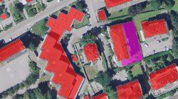
MO - Couverture du sol (bâtiments)
Couche d'information de la mensuration officielle regroupant uniquement les bâtiments et les numéros de bâtiments (catégorie de la couverture du sol). Une spécificité du modèle valaisan est la distinction des bâtiments en 6 sous-catégories: habitation, bâtiment public, bâtiment industriel, bâtiment agricole, bâtiment mixte et autre bâtiment
Simple
- Alternate title
-
Bâtiments
- Date (Creation)
- 2001-01-01
- Date (Revision)
- 2026-01-07
- Identifier
- 11
- Purpose
-
Représentation isolée des bâtiments de la MO
- Status
- On going
Custodian
- Spatial representation type
- Vector
Spatial resolution
Equivalent scale
- Denominator
- 1000
- Topic category
-
- A Imagery base maps earth cover
Extent
Extent
- Description
-
Canton of Valais (VS)
))

- Maintenance and update frequency
- Weekly
Resource format
- Title
-
ESRI Enterprise Geodatabase
- Date
- GEMET - INSPIRE themes, version 1.0
-
-
Land use
-
Land cover
-
Buildings
-
- geocat.ch
-
-
official geodata
-
cadastral surveying
-
Resource constraints
- Use limitation
-
Aucune
Resource constraints
- Access constraints
- Other restrictions
- Other constraints
-
Géodonnées accessibles au public (niveau A selon l'OGéo)
- Other constraints
-
Les conditions générales d'utilisation des géodonnées du Canton du Valais font foi ( https://www.vs.ch/fr/web/guest/information-legale).
Associated resource
- Association Type
- Reference from one resource to another
- Metadata Reference
- Language
- Français
- Character encoding
- UTF8
- Language
- Deutsch
- Character encoding
- UTF8
- Environment description
-
S:\Géodonnées VS\A2 Couverture et utilisation sol\MO-Bâtiment.lyr
- Supplemental Information
-
GeoMeta - Les métadonnées de la mensuration officielle
- Subtopic Category
- A2 Land Cover, Land Use
- Basic Geodata
- true
- Basic Geodata ID
-
55>A.1
- Basic Geodata Legal Level
- Cantonal
- Basic Geodata Type
- basicGeodata
- Included with dataset
- 0
- Title
-
Catalogue de données MD.01-MO-CH, version 24
- Date (Creation)
- 2001-01-01
- Included with dataset
- 0
- Title
-
MD.01-MO-VS_MN95_2f.ili
- Date (Creation)
- 2001-01-01
- Distribution format
-
-
OGC Web Map Service (WMS)
-
ZIP
-
ESRI File Geodatabase FileGDB (GDB)
-
OGC Geopackage (GPKG)
-
Distributor
Digital transfer options
- OnLine resource
-
Géoportail du Canton du Valais
Géoportail du Canton du Valais
Digital transfer options
- OnLine resource
-
Landing Page
Landing Page pour opendata
Digital transfer options
- OnLine resource
-
MO (GPKG)
Téléchargement (ZIP) des données pour l'ensemble du Canton du Valais, au format GPKG MN95 (CH1903+ / LV95).
Digital transfer options
- OnLine resource
-
MO (GDB)
Téléchargement (ZIP) des données pour l'ensemble du Canton du Valais, au format GDB MN95 (CH1903+ / LV95).
Digital transfer options
- OnLine resource
-
OpenData Valais
Site de téléchargement de géodonnées à l'Etat du Valais : multiformat et WebMercator
Digital transfer options
- OnLine resource
-
5
CS Batiment
Digital transfer options
- OnLine resource
-
7
CS Numéro de bâtiment
- Statement
-
Bureaux de géomètres
- Hierarchy level
- Dataset
- Description
-
Levé géodésique et calcul
- Reference system identifier
- EPSG:2056/CH1903+_LV95
- Title
-
Plan du RF
- Date (Publication)
- 2001-01-01
Metadata
- Metadata identifier
- abafbe80-c429-48b8-a5d1-20ed1f1f4eeb
- Language
- Français
- Character encoding
- UTF8
- Language
- Deutsch
- Character encoding
- UTF8
- Language
- Italiano
- Character encoding
- UTF8
- Language
- English
- Character encoding
- UTF8
- Language
- Rumantsch
- Character encoding
- UTF8
Distributor
Type of resource
- Resource scope
- Dataset
- Metadata linkage
-
https://www.geocat.ch/geonetwork/srv/api/records/abafbe80-c429-48b8-a5d1-20ed1f1f4eeb
- Date info (Creation)
- 2016-08-30T16:41:10Z
- Date info (Revision)
- 2026-06-03T14:14:05.857786Z
Metadata standard
- Title
-
eCH-0271