geocat.ch
Arrondissements du registre foncier
Description des arrondissements du registre foncier valaisans sous forme de polygones.
Simple
- Alternate title
-
Arrondissements du RF
- Date (Creation)
- 2009-12-02
- Identifier
- 232
- Purpose
-
Les données ont été constituées principalement pour établir des cartes chloroplètes en fonction des arrondissements du registre foncier
- Status
- Completed
Custodian
- Spatial representation type
- Vector
Spatial resolution
Equivalent scale
- Denominator
- 10000
- Topic category
-
- D Boundaries
Extent
Extent
- Description
-
Canton of Valais (VS)
))

- Maintenance and update frequency
- Annually
Resource format
- Title
-
ESRI Enterprise Geodatabase
- Date
- GEMET themes
-
-
administration
-
- GEMET - INSPIRE themes, version 1.0
-
-
Administrative units
-
Geographical names
-
- GEMET
-
-
municipality
-
administrative boundary
-
- geocat.ch
-
-
sovereign border
-
Resource constraints
- Use limitation
-
Aucunes
Resource constraints
- Access constraints
- Other restrictions
- Other constraints
-
Géodonnées accessibles au public (niveau A selon l'OGéo)
- Other constraints
-
Les conditions générales d'utilisation des géodonnées du Canton du Valais font foi ( https://www.vs.ch/fr/web/guest/information-legale).
- Language
- Français
- Character encoding
- UTF8
- Environment description
-
S:\Géodonnées VS\E2 Cadastre foncier\Arrondissements du registre foncier.lyr
- Distribution format
-
-
ESRI Shapefile (SHP)
-
autres formats sur demande / andere Formate auf Anfrage
-
Distributor
- Statement
-
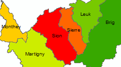
Les limites des arrondissements du registre foncier sont dérivées du jeu de données des limites communales. Les arrondissements sont des regroupements de districts selon la loi d'application du code civil suisse.
- Hierarchy level
- Dataset
- Description
-
Le jeu de données des limites communales est repris. Les limites communales au sein de l'arrondissement sont supprimées.
- Geometric object type
- Surface
- Geometric object count
- 6
- Reference system identifier
- EPSG:2056/CH1903+_MN95
Metadata
- Metadata identifier
- 93226986-f284-4b19-931a-caa5faca0f28
- Language
- Français
- Character encoding
- UTF8
- Language
- Deutsch
- Character encoding
- UTF8
- Language
- Italiano
- Character encoding
- UTF8
- Language
- English
- Character encoding
- UTF8
- Language
- Rumantsch
- Character encoding
- UTF8
Distributor
Type of resource
- Resource scope
- Dataset
- Metadata linkage
-
https://www.geocat.ch/geonetwork/srv/api/records/93226986-f284-4b19-931a-caa5faca0f28
- Date info (Creation)
- 2016-07-25T14:51:10Z
- Date info (Revision)
- 2026-04-13T09:41:42.584979Z
Metadata standard
- Title
-
eCH-0271