geocat.ch
Engagement autoroute 118
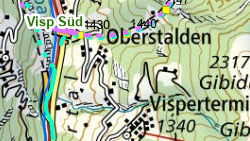
Secteurs d'intervention des sapeurs-pompiers (SP) sur les routes nationales.
Simple
- Alternate title
-
Engagement route nationale 118
- Date (Creation)
- 2019-10-10
- Date (Revision)
- 2026-01-06
- Identifier
- 532
- Purpose
-
Représentation des secteurs d'intervention des SP sur les routes nationales
- Status
- On going
Custodian
- Spatial representation type
- Vector
Spatial resolution
Equivalent scale
- Denominator
- 5000
- Topic category
-
- R Intelligence military
Extent
Extent
- Description
-
Canton of Valais (VS)
))

- Maintenance and update frequency
- As needed
Resource format
- Title
-
ESRI Enterprise Geodatabase
- Date
- GEMET themes
-
-
disasters, accidents, risk
-
- GEMET - INSPIRE themes, version 1.0
-
-
Human health and safety
-
- GEMET
-
-
fire
-
- GEMET
-
-
traffic accident
-
- GEMET
-
-
alarm
-
- GEMET
-
-
disaster zone
-
Resource constraints
- Use limitation
-
Accès restreint
Resource constraints
- Access constraints
- Other restrictions
- Other constraints
-
Accès restreint
- Other constraints
-
Les conditions générales d'utilisation des géodonnées du Canton du Valais font foi ( https://www.vs.ch/fr/web/guest/information-legale).
- Language
- Français
- Character encoding
- UTF8
- Language
- Deutsch
- Character encoding
- UTF8
- Included with dataset
- 0
- Title
-
Engagement autoroute 118
- Date (Creation)
- 2019-11-04
- Distribution format
-
-
ESRI Shapefile (SHP)
-
autres formats sur demande / andere Formate auf Anfrage
-
Distributor
Digital transfer options
- OnLine resource
-
Géoportail du Canton du Valais
Géoportail du Canton du Valais
- Statement
-
OCF, OFROU : MISTRA
- Hierarchy level
- Dataset
- Description
-
Digitalisation selon liste d'intervention (fournie par OCF)
- Geometric object type
- Curve
- Geometric object count
- 310
- Reference system identifier
- EPSG:2056/CH1903+_MN95
Metadata
- Metadata identifier
- 7f70376b-663f-4c18-93dd-b0400c174a8e
- Language
- Français
- Character encoding
- UTF8
- Language
- Deutsch
- Character encoding
- UTF8
- Language
- Italiano
- Character encoding
- UTF8
- Language
- English
- Character encoding
- UTF8
- Language
- Rumantsch
- Character encoding
- UTF8
Distributor
Type of resource
- Resource scope
- Dataset
- Metadata linkage
-
https://www.geocat.ch/geonetwork/srv/api/records/7f70376b-663f-4c18-93dd-b0400c174a8e
- Date info (Creation)
- 2020-03-02T15:08:41Z
- Date info (Revision)
- 2026-04-13T09:47:24.751748Z
Metadata standard
- Title
-
eCH-0271