geocat.ch
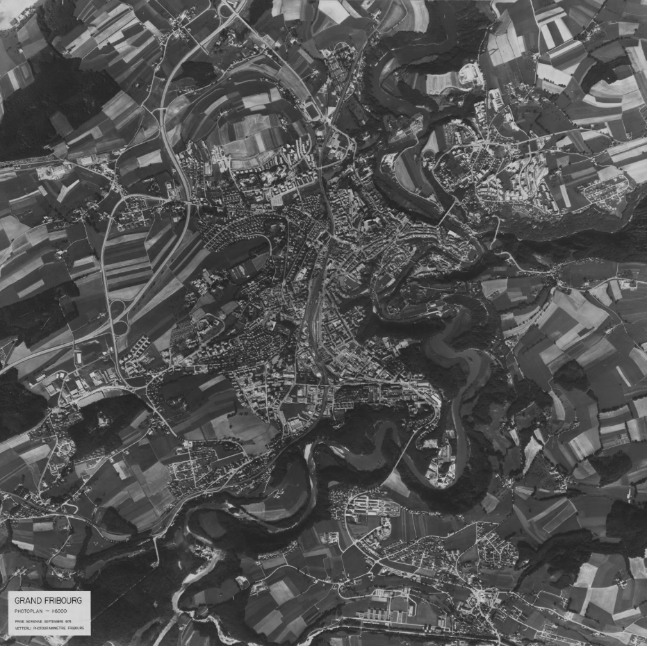
Orthophoto de 1974 - Ville de Fribourg
Orthophoto de la Ville de Fribourg réalisée par Swissair/Swissphoto en 1974.
Simple
- Date (Creation)
- 2025-11-03
User
- Topic category
-
- A Imagery base maps earth cover
Extent
Extent
- Description
-
Fribourg
N
S
E
W
))

- Maintenance and update frequency
- Unknown
- GEMET
-
-
ville
-
photo
-
- geocat.ch
-
-
orthophoto
-
carte historique
-
- Language
- Français
- Subtopic Category
- A3 Aerial and Satellite Imagery
- Distribution format
-
-
nan
-
Digital transfer options
- OnLine resource
-
Guichet cartographique de la Ville de Fribourg
Digital transfer options
- OnLine resource
-
Guichet intranet de la Ville de Fribourg
Accès privé
Metadata
- Metadata identifier
- 7d24a341-c703-4d6d-ae39-98b6b66455d6
- Language
- Français
- Language
- Deutsch
Point of contact
- Metadata linkage
-
https://www.geocat.ch/geonetwork/srv/api/records/7d24a341-c703-4d6d-ae39-98b6b66455d6
- Date info (Creation)
- 2025-11-03T10:24:52.352Z
- Date info (Revision)
- 2026-06-08T11:20:47.180551Z
Metadata standard
- Title
-
ISO 19115-3