geocat.ch
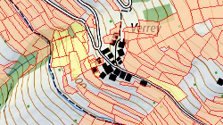
Surfaces agricoles cultivées: Périmètre SAU et surfaces d’estivage
Par surface agricole utile SAU, on entend la superficie qui est affectée à la production végétale, dont l’exposant dispose pendant toute l’année. Les surfaces d’estivage correspondent à la surface pâturable. La surface pâturable est la surface où se tiennent les animaux.
Simple
- Alternate title
-
Périmètre SAU et surfaces d’estivage
- Date (Creation)
- 2017-12-21
- Date (Revision)
- 2025-12-15
- Identifier
- 462
- Purpose
-
Représenter la surface agricole exploitable dans le cadre du programme des paiements directs.
- Status
- On going
Custodian
- Spatial representation type
- Vector
Spatial resolution
Equivalent scale
- Denominator
- 5000
- Topic category
-
- S Farming
- A Imagery base maps earth cover
Extent
Extent
- Description
-
Canton of Valais (VS)
))

- Maintenance and update frequency
- Annually
Resource format
- Title
-
ESRI Enterprise Geodatabase
- Date
- GEMET
-
-
agriculture
-
- GEMET
-
-
animal husbandry
-
- GEMET
-
-
resources
-
- GEMET
-
-
soil
-
- geocat.ch
-
-
usable agricultural area UAA
-
official geodata
-
summering
-
Resource constraints
- Use limitation
-
Aucunes
Resource constraints
- Access constraints
- Other restrictions
- Other constraints
-
Géodonnées accessibles au public (niveau A selon l'OGéo)
- Other constraints
-
Les conditions générales d'utilisation des géodonnées du Canton du Valais font foi ( https://www.vs.ch/fr/web/guest/information-legale).
Associated resource
- Association Type
- Reference from one resource to another
- Metadata Reference
- Language
- Français
- Character encoding
- UTF8
- Language
- Deutsch
- Character encoding
- UTF8
- Environment description
-
S:\Géodonnées VS\S Agriculture\Périmètre SAU et surfaces d’estivage.lyr
- Supplemental Information
- Subtopic Category
- A2 Land Cover, Land Use
- Basic Geodata
- true
- Basic Geodata ID
-
153>A.5
- Basic Geodata Legal Level
- Cantonal
- Basic Geodata Type
- basicGeodata
- Included with dataset
- 0
- Title
-
Modèles de géodonnées minimaux - Exploitation agricole
- Date (Creation)
- 2017-11-02
- Included with dataset
- 0
- Title
-
Perimeter_LN_Soemmerungsflaechen_V1_3.ili
- Date (Creation)
- 2017-03-21
- Distribution format
-
-
ESRI Shapefile (SHP)
-
autres formats sur demande / andere Formate auf Anfrage
-
Distributor
- Statement
-
Données saisies par l'exploitant via l'application Internet ePDIR et contrôlées par le service de l'agriculture. La couche «Périmètre SAU et surfaces d’estivage» constitue une base pour la saisie spatiale des cultures «Surfaces d’utilisation».
- Hierarchy level
- Dataset
- Description
-
Géométrie saisie manuellement sur la base d'orthophoto ou dérivée de la parcelle. Stockage dans SAP.
- Geometric object type
- Surface
- Geometric object count
- 334173
- Reference system identifier
- EPSG:2056/CH1903+_MN95
- Title
-
Modèle de représentation relatif aux modèles de géodonnées minimaux - Exploitation agricole
- Date (Publication)
- 2017-02-27
Metadata
- Metadata identifier
- 7b776aac-553b-467c-913c-268c3cf51f88
- Language
- Français
- Character encoding
- UTF8
- Language
- Deutsch
- Character encoding
- UTF8
- Language
- Italiano
- Character encoding
- UTF8
- Language
- English
- Character encoding
- UTF8
- Language
- Rumantsch
- Character encoding
- UTF8
Distributor
Type of resource
- Resource scope
- Dataset
- Metadata linkage
-
https://www.geocat.ch/geonetwork/srv/api/records/7b776aac-553b-467c-913c-268c3cf51f88
- Date info (Creation)
- 2018-03-02T06:43:58Z
- Date info (Revision)
- 2026-04-29T11:37:12.769984Z
Metadata standard
- Title
-
GM03 2+