geocat.ch
Plan directeur cantonal: D.4 Projet de déviation routière
Projets de déviation routière
Simple
- Alternate title
-
Plan directeur cantonal: Projet de déviation routière
- Date (Creation)
- 2018-05-30
- Date (Revision)
- 2026-05-07
- Identifier
- 516
- Purpose
-
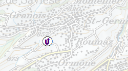
Situer les projets de déviation routière dans le cadre du plan directeur cantonal
- Status
- Completed
Custodian
- Spatial representation type
- Vector
Spatial resolution
Equivalent scale
- Denominator
- 40000
- Topic category
-
- E Planning cadastre
Extent
Extent
- Description
-
Canton of Valais (VS)
))

- Maintenance and update frequency
- As needed
Resource format
- Title
-
ESRI Enterprise Geodatabase
- Date
- GEMET - INSPIRE themes, version 1.0
-
-
Transport networks
-
- GEMET
-
-
urban planning and development
-
- geocat.ch
-
-
structure plan
-
official geodata
-
Resource constraints
- Use limitation
-
Aucune
Resource constraints
- Access constraints
- Other restrictions
- Other constraints
-
Géodonnées accessibles au public (niveau A selon l'OGéo)
- Other constraints
-
Les conditions générales d'utilisation des géodonnées du Canton du Valais font foi ( https://www.vs.ch/fr/web/guest/information-legale).
- Language
- Français
- Character encoding
- UTF8
- Language
- Deutsch
- Character encoding
- UTF8
- Subtopic Category
- E1 Spatial Planning, Spatial Development
- Basic Geodata
- true
- Basic Geodata ID
-
69>A
- Basic Geodata Legal Level
- Cantonal
- Basic Geodata Type
- basicGeodata
- Distribution format
-
-
ESRI Shapefile (SHP)
-
autres formats sur demande / andere Formate auf Anfrage
-
ArcGIS REST Feature Service
-
Distributor
Digital transfer options
- OnLine resource
-
Géoportail du Canton du Valais
Géoportail du Canton du Valais
Digital transfer options
- OnLine resource
-
PDc_Deviation_proj
Projet de déviation routière
- Statement
-
SDT
- Hierarchy level
- Dataset
- Description
-
Numérisation
- Geometric object type
- Point
- Geometric object count
- 6
- Reference system identifier
- EPSG:2056/CH1903+_MN95
Metadata
- Metadata identifier
- 78cf1c4b-85f6-4701-b021-63b1961c17ff
- Language
- Français
- Character encoding
- UTF8
- Language
- Deutsch
- Character encoding
- UTF8
- Language
- Italiano
- Character encoding
- UTF8
- Language
- English
- Character encoding
- UTF8
- Language
- Rumantsch
- Character encoding
- UTF8
Distributor
Type of resource
- Resource scope
- Dataset
- Metadata linkage
-
https://www.geocat.ch/geonetwork/srv/api/records/78cf1c4b-85f6-4701-b021-63b1961c17ff
- Date info (Creation)
- 2019-06-18T14:02:25Z
- Date info (Revision)
- 2026-05-20T08:20:42.494523Z
Metadata standard
- Title
-
eCH-0271