geocat.ch
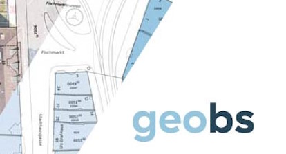
Zonenplan Riehen
Der Zonenplan ist ein kommunales Planungsinstrument, welches grundeigentümerverbindlich und parzellenscharf die zulässige Art der Landnutzung sowie das maximale Ausmass von baulichen Anlagen regelt.
Weitere Informationen:
* [Legende und Bemerkung zum Zonenplan]( https://map.geo.bs.ch/file_proxy/RN_Nutzungsplanung_Grundnutzung_Z2A/Planlegende_Zonenplan_Riehen.pdf)
Simple
- Date (Publication)
- 2018-04-30
Distributor
- Topic category
-
- E Planning cadastre
Extent
Extent
- Description
-
Gemeinde Riehen
))

- Maintenance and update frequency
- As needed
- Keywords
-
-
kantonaler Nutzungsplan
-
- Keywords
-
-
Landnutzung
-
- Keywords
-
-
NPRI
-
- Keywords
-
-
Nutzungsplan
-
- Keywords
-
-
Nutzungsplanung
-
- Keywords
-
-
opendata.swiss
-
Resource constraints
- Use constraints
- Other restrictions
- Other constraints
-
Opendata BY: Freie Nutzung. Quellenangabe ist Pflicht. Es gelten die Nutzungsbedingungen für Geodaten des Kantons Basel-Stadt. ( http://www.geo.bs.ch/agb)
Associated resource
- Association Type
- Reference to resources that are parts of this resource
- Metadata Reference
Associated resource
- Association Type
- Reference to resources that are parts of this resource
- Metadata Reference
Associated resource
- Association Type
- Reference to resources that are parts of this resource
- Metadata Reference
Associated resource
- Association Type
- Reference to resources that are parts of this resource
- Metadata Reference
Associated resource
- Association Type
- Reference to resources that are parts of this resource
- Metadata Reference
Associated resource
- Association Type
- Reference to resources that are parts of this resource
- Metadata Reference
- Language
- Deutsch
- Character encoding
- UTF8
- Basic Geodata
- true
- Basic Geodata ID
-
73>A
- Basic Geodata Access Level
- A
- Distribution format
-
-
ESRI Shapefile (SHP)
-
OGC Geopackage (GPKG)
-
GeoJSON (GEOJSON)
-
ESRI File Geodatabase FileGDB (GDB)
-
FlatGeobuf
-
AutoCAD DXF (DXF)
-
AutoCAD DWG (DWG)
-
TEXT, comma separated (CSV)
-
Distributor
Digital transfer options
- OnLine resource
-
ÖREB-Kataster
ÖREB-Kataster
- OnLine resource
-
MapBS
MapBS
- OnLine resource
-
Geoportal Kanton Basel-Stadt
Geoportal Kanton Basel-Stadt
- OnLine resource
-
shp
Datensatz im shp Format
- OnLine resource
-
gpkg
Datensatz im gpkg Format
- OnLine resource
-
geojson
Datensatz im geojson Format
- OnLine resource
-
gdb
Datensatz im gdb Format
- OnLine resource
-
fgb
Datensatz im fgb Format
- OnLine resource
-
dxf
Datensatz im dxf Format
- OnLine resource
-
dwg
Datensatz im dwg Format
- OnLine resource
-
csv
Datensatz im csv Format
- Reference system identifier
- LV95 EPSG:2056
Metadata
- Metadata identifier
- 786ef2b5-6a99-4350-8809-0d744cfbaab8
- Language
- Deutsch
- Character encoding
- UTF8
Distributor
Type of resource
- Resource scope
- Dataset
- Metadata linkage
-
https://www.geocat.ch/geonetwork/srv/api/records/786ef2b5-6a99-4350-8809-0d744cfbaab8
- Date info (Creation)
- 2026-07-21T13:23:58.101575Z
- Date info (Revision)
- 2026-08-21T07:09:46.448513Z
Metadata standard
- Title
-
eCH-0271