geocat.ch
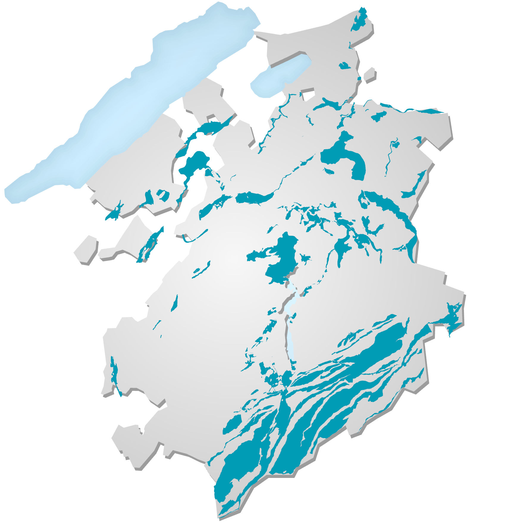
Zones réservées pour l’eau potable
Zones réservées à l'exploitation de l’eau potable: l'implantation de nouvelles sondes géothermiques verticales (SGV) y est interdite. Délimitées selon des critères hydrogéologiques, d’utilisation de l'eau et d'aménagement du territoire, ces zones regroupent les aquifères d'intérêt public (débit moyen exploitable égal ou supérieur à 200 l/min), à l'exception de certains secteurs de la zone à bâtir situés sur des aquifères de moindre importance stratégique pour l’alimentation en eau potable. Cette donnée sert à établir la carte d'admissibilité des SGV.
Simple
- Alternate title
-
Zones réservées pour l’eau potable ZEPot (interdiction de SGV)
- Date (Publication)
- 2021-06-22
- Presentation form
- Digital map
- Status
- On going
Point of contact
- Spatial representation type
- Vector
Spatial resolution
Equivalent scale
- Denominator
- 10000
- Topic category
-
- L Environment
Extent
Extent
- Description
-
Canton of Fribourg (FR)
))

- Maintenance and update frequency
- As needed
Resource format
- Title
-
ESRI Enterprise Geodatabase
- Date
- GEMET
-
-
geothermal energy
-
Resource constraints
- Other constraints
-
Propriété de l'Etat de Fribourg, accès public
- Language
- Français
- Character encoding
- UTF8
- Environment description
-
Serveur de consultation: OPR4034S_SGV_INTERDICT_ZEPOT
- Subtopic Category
- L1 Environmental Protection, Noise
- Included with dataset
- 0
- Title
-
Zones d’interdiction des sondes géothermiques verticales (SGV)
- Date (Publication)
- 2016-04-18
- Name
-
Zones d’interdiction des sondes géothermiques verticales (SGV)
- Date
- 2016-04-18
Property description
- Property name
- OPR4034S_SGV_INTERDICT_ZEPOT
- Definition
-
Zones d’interdiction des sondes géothermiques verticales (SGV)
Elements
- Member name
- AQUIFERES_ID
- Definition
-
Identifiant cantonal de l'aquifère
Elements
- Member name
- NOM
- Definition
-
Nom ou localisation de l'aquifère
Elements
- Member name
- ZEPOT_CRITERE
- Definition
-
Motif justifiant l'interdiction des SGV: "hydrogéologie" ou "aménagement du territoire"
- Statement
-
Les données proviennent du Service de l’environnement
- Hierarchy level
- Dataset
- Geometric object type
- Surface
- Geometric object count
- 10
- Reference system identifier
- CH1903+/MN95, Système de coordonnées nationales (EPSG:2056)
Metadata
- Metadata identifier
- 75c6f67a-4916-4cc5-827e-78e9cb84791f
- Language
- Français
- Character encoding
- UTF8
- Language
- Deutsch
- Character encoding
- UTF8
- Language
- Italiano
- Character encoding
- UTF8
- Language
- English
- Character encoding
- UTF8
Point of contact
Type of resource
- Resource scope
- Dataset
- Metadata linkage
-
https://www.geocat.ch/geonetwork/srv/api/records/75c6f67a-4916-4cc5-827e-78e9cb84791f
- Date info (Creation)
- 2021-06-21T13:42:58Z
- Date info (Revision)
- 2026-05-27T07:43:09.704212Z
Metadata standard
- Title
-
eCH-0271