geocat.ch
Gravimetrischer Atlas der Schweiz 1:100000
Atlas gravimétrique de la Suisse 1:100000
Atlante gravimetrico della Svizzera 1:100000
Gravimetric Atlas of Switzerland 1:100000
Atlas gravimetric da la Svizra 1:100000
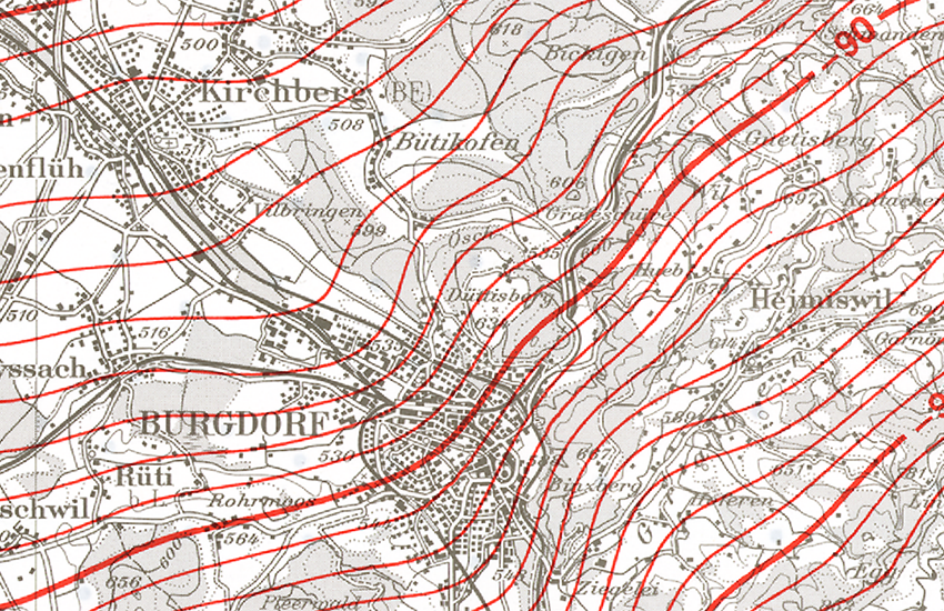
In 22 Blättern werden die Bouguer-Anomalien für die Schweiz dargestellt. Als Bouguer-Anomalie bezeichnet man die Differenz zwischen der in einem bestimmten Punkt auf der Erdoberfläche gemessenen Schwere und jenem Schwerewert, welchen man für eine schalenförmig homogene Erde am selben Punkt erwarten würde. Die Berechnungen der Schwereanomalien der Erdkruste basieren auf der internationalen Schwereformel von 1967. Die Geländeeinwirkung wurde mit einer konstanten Dichte von 2670kg/m3 bis 167 km (Zone O2 nach Hayford) berücksichtigt.- Der Gravimetrische Atlas der Schweiz (GRAV100) ist eine Publikation der Schweizerischen Geophysikalischen Kommission (Organ der Akademie der Naturwissenschaften).
Les anomalies de Bouguer sont représentées sur 22 feuilles couvrant l’ensemble du territoire suisse. On nomme anomalie de Bouguer la différence entre l’intensité de la pesanteur mesurée en un point donnée de la surface terrestre et la valeur calculée au même point d’un modèle de Terre idéale, dotée d’un croûte homogène. Les calculs des anomalies gravitaires de la croûte terrestre se basent sur la formule internationale de gravité de 1967. L'incidence de la topographie a été prise en compte avec une densité constante de 2670 kg / m3 jusqu’à 167 km (zone O2 de Hayford).- L'Atlas gravimétrique de la Suisse (GRAV100) est une publication de la Commission suisse de géophysique (organe de l'Académie suisse des sciences naturelles).
L’atlante riproduce i valori delle anomalie di Bouguer su 22 fogli che coprono tutto il territorio svizzero. L’anomalia di Bouguer esprime la differenza tra la gravità misurata e il relativo valore teorico per un modello terrestre ideale a crosta omogenea, tenuto conto di diversi parametri quali l’altitudine, la latitudine e l’influenza della topografia. I calcoli delle anomalie di gravità della crosta terrestre si basano sulla formula internazionale di gravità del 1967. L’incidenza della topografia è stata considerata con una densità costante di 2670 kg/m3 fino a 167 km (zona O2 di Hayford). L’Atlante gravimetrico della Svizzera (GRAV100) è una pubblicazione della Commissione svizzera di geofisica (organo dell’Accademia svizzera di scienze naturali).
The Bouguer anomalies for Switzerland are shown on 22 sheets. A Bouguer anomaly is the difference between the gravity measured at a particular point on the Earth's surface and the gravity value expected at the same point for an Earth model with a homogeneous crust. Gravity anomalies in the Earth's crust are calculated using the International Gravity Formula of 1967. Topographic effects are taken into account using a constant density of 2670 kg/m3 to a depth of 167 km (Hayford Zone O2). The Gravimetric Atlas of Switzerland (GRAV100) is a publication of the Swiss Geophysical Commission (part of the Swiss Academy of Sciences).
En 22 fegls vegnan preschentadas las anomalias da Bouguer per la Svizra. Anomalias da Bouguer numnan ins la differenza tranter la gravitad ch'è vegnida mesirada en in punct fixà sin la surfatscha da la terra e la valur da la gravitad calculada en il medem punct per in model terrester ideal cun crusta da terra omogena. Las calculaziuns da las anomalias da la gravitad da la crusta da la terra sa basan sin la furmla internaziunala da gravitad da l'onn 1967. L'influenza da la topografia è vegnida resguardada cun ina densitad constanta da 2670 kg/m3 fin ad ina distanza da 167 km (zona O2 tenor Hayford). – L'Atlas gravimetric da la Svizra (GRAV100) vegn publitgà da la Cumissiun svizra da geofisica (Organ da l'Academia svizra da las scienzas natiralas).
Simple
-
Autre titreAltri nomi o acronimiAlternate titleAlternate titleAlternativtitel
-
Gravimetrischer Atlas 100
Atlas gravimétrique 100
Atlante gravimetrico 100
Gravimetric Atlas 100
Atlas gravimetric 100
-
Date (Révision)Data (Revisione)Date (Revision)Date (Revision)Datum (Aktualisierung)
- 2002-12-31
-
Date (Création)Data (Creazione)Date (Creation)Date (Creation)Datum (Erstellung)
- 1994-01-01T00:00:00
-
IdentifiantIdentificatoreIdentifierIdentifierKennung
- ch.swisstopo.geologie-gravimetrischer_atlas
-
Forme de la présentationForma della presentazionePresentation formPresentation formPräsentationsform
-
Carte papierMappa cartaceaHardcopy mapHardcopy mapPapierkarte
-
ButScopoPurposePurposeZweck
-
Übersicht über das Schwerefeld in der Schweiz
Vue d'ensemble du champ gravimétrique en Suisse
-
ÉtatStatoStatusStatusBearbeitungsstatus
-
TerminéCompletatoCompletedCompletedAbgeschlossen
Distributeur
Distributore
Distributor
Distributor
Verteiler
Organisateur
Originatore
Originator
Originator
Urheber
Point de contact
Punto di contatto
Point of contact
Point of contact
Ansprechpartner
Propriétaire
Proprietario
Owner
Owner
Eigentümer
-
Type de représentation spatialeTipo di rappresentazione spazialeSpatial representation typeSpatial representation typeRäumliche Darstellungsart
-
paperMappaperMappaperMappaperMappaperMap
Résolution spatiale
Risoluzione spaziale
Spatial resolution
Spatial resolution
Räumliche Auflösung
Fraction représentative
Frazione rappresentativa
Equivalent scale
Equivalent scale
Vergleichsmassstab
-
DénominateurDenominatoreDenominatorDenominatorMassstabszahl
- 100000
-
Catégorie de thèmeCategoria ISOTopic categoryTopic categoryThematik
-
-
F Informations géoscientifiquesF Informazioni geoscientificheF Geoscientific informationF Geoscientific informationF Erdwissenschaften
-
Étendue
Estensione
Extent
Extent
Ausdehnung
Étendue
Estensione
Extent
Extent
Ausdehnung
-
DescriptionDescrizioneDescriptionDescriptionBeschreibung
-
Switzerland
Schweiz
Suisse
Svizzera
Svizra
))

-
Fréquence de mise à jourFrequenza di aggiornamentoMaintenance and update frequencyMaintenance and update frequencyWartungsintervall
-
Comme nécessaireSecondo necessitàAs neededAs neededBei Bedarf
-
Durée de conservationDurata di conservazioneDuration of ConservationDuration of ConservationAufbewahrungsdauer NV in Jahren
- 275
-
Évaluation de la valeur archivistiqueValutazione del valore archivisticoAppraisal of Archival ValueAppraisal of Archival ValueBewertung Archivwürdigkeit
-
AAAAA
-
Raison de la valeur d'archivageMotivo del valore archivisticoReason for Archiving ValueReason for Archiving ValueBegründung Archivwürdigkeit
-
Preuve de la pratique couranteProva della pratica commercialeEvidence of business practiceEvidence of business practiceNachweis der Geschäftspraxis
- geocat.ch
-
-
Planification de la conservation et de l'archivage AAP - Conféderation
Pianificazione della conservazione e dell’archiviazione AAP - Confederazione
Conservation and archiving planning AAP - Confederation
-
géodonnées de base
geodati di base
official geodata
-
carte géophysique
carta geofisica
geophysical map
-
gravimétrie
gravimetria
gravimetry
-
anomalie de bouguer
anomalie di bouguer
bouguer anomaly
-
opendata.swiss
opendata.swiss
opendata.swiss
opendata.swiss
-
- GEMET
-
-
géophysique
geofisica
geophysics
-
- GEMET - INSPIRE themes, version 1.0
-
-
Géologie
Geologia
Geology
-
- geocat.ch
-
-
BGDI Bundesgeodaten-Infrastruktur
IFDG l’Infrastructure Fédérale de données géographiques
IFDG Infrastruttura federale dei dati geografici
FSDI Federal Spatial Data Infrastructure
-
Ressource associée
Risorsa associata
Associated resource
Associated resource
Verlinkte Ressource
-
TitreTitoloTitleTitleTitel
-
Geophysikalisches Kartenwerk
Cartes géophysiques
Carte geofisiche
-
Type d'associationTipo di associazioneAssociation TypeAssociation TypeAssoziationstyp
-
Citation de travail plus largeCitazione di un'opera più ampiaReference to a master resource of which this one is a partReference to a master resource of which this one is a partÜbergeordneter Datenbestand
-
LangueLinguaLanguageLanguageSprache
- Deutsch
-
Encodage de caractèresCodifica dei caratteriCharacter encodingCharacter encodingZeichenkodierung
-
Utf8UTF8UTF8UTF8Utf8
-
LangueLinguaLanguageLanguageSprache
- Français
-
Encodage de caractèresCodifica dei caratteriCharacter encodingCharacter encodingZeichenkodierung
-
Utf8UTF8UTF8UTF8Utf8
-
Catégorie de sous-thèmeCategoria di sottotemaSubtopic CategorySubtopic CategoryThematische Unterkategorien
-
F1 GéologieF1 GeologiaF1 GeologyF1 GeologyF1 Geologie
-
Géodonnées de baseGeodati di baseBasic GeodataBasic GeodataGeobasisdaten
- true
-
Identifiant Géodonnées de baseIdentificativo dei geodati di baseBasic Geodata IDBasic Geodata IDIdentifikator des Geobasisdatensatzes
-
47.11
-
Niveau des géodonnées de baseLivello legale dei geodati di baseBasic Geodata Legal LevelBasic Geodata Legal LevelGeobasisdatenebene
-
FédéralFederaleFederalFederalNational
-
Format de distributionFormato (codifica)Distribution formatDistribution formatAbgabeformat
-
-
nan
-
Options de transfert numérique
Opzioni di trasferimento digitale
Digital transfer options
Digital transfer options
Optionen für die digitale Übertragung
-
Ressource en ligneRisorsa onlineOnLine resourceOnLine resourceOnline
-
Vorschau map.geo.admin.ch
Vorschau map.geo.admin.chAperçu map.geo.admin.chPrevisione map.geo.admin.chPreview map.geo.admin.ch
Options de transfert numérique
Opzioni di trasferimento digitale
Digital transfer options
Digital transfer options
Optionen für die digitale Übertragung
-
Ressource en ligneRisorsa onlineOnLine resourceOnLine resourceOnline
-
ch.swisstopo.geologie-gravimetrischer_atlas
WMS-BGDI Dienst, Layer "Gravimetrischer Atlas 100"Service WMS-IFDG, couche "Atlas gravimétrique 100"Servizio WMS-IFDG, strato "Atlante gravimetrico 100"WMS-FSDI service, layer "Gravimetric Atlas 100"WMS-BGDI Dienst, Layer "Gravimetrischer Atlas 100"
Options de transfert numérique
Opzioni di trasferimento digitale
Digital transfer options
Digital transfer options
Optionen für die digitale Übertragung
-
Ressource en ligneRisorsa onlineOnLine resourceOnLine resourceOnline
-
ch.swisstopo.geologie-gravimetrischer_atlas
WMTS-BGDI Dienst, Layer "Gravimetrischer Atlas 100"Service WMTS-IFDG, couche , Layer "Atlas gravimétrique 100"Servizio WMTS-IFDG, strato "Atlante gravimetrico 100"WMTS-FSDI service, layer "Gravimetric Atlas 100"WMTS-BGDI Dienst, Layer "Gravimetrischer Atlas 100"
Options de transfert numérique
Opzioni di trasferimento digitale
Digital transfer options
Digital transfer options
Optionen für die digitale Übertragung
Options de transfert numérique
Opzioni di trasferimento digitale
Digital transfer options
Digital transfer options
Optionen für die digitale Übertragung
Options de transfert numérique
Opzioni di trasferimento digitale
Digital transfer options
Digital transfer options
Optionen für die digitale Übertragung
-
Généralités sur la provenanceInformazioni generali sulla provenienzaStatementStatementErklärung
-
Die Blätter des Gravimetrischen Atlas, mit dem Blattschnitt der Landeskarte 1:100 000, geben Auskunft über das Schwerefeld der Schweiz.
-
NiveauLivelloHierarchy levelHierarchy levelBezugsebene
-
Jeu de donnéesSet di datiDatasetDatasetDatenbestand
-
Nom du système de référenceNome del sistema di riferimentoReference system identifierReference system identifierName des Referenzsystems
- Referenzsystem entsprechend der zugrundeliegenden topographischen Karte (CH1903)
Metadata
-
Identifiant des métadonnéesIdentificativo della schedaMetadata identifierMetadata identifierIdentifikator des Metadatensatzes
- 732cb247-8307-4cc7-8c31-b1c505a94633
-
LangueLinguaLanguageLanguageSprache
- Deutsch
-
Encodage de caractèresCodifica dei caratteriCharacter encodingCharacter encodingZeichenkodierung
-
Utf8UTF8UTF8UTF8Utf8
-
LangueLinguaLanguageLanguageSprache
- Français
-
Encodage de caractèresCodifica dei caratteriCharacter encodingCharacter encodingZeichenkodierung
-
Utf8UTF8UTF8UTF8Utf8
-
LangueLinguaLanguageLanguageSprache
- Italiano
-
Encodage de caractèresCodifica dei caratteriCharacter encodingCharacter encodingZeichenkodierung
-
Utf8UTF8UTF8UTF8Utf8
-
LangueLinguaLanguageLanguageSprache
- English
-
Encodage de caractèresCodifica dei caratteriCharacter encodingCharacter encodingZeichenkodierung
-
Utf8UTF8UTF8UTF8Utf8
-
LangueLinguaLanguageLanguageSprache
- Rumantsch
-
Encodage de caractèresCodifica dei caratteriCharacter encodingCharacter encodingZeichenkodierung
-
Utf8UTF8UTF8UTF8Utf8
Point de contact
Punto di contatto
Point of contact
Point of contact
Ansprechpartner
Type de ressource
Tipo di risorsa
Type of resource
Type of resource
Anwendungsbereich der Metadaten
-
Domaine d'application de la ressourceAmbito di applicazione della risorsaResource scopeResource scopeDomäne der Ressourcenanwendung
-
Jeu de donnéesSet di datiDatasetDatasetDatenbestand
-
Lien vers la métadonnéeCollegamento ai metadatiMetadata linkageMetadata linkageLink zu den Metadaten
-
Informations de date (Création)Informazioni sulla data (Creazione)Date info (Creation)Date info (Creation)Datumsangaben (Erstellung)
- 2009-06-11T12:00:00Z
-
Informations de date (Révision)Informazioni sulla data (Revisione)Date info (Revision)Date info (Revision)Datumsangaben (Aktualisierung)
- 2026-04-13T09:25:31.393065Z
Norme des métadonnées
Standard dei metadati
Metadata standard
Metadata standard
Metadatenstandard
-
TitreTitoloTitleTitleTitel
-
eCH-0271