geocat.ch
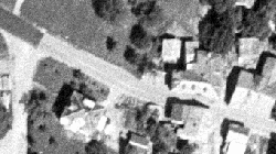
Anciennes photographies aériennes (périmètres Brig-Glis et Conches) n/b
Images aériennes de swisstopo de 1930 à 1999 du périmètre Brig-Glis et de 1940 à 1941 du périmètre Goms
Simple
- Alternate title
-
Anciennes photo aériennes (périmètres Brig-Glis et Conches)
- Date (Creation)
- 2017-12-01
- Identifier
- 405
- Purpose
-
Mise à disposition des images aériennes pour des projets cantonaux
- Status
- Historical archive
Custodian
- Spatial representation type
- Grid
- Topic category
-
- A Imagery base maps earth cover
Extent
Extent
- Description
-
Brig-Glis
))

Extent
Extent
- Description
-
Région Goms
- Geographic identifier
- VS_Goms
))

- Maintenance and update frequency
- Not planned
Resource format
- Title
-
Tagged Image File Format (TIFF)
- Date
- GEMET
-
-
history
-
aerial photograph
-
- geocat.ch
-
-
official geodata
-
Resource constraints
- Use limitation
-
sous licence
Resource constraints
- Access constraints
- Other restrictions
- Other constraints
-
Géodonnées accessibles au public (niveau A selon l'OGéo)
- Other constraints
-
Les conditions générales d'utilisation des géodonnées du Canton du Valais font foi ( https://www.vs.ch/fr/web/guest/information-legale).
- Language
- Français
- Character encoding
- UTF8
- Subtopic Category
- A3 Aerial and Satellite Imagery
- Basic Geodata
- true
- Basic Geodata ID
-
36.1
- Basic Geodata Legal Level
- Federal
- Basic Geodata Type
- Reference Geodata
- Distribution format
-
-
GeoTIFF (GEOTIFF)
-
Cloud Optimized GeoTIFF (TIFF / TIF)
-
Distributor
- Statement
-
Photos aériennes analogues de Swisstopo
- Hierarchy level
- Dataset
- Description
-
Numérisation
- Reference system identifier
- EPSG:2056/CH1903+_MN95
Metadata
- Metadata identifier
- 711c9e7a-af96-42af-a216-ec84957198bf
- Language
- Français
- Character encoding
- UTF8
- Language
- Deutsch
- Character encoding
- UTF8
- Language
- Italiano
- Character encoding
- UTF8
- Language
- English
- Character encoding
- UTF8
- Language
- Rumantsch
- Character encoding
- UTF8
Distributor
Type of resource
- Resource scope
- Dataset
- Metadata linkage
-
https://www.geocat.ch/geonetwork/srv/api/records/711c9e7a-af96-42af-a216-ec84957198bf
- Date info (Creation)
- 2018-08-03T14:25:46Z
- Date info (Revision)
- 2026-05-18T11:53:08.205412Z
Metadata standard
- Title
-
eCH-0271