geocat.ch
Plan de la Ville de Fribourg de 1848 (BCU)
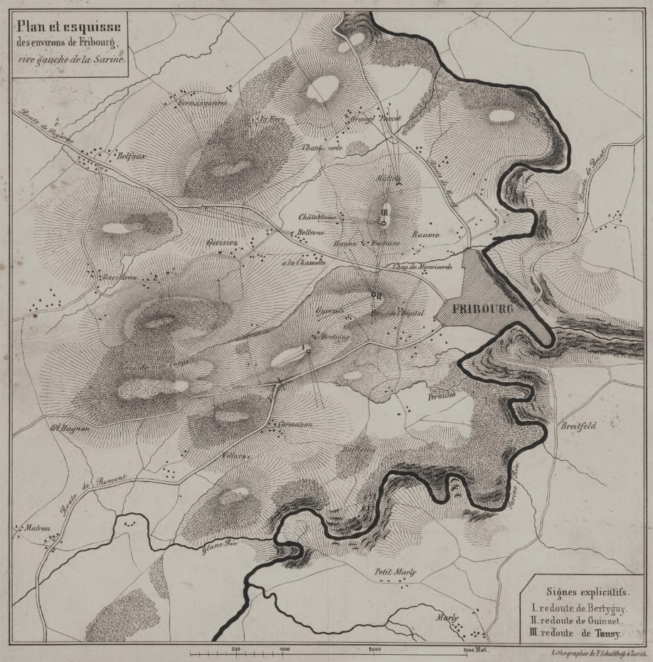
Le plan intitulé "Plan et esquisse des environs de Fribourg, rive gauche de la Sarine" mesure 20 x 20 cm.
Il représente la rive gauche de la Sarine, incluant Fribourg et les villes/villages voisins. On y voit l'emplacement de la redoute de Bertigny, de Guinzet et de Tansy.
Simple
- Alternate title
-
Plan 1848
- Date (Creation)
- 2024-07-08
- Identifier
- BCUF: 6/P (Glasson 1086) © Tous droits réservés
- Presentation form
- Hardcopy map
- Other citation details
-
FR029
- Status
- Historical archive
Principal investigator
Bibliothèque cantonale et universitaire (BCU) - Nicolas Bugnon (Service de la culture (SeCu))
Rue de la Carrière 22
Fribourg
1701
CH
- Topic category
-
- A Imagery base maps earth cover
- R Intelligence military
Extent
Extent
- Description
-
Fribourg
N
S
E
W
))

Extent
Extent
- Description
-
Granges-Paccot
N
S
E
W
))

Extent
Extent
- Description
-
Belfaux
N
S
E
W
))

Extent
Extent
- Description
-
Givisiez
N
S
E
W
))

- GEMET
-
-
plan
-
- geocat.ch
-
-
carte historique
-
- Language
- Français
- Subtopic Category
- A1 Base Maps, Landscape Models
- Distribution format
-
-
nan
-
Digital transfer options
- OnLine resource
-
Plan(s) et détails
Digital transfer options
- OnLine resource
-
Guichet intranet de la Ville de Fribourg
Accès privé
Digital transfer options
- OnLine resource
-
Plan(s) et détails
- Reference system identifier
- CH1903+/MN95
Metadata
- Metadata identifier
- 6a414924-3cd0-47d3-9366-7ded5b818521
- Language
- Français
- Language
- Deutsch
Point of contact
- Metadata linkage
-
https://www.geocat.ch/geonetwork/srv/api/records/6a414924-3cd0-47d3-9366-7ded5b818521
- Date info (Creation)
- 2024-07-08T08:17:00.342Z
- Date info (Revision)
- 2026-06-08T11:17:27.734229Z
Metadata standard
- Title
-
ISO 19115-3