geocat.ch
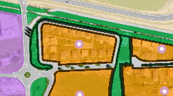
Plan d'affectation de zones
Définition des affectations primaires, zones et périmètres superposés communaux. De plus sont indiqués sous forme de point, les modifications partielles, homologations complémentaires et plans spéciaux.
Simple
- Alternate title
-
PAZ
- Date (Creation)
- 2015-01-01
- Date (Revision)
- 2026-05-28
- Identifier
- 5
- Purpose
-
Représentation harmonisée des plans de zones communaux
- Status
- On going
Custodian
- Spatial representation type
- Vector
Spatial resolution
Equivalent scale
- Denominator
- 2000
- Topic category
-
- E Planning cadastre
Extent
Extent
- Description
-
Canton of Valais (VS)
))

- Maintenance and update frequency
- Continual
Resource format
- Title
-
ESRI Enterprise Geodatabase
- Date
- GEMET
-
-
territory
-
land occupation
-
- geocat.ch
-
-
official geodata
-
opendata.swiss
-
Resource constraints
- Use limitation
-
aucunes
Resource constraints
- Access constraints
- Other restrictions
- Other constraints
- Publicly accessible basic geodata : level A (GeoIV, Art. 21).
- Other constraints
-
Les conditions générales d'utilisation des géodonnées du Canton du Valais font foi ( https://www.vs.ch/fr/web/guest/information-legale).
Associated resource
- Association Type
- Reference from one resource to another
- Metadata Reference
- Language
- Français
- Character encoding
- UTF8
- Language
- Deutsch
- Character encoding
- UTF8
- Environment description
-
S:\Géodonnées VS\E1 Développement territorial\Plan d’affectation de zones.lyr
- Subtopic Category
- E1 Spatial Planning, Spatial Development
- Basic Geodata
- true
- Basic Geodata ID
-
73>A.1
- Basic Geodata Legal Level
- Communal
- Basic Geodata Type
- basicGeodata oerebRegister
- Included with dataset
- 0
- Title
-
Annexe B de la directive de nomenclature et de saisie des géodonnées des plans d'affectation des zones
- Date (Creation)
- 2025-04-14
- Distribution format
-
-
OGC Web Map Service (WMS)
-
ZIP
-
ESRI File Geodatabase FileGDB (GDB)
-
OGC Geopackage (GPKG)
-
Distributor
Digital transfer options
- OnLine resource
-
Géoportail du Canton du Valais
Géoportail du Canton du Valais
Digital transfer options
- OnLine resource
-
Landing Page
Landing Page pour opendata
Digital transfer options
- OnLine resource
-
PAZ (GPKG)
Téléchargement (ZIP) des données pour l'ensemble du Canton du Valais, au format GPKG (CH1903+ / LV95).
Digital transfer options
- OnLine resource
-
PAZ (GDB)
Téléchargement (ZIP) des données pour l'ensemble du Canton du Valais, au format GDB (CH1903+ / LV95).
Digital transfer options
- OnLine resource
-
Permalink opendata.swiss
Permalink opendata.swiss
Digital transfer options
- OnLine resource
-
0
Affectations primaires
Digital transfer options
- OnLine resource
-
1
Zones superposées
Digital transfer options
- OnLine resource
-
2
Contenu linéaire
Digital transfer options
- OnLine resource
-
3
Contenu ponctuel
Digital transfer options
- OnLine resource
-
4
Périmètres superposés
Digital transfer options
- OnLine resource
-
5
Périmètres dossiers juridiques
Digital transfer options
- OnLine resource
-
6
Zones contestées
- Statement
-
Selon la procédure de révision globale, modification partielle des plans d'affectation des zones, ainsi que des plans d'aménagement détaillés ou des plans de quartier, les données proviennent des communes.
- Hierarchy level
- Dataset
- Description
-
Selon définition communale et sur la base de la mensuration officielle.
- Geometric object type
- Surface
- Geometric object count
- 69374
- Geometric object type
- Surface
- Geometric object count
- 5040
- Geometric object type
- Surface
- Geometric object count
- 23326
- Reference system identifier
- EPSG:2056/CH1903+_MN95
- Title
-
Directive de nomenclature et de saisie des géodonnées des plans d'affectation des zones
- Date (Publication)
- 2025-04-14
Metadata
- Metadata identifier
- 67f64e17-7108-46a6-8830-9a11f497a30b
- Language
- Français
- Character encoding
- UTF8
- Language
- Deutsch
- Character encoding
- UTF8
- Language
- Italiano
- Character encoding
- UTF8
- Language
- English
- Character encoding
- UTF8
- Language
- Rumantsch
- Character encoding
- UTF8
Distributor
Type of resource
- Resource scope
- Dataset
- Metadata linkage
-
https://www.geocat.ch/geonetwork/srv/api/records/67f64e17-7108-46a6-8830-9a11f497a30b
- Date info (Creation)
- 2021-08-13T13:10:44Z
- Date info (Revision)
- 2026-06-02T08:04:33.668974Z
Metadata standard
- Title
-
eCH-0271