geocat.ch
Arealstatistik Fürstentum Liechtenstein 1996
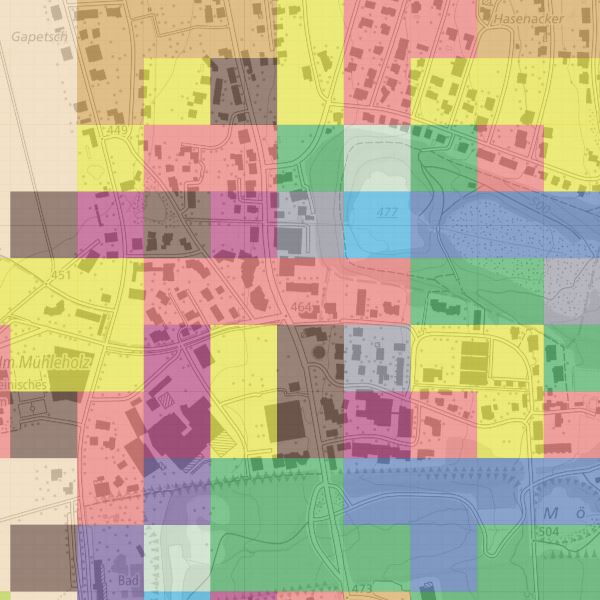
Für die visuelle Interpretation der Bodennutzung und Bodenbedeckung wurden Luftbilder mit einem Stichprobennetz von 100x100m überlagert. Die exakte Bodennutzung und -bedeckung an jedem Stichprobenpunkt wurde am Stereoskop von einem Team geschulter Interpreten nach einem Katalog von 25 Kategorien der Bodenbedeckung und 47 Kategorien der Bodennutzung beurteilt.
Zur einfacheren Nutzung wurden mögliche Kombinationen untersucht und in 75 Kombinationskategorien unterteilt. Zur einfacheren Interpretation der Kombinationskategorien wurden diese zusätzlich zur 27er und 17er Aggregation aufsummiert.
Semplice
- Altri nomi o acronimi
-
Bodennutzungsdaten (in 47 Kategorien) und Bodenbeckungsdaten (in 25 Kategorien) und Kombinationskategrien (75 Kombinationskategrorien, 17er und 27er Aggregation)
- Data (Creazione)
- 2001-12-31
- Data (Revisione)
- 2004-08-08
- Identificatore
- https://metadata.geo.llv.li/67266ae1-8c55-489f-9eb4-1a8622b51687
- Scopo
-
Detaillierte Erhebung der Bodennutzung und -bedeckung von Liechtenstein mit dem Ziel, deren Zustand und Entwicklung periodisch und statistisch signifikant auszuweisen.
- Stato
- Completato
Punto di contatto
- Orario di servizio
-
8:00-11:30 und 13:30-17:00
Editore
- Orario di servizio
-
8:00-11:30 und 13:30-17:00
- Tipo di rappresentazione spaziale
- Raster
Risoluzione spaziale
- Distanza di risoluzione
- 100 m
- Categoria ISO
-
- A Mappe di base con immagini della copertura terrestre
- O Struttura
Estensione
Estensione
- Descrizione
-
Liechtenstein
))

- Frequenza di aggiornamento
- Continua
- Altra frequenza di aggiornamento
-
P6Y0M0DT0H0M0S
Formato della risorsa
- Titolo
-
GeoTIFF (GEOTIFF)
- Data
- geocat.ch
-
-
dati raster
-
- GEMET
-
-
statistica
-
copertura del suolo
-
informazione statistica
-
- GEMET - INSPIRE themes, version 1.0
-
-
Copertura del suolo
-
Utilizzo del territorio
-
- Räumlicher Anwendungsbereich
-
-
Nazionali
-
Vincoli sulle risorse
- Vincoli di accesso
- Altre restrizioni
- Altri vincoli
- no limitations to public access
- Paese
- LI
- Tipo di legislazione
- Ordinanza
- Livello della disposizione legale
- national
- Titolo
-
Verordnung über die Gebühren für die Nutzung der Geodateninfrastruktur Liechtenstein
- Altri nomi o acronimi
-
GDI-Gebührenverordnung (GDI-GebV)
- Data (Creazione)
- 2011-08-30
Vincoli sulle risorse
- Limitazione d'uso
-
Zugangs- und Nutzungsbedingungen
- Vincoli d'uso
- Altre restrizioni
- Altri vincoli
-
gebührenpflichtig
- Lingua
- Deutsch
- Codifica dei caratteri
- UTF8
- Categoria di sottotema
- A1 Mappe di base, modelli paesaggistici
- Categoria di sottotema
- A2 Copertura del suolo, uso del suolo
- Descrizione dell'attributo
- Bodenbedeckung
- Formato (codifica)
-
-
GeoTIFF (GEOTIFF)
-
Punto di contatto
- Orario di servizio
-
8:00-11:30 und 13:30-17:00
Opzioni di trasferimento digitale
- Unità di distribuzione
-
ganzes Land
- Livello
- Set di dati
Rapporto sulla qualità
Risultato
- Titolo
-
VERORDNUNG (EG) Nr. 1089/2010 DER KOMMISSION vom 23. November 2010 zur Durchführung der Richtlinie 2007/2/EG des Europäischen Parlaments und des Rates hinsichtlich der Interoperabilität von Geodatensätzen und -diensten
- Data (Pubblicazione)
- 2010-12-08
- Spiegazione
-
nicht geprüft
- Grado di conformità
- false
- Informazioni generali sulla provenienza
-
Hauptgrundlage für die Erfassung ist ein Orthophoto
Das Staatsgebeit wird in ein regelmässiges Gitter von 100x100 Meter eingetteilt. Pro Quadrat wird am Punkt rechts unten Stickprobenwert für die Bodennutzung und die Bodenbedckung erhoben und dem ganzen Quadrat zugeteilt.
- Livello
- Set di dati
- Descrizione
-
Grundlage für die Datenerfassung bilden die Luftbilder von 1996
- Numero di dimensioni
- 2
- Geometria della cella
- Area
- Disponibilità dei parametri di trasformazione
- 1
- Frequenza di aggiornamento
- Secondo necessità
Metadati
- Identificativo della scheda
- 67266ae1-8c55-489f-9eb4-1a8622b51687
- Lingua
- Deutsch
- Codifica dei caratteri
- UTF8
- Lingua
- Français
- Codifica dei caratteri
- UTF8
- Lingua
- Italiano
- Codifica dei caratteri
- UTF8
- Lingua
- English
- Codifica dei caratteri
- UTF8
Punto di contatto
- Orario di servizio
-
8:00-11:30 und 13:30-17:00
Tipo di risorsa
- Ambito di applicazione della risorsa
- Set di dati
- Collegamento ai metadati
-
https://www.geocat.ch/geonetwork/srv/api/records/67266ae1-8c55-489f-9eb4-1a8622b51687
- Informazioni sulla data (Creazione)
- 2010-08-18T13:51:27Z
- Informazioni sulla data (Revisione)
- 2026-05-05T12:37:31.496407Z
Standard dei metadati
- Titolo
-
eCH-0271