geocat.ch
Arealstatistik Fürstentum Liechtenstein 1996
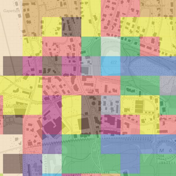
Für die visuelle Interpretation der Bodennutzung und Bodenbedeckung wurden Luftbilder mit einem Stichprobennetz von 100x100m überlagert. Die exakte Bodennutzung und -bedeckung an jedem Stichprobenpunkt wurde am Stereoskop von einem Team geschulter Interpreten nach einem Katalog von 25 Kategorien der Bodenbedeckung und 47 Kategorien der Bodennutzung beurteilt.
Zur einfacheren Nutzung wurden mögliche Kombinationen untersucht und in 75 Kombinationskategorien unterteilt. Zur einfacheren Interpretation der Kombinationskategorien wurden diese zusätzlich zur 27er und 17er Aggregation aufsummiert.
Simple
- Alternate title
-
Bodennutzungsdaten (in 47 Kategorien) und Bodenbeckungsdaten (in 25 Kategorien) und Kombinationskategrien (75 Kombinationskategrorien, 17er und 27er Aggregation)
- Date (Creation)
- 2001-12-31
- Date (Revision)
- 2004-08-08
- Identifier
- https://metadata.geo.llv.li/67266ae1-8c55-489f-9eb4-1a8622b51687
- Purpose
-
Detaillierte Erhebung der Bodennutzung und -bedeckung von Liechtenstein mit dem Ziel, deren Zustand und Entwicklung periodisch und statistisch signifikant auszuweisen.
- Status
- Completed
Point of contact
- Hours of service
-
8:00-11:30 und 13:30-17:00
Publisher
- Hours of service
-
8:00-11:30 und 13:30-17:00
- Spatial representation type
- Grid
Spatial resolution
- Spatial resolution
- 100 m
- Topic category
-
- A Imagery base maps earth cover
- O Structure
Extent
Extent
- Description
-
Liechtenstein
))

- Maintenance and update frequency
- Continual
- User defined maintenance frequency
-
P6Y0M0DT0H0M0S
Resource format
- Title
-
GeoTIFF (GEOTIFF)
- Date
- geocat.ch
-
-
raster data
-
- GEMET
-
-
statistics
-
land cover
-
statistical information
-
- GEMET - INSPIRE themes, version 1.0
-
-
Land cover
-
Land use
-
- Räumlicher Anwendungsbereich
-
-
National
-
Resource constraints
- Access constraints
- Other restrictions
- Other constraints
- no limitations to public access
- Country
- LI
- Legislation Type
- Ordinance
- Legislation Level
- national
- Title
-
Verordnung über die Gebühren für die Nutzung der Geodateninfrastruktur Liechtenstein
- Alternate title
-
GDI-Gebührenverordnung (GDI-GebV)
- Date (Creation)
- 2011-08-30
Resource constraints
- Use limitation
-
Zugangs- und Nutzungsbedingungen
- Use constraints
- Other restrictions
- Other constraints
-
gebührenpflichtig
- Language
- Deutsch
- Character encoding
- UTF8
- Subtopic Category
- A1 Base Maps, Landscape Models
- Subtopic Category
- A2 Land Cover, Land Use
- Attribute description
- Bodenbedeckung
- Distribution format
-
-
GeoTIFF (GEOTIFF)
-
Point of contact
- Hours of service
-
8:00-11:30 und 13:30-17:00
Digital transfer options
- Units of distribution
-
ganzes Land
- Hierarchy level
- Dataset
Report
Result
- Title
-
VERORDNUNG (EG) Nr. 1089/2010 DER KOMMISSION vom 23. November 2010 zur Durchführung der Richtlinie 2007/2/EG des Europäischen Parlaments und des Rates hinsichtlich der Interoperabilität von Geodatensätzen und -diensten
- Date (Publication)
- 2010-12-08
- Explanation
-
nicht geprüft
- Pass
- false
- Statement
-
Hauptgrundlage für die Erfassung ist ein Orthophoto
Das Staatsgebeit wird in ein regelmässiges Gitter von 100x100 Meter eingetteilt. Pro Quadrat wird am Punkt rechts unten Stickprobenwert für die Bodennutzung und die Bodenbedckung erhoben und dem ganzen Quadrat zugeteilt.
- Hierarchy level
- Dataset
- Description
-
Grundlage für die Datenerfassung bilden die Luftbilder von 1996
- Number of dimensions
- 2
- Cell geometry
- Area
- Transformation parameter availability
- 1
- Maintenance and update frequency
- As needed
Metadata
- Metadata identifier
- 67266ae1-8c55-489f-9eb4-1a8622b51687
- Language
- Deutsch
- Character encoding
- UTF8
- Language
- Français
- Character encoding
- UTF8
- Language
- Italiano
- Character encoding
- UTF8
- Language
- English
- Character encoding
- UTF8
Point of contact
- Hours of service
-
8:00-11:30 und 13:30-17:00
Type of resource
- Resource scope
- Dataset
- Metadata linkage
-
https://www.geocat.ch/geonetwork/srv/api/records/67266ae1-8c55-489f-9eb4-1a8622b51687
- Date info (Creation)
- 2010-08-18T13:51:27Z
- Date info (Revision)
- 2026-05-05T12:37:31.496407Z
Metadata standard
- Title
-
eCH-0271