 geocat.ch
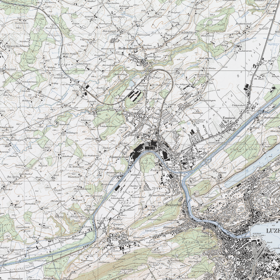
Landeskarte 1:25'000 (1960)
Seit dem Bundesgesetz von 1935 bilden die Landeskarten aller Massstäbe die noch heute gültigen offiziellen Karten der Schweiz. Sie haben damit die Dufour- und Siegfriedkarten abgelöst.
Simple
- Alternate title
-
LK251960_DS
- Date (Creation)
- 1960-01-01
- Presentation form
- Digital map
- Purpose
-
Topographische Landeskarten der Schweiz. Historische Kartenblätter als Basis für Studien in Landschaftsentwicklung und Geschichtsforschung.
- Status
- Completed
Publisher
Owner
- Spatial representation type
- Grid
Spatial resolution
Equivalent scale
- Denominator
- 25000
- Topic category
-
- A Imagery base maps earth cover
Extent
Extent
- Description
-
Kanton Luzern
))
- Maintenance and update frequency
- Not planned
- geocat.ch
-
-
opendata.swiss
-
Basiskarte
-
Topographie
-
Kartenwerk
-
Resource constraints
- Access constraints
- none
- Use constraints
- Copyright
Resource constraints
- Use limitation
-
öffentlich zugängliche Geobasisdaten
Resource constraints
- Access constraints
- none
- Use constraints
- none
Resource constraints
- Use limitation
-
Freie Nutzung. Quellenangabe ist Pflicht
- Distribution format
-
-
Tagged Image File Format (.tif)
-
Point of contact
Digital transfer options
- OnLine resource
-
Datenshop
Produktansicht Geodatenshop
- Statement
-
Grundlagen: Landesvermessung
- Reference system identifier
- EPSG:2056
- Maintenance and update frequency
- Not planned
Metadata
- Metadata identifier
- 66708546-e7b7-49e4-9ec4-410a8be2b7b3
- Language
- Deutsch
- Character encoding
- UTF-8
Point of contact
Type of resource
- Resource scope
- Dataset
- Metadata linkage
-
https://www.geocat.ch/geonetwork/srv/api/records/66708546-e7b7-49e4-9ec4-410a8be2b7b3
- Date info (Creation)
- 2017-06-19
- Date info (Revision)
- 2026-06-19T03:31:59.238875Z
Metadata standard
- Title
-
ISO19115.3-2018.che
)))