geocat.ch
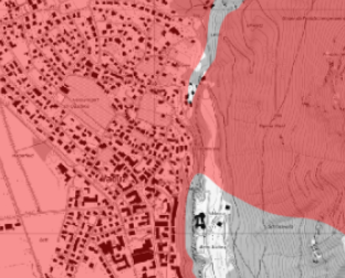
Gewässerschutzbereich Au
Gewässerschutzbereich Au zum Schutz nutzbarer unterirdischer Gewässer
Simple
- Alternate title
-
Gewässerschutzbereich Au zum Schutz nutzbarer unterirdischer Gewässer
- Date (Creation)
- 2006-12-31
- Identifier
- https://metadata.geo.llv.li/6606200b-66b9-494a-8ca9-7530389a0a21
- Purpose
-
Bodenkartierung 2006
- Status
- Completed
Owner
https://www.llv.li/inhalt/12298/amtsstellen/amt-fur-umwelt
- Hours of service
-
8:00-11:30 und 13:30-17:00
- Spatial representation type
- Vector
Spatial resolution
Equivalent scale
- Denominator
- 500
- Topic category
-
- F Geoscientific information
Extent
Extent
- Description
-
Liechtenstein
N
S
E
W
))

- Maintenance and update frequency
- Not planned
Point of contact
Civil Engineering and Geoinformation Office - Abteilung Vermessung und Geoinformation
Giessenstrasse 3
Vaduz
9490
LI
https://www.llv.li/en/national-administration/civil-engineering-and-geoinformation-office
- Hours of service
-
8:00-11:30 und 13:30-17:00
Resource format
- Title
-
INTERLIS 2 (XTF)
- Date
- GEMET
-
-
agriculture
-
soil use
-
soil use
-
Resource constraints
- Use limitation
-
Zugangs- und Nutzungsbedingungen
- Access constraints
- Other restrictions
- Other constraints
-
no limitations to public access
- Language
- Deutsch
- Character encoding
- UTF8
- Subtopic Category
- F2 Soils
- Distribution format
-
-
INTERLIS 1 (ITF)
-
Distributor
Civil Engineering and Geoinformation Office - Abteilung Vermessung und Geoinformation
Giessenstrasse 3
Vaduz
9490
LI
https://www.llv.li/en/national-administration/civil-engineering-and-geoinformation-office
- Hours of service
-
8:00-11:30 und 13:30-17:00
- Fees
-
Aufwand
Digital transfer options
Digital transfer options
- OnLine resource
-
OGC WMS Service der Liechtensteinen Landesverwaltung
OGC WMS Service der Liechtensteinen Landesverwaltung
- Topology level
- Full planar graph
- Geometric object type
- Surface
- Geometric object count
- 100
- Reference system identifier
- EPSG:2056
Metadata
- Metadata identifier
- 6606200b-66b9-494a-8ca9-7530389a0a21
- Language
- Deutsch
- Character encoding
- UTF8
- Language
- Français
- Character encoding
- UTF8
- Language
- Italiano
- Character encoding
- UTF8
- Language
- English
- Character encoding
- UTF8
Owner
Civil Engineering and Geoinformation Office - Abteilung Vermessung und Geoinformation
Giessenstrasse 3
Vaduz
9490
LI
https://www.llv.li/en/national-administration/civil-engineering-and-geoinformation-office
- Hours of service
-
8:00-11:30 und 13:30-17:00
Type of resource
- Resource scope
- Dataset
- Metadata linkage
-
https://www.geocat.ch/geonetwork/srv/api/records/6606200b-66b9-494a-8ca9-7530389a0a21
- Date info (Creation)
- 2023-04-17T12:32:16.722Z
- Date info (Revision)
- 2026-04-13T09:32:11.816437Z
Metadata standard
- Title
-
eCH-0271