geocat.ch
Découpage des axes des routes cantonales selon les restrictions de tonnage
Découpage des axes des routes cantonales selon les restrictions de tonnage localisées sur les routes par des signaux de police (signal OSR 2.16, annexe 2b). Cette signalisation est homologuée par la commission cantonale de signalisation routière (CCSR).
Simple
- Alternate title
-
Restriction de tonnage
- Date (Creation)
- 1990-01-01
- Date (Revision)
- 2024-09-19
- Identifier
- 337
- Purpose
-
Représentation des restrictions de tonnage sur les routes cantonales
- Status
- On going
Custodian
- Spatial representation type
- Vector
Spatial resolution
Equivalent scale
- Denominator
- 10000
- Topic category
-
- P Transportation
Extent
Extent
- Description
-
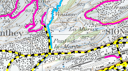
Canton of Valais (VS)
))

- Maintenance and update frequency
- Annually
Resource format
- Title
-
ESRI Enterprise Geodatabase
- Date
- GEMET - INSPIRE themes, version 1.0
-
-
Transport networks
-
- GEMET
-
-
road maintenance
-
- geocat.ch
-
-
locating
-
opendata.swiss
-
Resource constraints
- Use limitation
-
Aucune
Resource constraints
- Access constraints
- Other restrictions
- Other constraints
-
Les conditions générales d'utilisation des géodonnées du Canton du Valais font foi ( https://www.vs.ch/fr/web/guest/information-legale).
- Language
- Français
- Character encoding
- UTF8
- Language
- Deutsch
- Character encoding
- UTF8
- Environment description
-
S:\Géodonnées VS\P Transport\Réseaux.lyr
- Included with dataset
- true
- Title
-
Structure - Restrictions de tonnage
- Date (Creation)
- 2021-11-11
- Distribution format
-
-
ESRI Shapefile (SHP)
-
OGC Web Map Service (WMS)
-
ArcGIS REST Feature Service
-
Distributor
Digital transfer options
- OnLine resource
-
Géoportail du Canton du Valais
Digital transfer options
- OnLine resource
-
OpenData Valais
OpenData Valais - Site de téléchargement de géodonnées à l'Etat du Valais : multiformat et WebMercator
Digital transfer options
- OnLine resource
-
Landing Page
Landing Page pour opendata
Digital transfer options
- OnLine resource
-
Permalink opendata.swiss
Permalink opendata.swiss
Digital transfer options
- OnLine resource
-
5
Tonnages
Digital transfer options
- OnLine resource
-
VS_M_CLTONNAGE
Restriction tonnage
- Statement
-
Décision interne du SDM
- Hierarchy level
- Dataset
- Description
-
Saisie à partir des points de repères
- Geometric object type
- Curve
- Geometric object count
- 545
- Reference system identifier
- EPSG:2056/CH1903+_MN95
Metadata
- Metadata identifier
- 56d991af-8dff-4a4e-973a-54b62cbfd21b
- Language
- Français
- Character encoding
- UTF8
- Language
- Deutsch
- Character encoding
- UTF8
- Language
- Italiano
- Character encoding
- UTF8
- Language
- English
- Character encoding
- UTF8
- Language
- Rumantsch
- Character encoding
- UTF8
Distributor
Type of resource
- Resource scope
- Dataset
- Metadata linkage
-
https://www.geocat.ch/geonetwork/srv/api/records/56d991af-8dff-4a4e-973a-54b62cbfd21b
- Date info (Creation)
- 2014-12-17T07:06:43Z
- Date info (Revision)
- 2026-04-13T09:23:34.910742Z
Metadata standard
- Title
-
eCH-0271