 geocat.ch
Regionaler Teilrichtplan LuzernPlus: Siedlungslenkung 2030
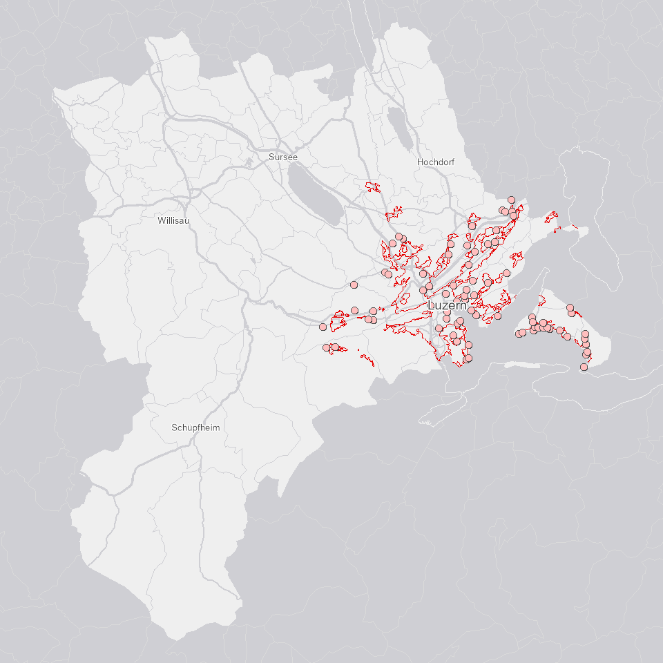
Der Regionale Teilrichtplan Siedlungslenkung 2030 zeigt die Siedlungsbegrenzungen und im Teilrichtplan nicht behandelte Gebiete.
Simple
- Alternate title
-
TRPLPSIL_DS
- Date (Creation)
- 2021-08-24
- Presentation form
- Digital map
- Purpose
-
Um die langfristige Siedlungsausdehnung zu lenken, die bestehenden Bauzonen möglichst optimal zu nutzen und die Zersiedlung zu vermindern, legt der regionale Entwicklungsträger LuzernPlus (Gemeindeverband) die regionalen Siedlungsbegrenzungslinien im Luzerner Verbandsgebiet von LuzernPlus behördenverbindlich fest. Der Regionale Teilrichtplan Siedlungslenkung 2030 wurde am 23. Januar 2015 vom Regierungsrat mit Entscheid Nr. 112 genehmigt.
- Status
- Completed
Publisher
Owner
- Spatial representation type
- Vector
- Topic category
-
- E Planning cadastre
Extent
Extent
- Description
-
Kanton Luzern
))
- Maintenance and update frequency
- Not planned
- geocat.ch
-
-
opendata.swiss
-
Nutzungsplanung
-
Raumplanung
-
Richtplanung
-
Wirtschaftliche Aktivitäten
-
Siedlung
-
Resource constraints
- Access constraints
- none
- Use constraints
- Copyright
Resource constraints
- Use limitation
-
öffentlich zugängliche Geobasisdaten
Resource constraints
- Access constraints
- none
- Use constraints
- none
Resource constraints
- Use limitation
-
Freie Nutzung. Quellenangabe ist Pflicht
- Language
- Deutsch
- Character encoding
- UTF-8
- Included with dataset
- false
- Title
-
TRPLPSIL_V2_PT
- Date (Publication)
- 2020-06-18
- Name
-
TRPLPSIL_V2_PT
- Scope
-
Punkte
- Version
-
V2
- Date
- 2025-09-03
Property description
- Property name
- Punkte
- Definition
-
Regionaler Teilrichtplan Siedlungslenkung 2030: Orientierende Inhalte
- Abstract
- false
Elements
- Member name
- OBJECTID
- Definition
-
OBJECTID
- Cardinalities
-
1
- Type name
-
GUID
Elements
- Member name
- SHAPE
- Definition
-
SHAPE
- Cardinalities
-
1
- Type name
-
SHAPE
Elements
- Member name
- TYP
- Definition
-
Typ
- Cardinalities
-
1
- Type name
-
Text
- Codelist
-
Code Label Definition Code Label Definition Value type 1
Gebiet nicht behandelt
1
Gebiet nicht behandelt
2
Sonderbauzone
2
Sonderbauzone
3
Weilerzone
3
Weilerzone
4
Betriebserweiterung
4
Betriebserweiterung
- Language
- Deutsch
- Character encoding
- UTF-8
- Included with dataset
- false
- Title
-
TRPLPSIL_V2_LI
- Date (Publication)
- 2020-06-18
- Name
-
TRPLPSIL_V2_LI
- Scope
-
Linien
- Version
-
V2
- Date
- 2025-09-03
Property description
- Property name
- Linien
- Definition
-
Regionaler Teilrichtplan Siedlungslenkung 2030: Siedlungsbegrenzung
- Abstract
- false
Elements
- Member name
- OBJECTID
- Definition
-
OBJECTID
- Cardinalities
-
1
- Type name
-
GUID
Elements
- Member name
- TYP
- Definition
-
Linientyp
- Cardinalities
-
1
- Type name
-
Text
- Codelist
-
Code Label Definition Code Label Definition Value type 1
Siedlungsbegrenzungslinie Typ A
Die Siedlungsbegrenzungslinie Typ A begrenzt die Bauzonen
1
Siedlungsbegrenzungslinie Typ A
Die Siedlungsbegrenzungslinie Typ A begrenzt die Bauzonen
2
Siedlungsbegrenzungslinie Typ B
Im Bereich der Siedlungsbegrenzungslinie Typ B kann die Bauzone erweitert werden
2
Siedlungsbegrenzungslinie Typ B
Im Bereich der Siedlungsbegrenzungslinie Typ B kann die Bauzone erweitert werden
3
Siedlungsbegrenzungslinie Typ C
Künftige Bauzonenerweiterungen sind bis zur Siedlungsbegrenzungslinie Typ C zulässig
3
Siedlungsbegrenzungslinie Typ C
Künftige Bauzonenerweiterungen sind bis zur Siedlungsbegrenzungslinie Typ C zulässig
Elements
- Member name
- KT
- Definition
-
Kantonsnummer
- Cardinalities
-
1
- Type name
-
Short Integer
- Codelist
-
Code Label Definition Code Label Definition Value type 1
ZH
1
ZH
2
BE
2
BE
3
LU
3
LU
4
UR
4
UR
5
SZ
5
SZ
6
OW
6
OW
7
NW
7
NW
8
GL
8
GL
9
ZG
9
ZG
10
FR
10
FR
11
SO
11
SO
12
BS
12
BS
13
BL
13
BL
14
SH
14
SH
15
AR
15
AR
16
AI
16
AI
17
SG
17
SG
18
GR
18
GR
19
AG
19
AG
20
TG
20
TG
21
TI
21
TI
22
VD
22
VD
23
VS
23
VS
24
NE
24
NE
25
GE
25
GE
26
JU
26
JU
27
FL
27
FL
0
See
0
See
99
Nicht bestimmt
99
Nicht bestimmt
Elements
- Member name
- SHAPE
- Definition
-
SHAPE
- Cardinalities
-
1
- Type name
-
SHAPE
Elements
- Member name
- SHAPE.LEN
- Definition
-
SHAPE.LEN
- Cardinalities
-
1
- Type name
-
Double
- Distribution format
-
-
ESRI Geodatabase (.gdb)
-
ESRI Shapefile (.shp)
-
OGC GeoPackage (.gpkg)
-
Point of contact
Digital transfer options
- OnLine resource
-
Datenshop
Produktansicht Geodatenshop
- Statement
-
unbekannt
- Geometric object type
- Point
- Reference system identifier
- EPSG:2056
- Maintenance and update frequency
- Not planned
Metadata
- Metadata identifier
- 52e5c44a-149b-4f6b-8343-1788e84985ec
- Language
- Deutsch
- Character encoding
- UTF-8
Point of contact
Type of resource
- Resource scope
- Dataset
- Metadata linkage
-
https://www.geocat.ch/geonetwork/srv/api/records/52e5c44a-149b-4f6b-8343-1788e84985ec
- Date info (Creation)
- 2020-06-18
- Date info (Revision)
- 2026-06-20T03:25:58.551063Z
Metadata standard
- Title
-
ISO19115.3-2018.che
)))