geocat.ch
Markierungs- und Signalisationskataster Riehen
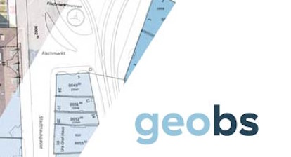
Der Markierungs- und Signalisationskataster enthält Informationen zur bestehenden Strasseninfrastruktur auf der Riehener Gemeindeallmend und dient als kommunales und kantonales Planungsinstrument.
Weitere Informationen:
* [Vollständige Legende]( https://map.geo.bs.ch/file_proxy/ch.bs.markierungs_und_signalisationskataster_riehen_msri.strassensignalisation_verkehrszeichen/MSRI_Legende.pdf)
Simple
- Date (Publication)
- 2026-05-05
Distributor
- Topic category
-
- P Transportation
Extent
Extent
- Description
-
Gemeinde Riehen
))

- Maintenance and update frequency
- Daily
- Keywords
-
-
MSRI
-
Resource constraints
- Use constraints
- Other restrictions
- Other constraints
-
Die Geodaten sind beschränkt öffentlich zugänglich. Es gelten die Nutzungsbedingungen für Geodaten des Kantons Basel-Stadt. ( http://www.geo.bs.ch/agb)
Associated resource
- Association Type
- Reference to resources that are parts of this resource
- Metadata Reference
Associated resource
- Association Type
- Reference to resources that are parts of this resource
- Metadata Reference
Associated resource
- Association Type
- Reference to resources that are parts of this resource
- Metadata Reference
Associated resource
- Association Type
- Reference to resources that are parts of this resource
- Metadata Reference
Associated resource
- Association Type
- Reference to resources that are parts of this resource
- Metadata Reference
Associated resource
- Association Type
- Reference to resources that are parts of this resource
- Metadata Reference
Associated resource
- Association Type
- Reference to resources that are parts of this resource
- Metadata Reference
Associated resource
- Association Type
- Reference to resources that are parts of this resource
- Metadata Reference
Associated resource
- Association Type
- Reference to resources that are parts of this resource
- Metadata Reference
Associated resource
- Association Type
- Reference to resources that are parts of this resource
- Metadata Reference
Associated resource
- Association Type
- Reference to resources that are parts of this resource
- Metadata Reference
Associated resource
- Association Type
- Reference to resources that are parts of this resource
- Metadata Reference
- Language
- Deutsch
- Character encoding
- UTF8
- Basic Geodata
- true
- Basic Geodata ID
-
73-BS
- Basic Geodata Access Level
- B
Distributor
Digital transfer options
- OnLine resource
-
MapBS
MapBS
- OnLine resource
-
Geoportal Kanton Basel-Stadt
Geoportal Kanton Basel-Stadt
- Reference system identifier
- LV95 EPSG:2056
Metadata
- Metadata identifier
- 4d7c6255-7482-4779-b9c1-dddb6f3da456
- Language
- Deutsch
- Character encoding
- UTF8
Distributor
Type of resource
- Resource scope
- Dataset
- Metadata linkage
-
https://www.geocat.ch/geonetwork/srv/api/records/4d7c6255-7482-4779-b9c1-dddb6f3da456
- Date info (Creation)
- 2026-07-21T13:06:42.88031Z
- Date info (Revision)
- 2026-08-21T07:42:13.707054Z
Metadata standard
- Title
-
eCH-0271