 geocat.ch
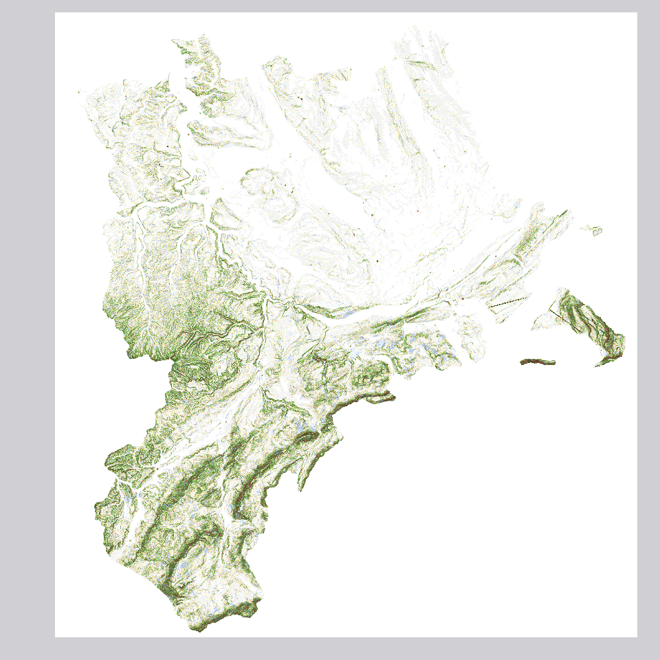
Bodenhypothesekarte: Geländeformen
zeigt modellbasierte, mögliche Verteilung von Geländeformen. Nomenklatur gemäss Bund.
Simple
- Alternate title
-
BHYKGELF_DS
- Date (Creation)
- 2003-01-01
- Presentation form
- Digital map
- Purpose
-
Die Modellierung von 2003 basiert auf der Grundlage des Höhenmodells DHM25 im Massstab 1:25'000. Die Geländeformen-Karte ersetzt die detaillierte Bodenkarte nicht.Zeigt Geländeformen des Bodens gemäß Nomenklatur der eidgenössischen Forschungsanstalt für Agrarökologie und Landbau FAL (heute: Agroscope) Erläuterung Die Geländeform wird im Bodencode (z.B. bG23f) als letzte Ziffer verstanden (hier f). Sie liefert Aussagen zur Beschaffenheit der Erdoberfläche bzgl. Kurvatur, Neigung, Form, Steilheit im bodenkundlichen Sinn.
- Status
- Completed
Publisher
Owner
- Spatial representation type
- Grid
Spatial resolution
Equivalent scale
- Denominator
- 25000
- Topic category
-
- F Geoscientific information
Extent
Extent
- Description
-
Kanton Luzern
))
- Maintenance and update frequency
- Not planned
- geocat.ch
-
-
opendata.swiss
-
Boden
-
Geländemodell
-
Geomorphologie
-
Topographie
-
Umweltbeobachtung
-
Resource constraints
- Access constraints
- none
- Use constraints
- Copyright
Resource constraints
- Use limitation
-
öffentlich zugängliche Geobasisdaten
Resource constraints
- Access constraints
- none
- Use constraints
- none
Resource constraints
- Use limitation
-
Freie Nutzung. Quellenangabe ist Pflicht
- Distribution format
-
-
Tagged Image File Format (.tif)
-
Point of contact
Digital transfer options
- OnLine resource
-
Datenshop
Produktansicht Geodatenshop
- Statement
-
Abgeleitet von: Diverse
- Statement
-
Grundlagen: Diverse
- Reference system identifier
- EPSG:2056
- Maintenance and update frequency
- Not planned
Metadata
- Metadata identifier
- 4b08a0c7-9b40-4038-8fd3-17233bac3c4d
- Language
- Deutsch
- Character encoding
- UTF-8
Point of contact
Type of resource
- Resource scope
- Dataset
- Metadata linkage
-
https://www.geocat.ch/geonetwork/srv/api/records/4b08a0c7-9b40-4038-8fd3-17233bac3c4d
- Date info (Creation)
- 2017-06-19
- Date info (Revision)
- 2026-06-19T03:18:25.656039Z
Metadata standard
- Title
-
ISO19115.3-2018.che
)))