geocat.ch
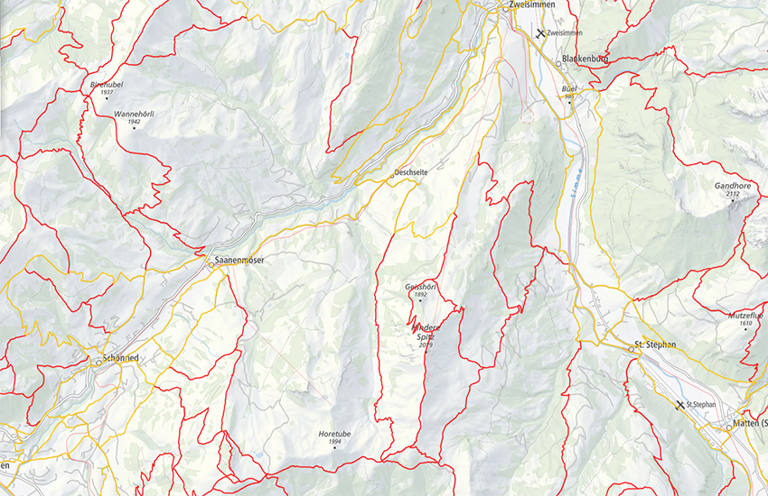
swissTLM3D Wanderwege
swissTLM3D chemins de randonnée pédestre
swissTLM3D percorsi escursionistici
swissTLM3D hiking trails
swissTLM3D sendas da viandar
swissTLM3D Wanderwege enthält die signalisierten Wanderrouten der Schweiz und des Fürstentums Liechtenstein. Der Datensatz wird in Zusammenarbeit mit dem Bundesamt für Strassen ASTRA, SchweizMobil, Schweizer Wanderwege und den Kantonen publiziert. Die Daten werden einmal pro Jahr mit dem Datensatz swissTLM3D vollständig aktualisiert. Bei Bedarf werden im Laufe des Jahres punktuelle Korrekturen und Verbesserungen publiziert.
swissTLM3D chemins de randonnée pédestre comprend les chemins de randonnée officiels de la Suisse et de la Principauté de Liechtenstein. Le jeu de données est publié en collaboration avec l'Office fédéral des routes OFROU, SuisseMobile, Suisse Rando et les cantons. Les données sont mises à jour complètement une fois par an avec le jeu de données swissTLM3D. En cours d’année, des corrections et améliorations ponctuelles sont publiées au besoin.
swissTLM3D sentieri pedestri comprende i sentieri pedestri ufficiali della Svizzera e del Principato del Liechtenstein. Il set di dati viene pubblicato in collaborazione con l'Ufficio federale delle strade USTRA, SvizzeraMobile, Sentieri Svizzeri e i cantoni. I dati vengono aggiornati completamente una volta all'anno con il dataset swissTLM3D. Correzioni e miglioramenti puntuali vengono pubblicati regolarmente durante l’anno.
swissTLM3D hiking trails contains the hiking trails of Switzerland and the Principality of Liechtenstein. This dataset is published in collaboration with the Federal roads office FEDRO, SwitzerlandMobility, Suisse Rando and the cantons. The data is fully updated once a year with the swissTLM3D dataset. If necessary, ad hoc corrections and improvements are published during the year.
swissTLM3D Sendas da viandar cuntegna las sendas da viandar uffizialas da la Svizra e dal Principadi da Liechtenstein. L'unitad da datas vegn publitgada en collavuraziun cun l'Uffizi federal da vias UVias, cun SvizraMobila, cun Sendas svizras e cun ils chantuns. swissTLM3D Sendas da viandar è ina part da l'unitad da datas swissTLM3D.
Simple
-
Autre titreAltri nomi o acronimiAlternate titleAlternate titleAlternativtitel
-
Wanderwege
Chemins de randonnée pédestre
Percorsi escursionistici
Hiking trails
Sendas da viandar
-
Date (Création)Data (Creazione)Date (Creation)Date (Creation)Datum (Erstellung)
- 2012-04-01
-
Date (Révision)Data (Revisione)Date (Revision)Date (Revision)Datum (Aktualisierung)
- 2026-02-24
-
ÉditionEdizioneEditionEditionAusgabe
-
Version 2.4
-
IdentifiantIdentificatoreIdentifierIdentifierKennung
- ch.swisstopo.swisstlm3d-wanderwege
-
ÉtatStatoStatusStatusBearbeitungsstatus
-
ContinuIn corsoOn goingOn goingKontinuierliche Aktualisierung
Point de contact
Punto di contatto
Point of contact
Point of contact
Ansprechpartner
-
Type de représentation spatialeTipo di rappresentazione spazialeSpatial representation typeSpatial representation typeRäumliche Darstellungsart
-
vecteurVettorialeVectorVectorVektor
Résolution spatiale
Risoluzione spaziale
Spatial resolution
Spatial resolution
Räumliche Auflösung
Fraction représentative
Frazione rappresentativa
Equivalent scale
Equivalent scale
Vergleichsmassstab
-
DénominateurDenominatoreDenominatorDenominatorMassstabszahl
- 5000
Résolution spatiale
Risoluzione spaziale
Spatial resolution
Spatial resolution
Räumliche Auflösung
Fraction représentative
Frazione rappresentativa
Equivalent scale
Equivalent scale
Vergleichsmassstab
-
DénominateurDenominatoreDenominatorDenominatorMassstabszahl
- 25000
-
Catégorie de thèmeCategoria ISOTopic categoryTopic categoryThematik
-
-
P TransportP TrasportiP TransportationP TransportationP Verkehrswesen
-
Étendue
Estensione
Extent
Extent
Ausdehnung
Étendue
Estensione
Extent
Extent
Ausdehnung
-
DescriptionDescrizioneDescriptionDescriptionBeschreibung
-
Switzerland
Schweiz
Suisse
Svizzera
Svizra
))

Étendue
Estensione
Extent
Extent
Ausdehnung
Étendue
Estensione
Extent
Extent
Ausdehnung
-
DescriptionDescrizioneDescriptionDescriptionBeschreibung
-
Liechtenstein
Liechtenstein
Liechtenstein
Liechtenstein
Liechtenstein
))

-
Fréquence de mise à jourFrequenza di aggiornamentoMaintenance and update frequencyMaintenance and update frequencyWartungsintervall
-
Comme nécessaireSecondo necessitàAs neededAs neededBei Bedarf
- GEMET - INSPIRE themes, version 1.0
-
-
Dénominations géographiques
Nomi geografici
Geographical names
-
Réseaux de transport
Reti di trasporto
Transport networks
-
- GEMET
-
-
sentier de randonnée
sentiero escursionistico
hiking trail
-
vecteur
vettore
vector
-
système d'information géographique
sistema informativo geografico
geographic information system
-
- geocat.ch
-
-
SIG (Système d'Information Géographique)
SIG (Sistema Informativo Geografico)
GIS (Geographic Information System)
-
opendata.swiss
opendata.swiss
opendata.swiss
opendata.swiss
-
modèle du territoire
modello del territorio
landscape model
-
- geocat.ch
-
-
BGDI Bundesgeodaten-Infrastruktur
IFDG l’Infrastructure Fédérale de données géographiques
IFDG Infrastruttura federale dei dati geografici
FSDI Federal Spatial Data Infrastructure
-
Contraintes sur la ressource
Vincoli sulle risorse
Resource constraints
Resource constraints
Ressourcenbeschränkungen
-
Contraintes d'utilisationVincoli d'usoUse constraintsUse constraintsNutzungseinschränkungen
-
LicenceLicenzaLicenseLicenseLizenz
Contraintes sur la ressource
Vincoli sulle risorse
Resource constraints
Resource constraints
Ressourcenbeschränkungen
-
Autres contraintesAltri vincoliOther constraintsOther constraintsAndere Einschränkungen
- Freie Nutzung. Quellenangabe ist Pflicht.Utilisation libre. Obligation d’indiquer la source.Libero utilizzo. Indicazione della fonte obbligatoria.NonCommercialAllowed-CommercialAllowed-ReferenceRequired
Ressource associée
Risorsa associata
Associated resource
Associated resource
Verlinkte Ressource
-
Type d'associationTipo di associazioneAssociation TypeAssociation TypeAssoziationstyp
-
Citation de travail plus largeCitazione di un'opera più ampiaReference to a master resource of which this one is a partReference to a master resource of which this one is a partÜbergeordneter Datenbestand
-
Metadata ReferenceRiferimento metadatiMetadata ReferenceMetadata ReferenceMetadatenreferenz
Ressource associée
Risorsa associata
Associated resource
Associated resource
Verlinkte Ressource
-
TitreTitoloTitleTitleTitel
-
Topografisches Landschaftsmodell (Landesvermessung)
Modèle topographique du paysage (mensuration nationale)
Modello topografico del paesaggio (misurazione nazionale)
topographical landscape model (national survey)
-
Type d'associationTipo di associazioneAssociation TypeAssociation TypeAssoziationstyp
-
Citation de travail plus largeCitazione di un'opera più ampiaReference to a master resource of which this one is a partReference to a master resource of which this one is a partÜbergeordneter Datenbestand
-
LangueLinguaLanguageLanguageSprache
- Deutsch
-
Encodage de caractèresCodifica dei caratteriCharacter encodingCharacter encodingZeichenkodierung
-
Utf8UTF8UTF8UTF8Utf8
-
Géodonnées de baseGeodati di baseBasic GeodataBasic GeodataGeobasisdaten
- true
-
Identifiant Géodonnées de baseIdentificativo dei geodati di baseBasic Geodata IDBasic Geodata IDIdentifikator des Geobasisdatensatzes
-
38.1
-
Niveau des géodonnées de baseLivello legale dei geodati di baseBasic Geodata Legal LevelBasic Geodata Legal LevelGeobasisdatenebene
-
FédéralFederaleFederalFederalNational
-
Type de géodonnées de baseTipo di geodati di baseBasic Geodata TypeBasic Geodata TypeGeobasisdatentyp
-
Géodonnées de référenceGeodati di riferimentoReference GeodataReference GeodataGeoreferenzdaten
-
Format de distributionFormato (codifica)Distribution formatDistribution formatAbgabeformat
-
-
ESRI File Geodatabase FileGDB (GDB)
-
OGC Geopackage (GPKG)
-
Options de transfert numérique
Opzioni di trasferimento digitale
Digital transfer options
Digital transfer options
Optionen für die digitale Übertragung
-
Ressource en ligneRisorsa onlineOnLine resourceOnLine resourceOnline
-
Vorschau map.geo.admin.ch
Vorschau map.geo.admin.chAperçu map.geo.admin.chPrevisione map.geo.admin.chPreview map.geo.admin.ch
Options de transfert numérique
Opzioni di trasferimento digitale
Digital transfer options
Digital transfer options
Optionen für die digitale Übertragung
-
Ressource en ligneRisorsa onlineOnLine resourceOnLine resourceOnline
-
ch.swisstopo.swisstlm3d-wanderwege
WMS-BGDI Dienst, Layer "Wanderwege"Service WMS-IFDG, couche "Chemins de randonnée pédestre"Servizio WMS-IFDG, strato "Percorsi escursionistici"WMS-FSDI service, layer "Hiking trails"WMS-BGDI Dienst, Layer "Wanderwege"
Options de transfert numérique
Opzioni di trasferimento digitale
Digital transfer options
Digital transfer options
Optionen für die digitale Übertragung
-
Ressource en ligneRisorsa onlineOnLine resourceOnLine resourceOnline
-
ch.swisstopo.swisstlm3d-wanderwege
WMTS-BGDI Dienst, Layer "Wanderwege"Service WMTS-IFDG, couche , Layer "Chemins de randonnée pédestre"Servizio WMTS-IFDG, strato "Percorsi escursionistici"WMTS-FSDI service, layer "Hiking trails"WMTS-BGDI Dienst, Layer "Wanderwege"
Options de transfert numérique
Opzioni di trasferimento digitale
Digital transfer options
Digital transfer options
Optionen für die digitale Übertragung
Options de transfert numérique
Opzioni di trasferimento digitale
Digital transfer options
Digital transfer options
Optionen für die digitale Übertragung
-
Ressource en ligneRisorsa onlineOnLine resourceOnLine resourceOnline
-
swisstlm3d-wanderwege
Geopackage (ZIP)Geopackage (ZIP)Geopackage (ZIP)Geopackage (ZIP)
Options de transfert numérique
Opzioni di trasferimento digitale
Digital transfer options
Digital transfer options
Optionen für die digitale Übertragung
Options de transfert numérique
Opzioni di trasferimento digitale
Digital transfer options
Digital transfer options
Optionen für die digitale Übertragung
-
Ressource en ligneRisorsa onlineOnLine resourceOnLine resourceOnline
-
RESTful API von geo.admin.ch
RESTful API von geo.admin.chRESTful API de geo.admin.chRESTful API da geo.admin.chRESTful API from geo.admin.chRESTful API dad geo.admin.ch
-
Généralités sur la provenanceInformazioni generali sulla provenienzaStatementStatementErklärung
-
Geometrische Genauigkeit: swissTLM3D (0.2 -1.5 m in allen drei Dimensionen für gut definierte Objekte wie z.B. Strassen und Gebäude, 1 - 3 m in allen drei Dimensionen für nicht klar abgrenzbare Objekte wie z.B. Wald)
Précision géométrique: swissTLM3D (0,2 -1,5 m dans les trois dimensions pour des objets bien définis, par ex. routes et bâtiments, 1 - 3 m dans les trois dimensions pour les objets non délimitables clairement, par ex. forêts)
Precisione geometrica: swissTLM3D (0.2 -1.5 m in ognuna delle tre dimensioni per oggetti ben definiti quali ad es. strade e edifici, 1 - 3 m in ognuna delle tre dimensioni per oggetti dai contorni meno netti quali ad es. le foreste).
Geometric accuracy: swissTLM3D (0.2 -1.5 m in all three dimensions for well-defined landscape features such as roads and buildings, 1 - 3 m in all three dimensions for landscape features which are not clearly defined such as forests)
-
NiveauLivelloHierarchy levelHierarchy levelBezugsebene
-
Jeu de donnéesSet di datiDatasetDatasetDatenbestand
-
Niveau de topologieLivello di topologiaTopology levelTopology levelTopologieebene
-
Topologie de réseauTopologia 1DTopology 1DTopology 1DNetzwerktopologie
-
Type d’objet géométriqueTipo di oggetto geometricoGeometric object typeGeometric object typeTyp des geometrischen Objekts
-
LigneCurvaCurveCurvecurve
-
Nombre d’objets géométriquesNumero di oggetti geometriciGeometric object countGeometric object countAnzahl geometrischer Objekte
- 351239
-
Nom du système de référenceNome del sistema di riferimentoReference system identifierReference system identifierName des Referenzsystems
- EPSG:2056
-
Nom du système de référenceNome del sistema di riferimentoReference system identifierReference system identifierName des Referenzsystems
- EPSG:5728
Metadata
-
Identifiant des métadonnéesIdentificativo della schedaMetadata identifierMetadata identifierIdentifikator des Metadatensatzes
- 4a064664-a346-4c1a-b424-4e8a0f0b56cb
-
LangueLinguaLanguageLanguageSprache
- Deutsch
-
Encodage de caractèresCodifica dei caratteriCharacter encodingCharacter encodingZeichenkodierung
-
Utf8UTF8UTF8UTF8Utf8
-
LangueLinguaLanguageLanguageSprache
- Français
-
Encodage de caractèresCodifica dei caratteriCharacter encodingCharacter encodingZeichenkodierung
-
Utf8UTF8UTF8UTF8Utf8
-
LangueLinguaLanguageLanguageSprache
- Italiano
-
Encodage de caractèresCodifica dei caratteriCharacter encodingCharacter encodingZeichenkodierung
-
Utf8UTF8UTF8UTF8Utf8
-
LangueLinguaLanguageLanguageSprache
- English
-
Encodage de caractèresCodifica dei caratteriCharacter encodingCharacter encodingZeichenkodierung
-
Utf8UTF8UTF8UTF8Utf8
-
LangueLinguaLanguageLanguageSprache
- Rumantsch
-
Encodage de caractèresCodifica dei caratteriCharacter encodingCharacter encodingZeichenkodierung
-
Utf8UTF8UTF8UTF8Utf8
Point de contact
Punto di contatto
Point of contact
Point of contact
Ansprechpartner
-
Heures de serviceOrario di servizioHours of serviceHours of serviceBetriebszeiten
-
08h30 - 11h00 / 14h00 - 16h00 GMT+1
Type de ressource
Tipo di risorsa
Type of resource
Type of resource
Anwendungsbereich der Metadaten
-
Domaine d'application de la ressourceAmbito di applicazione della risorsaResource scopeResource scopeDomäne der Ressourcenanwendung
-
Jeu de donnéesSet di datiDatasetDatasetDatenbestand
-
Lien vers la métadonnéeCollegamento ai metadatiMetadata linkageMetadata linkageLink zu den Metadaten
-
https://www.geocat.ch/geonetwork/srv/api/records/4a064664-a346-4c1a-b424-4e8a0f0b56cb
-
Informations de date (Création)Informazioni sulla data (Creazione)Date info (Creation)Date info (Creation)Datumsangaben (Erstellung)
- 2012-02-22T09:59:06Z
-
Informations de date (Révision)Informazioni sulla data (Revisione)Date info (Revision)Date info (Revision)Datumsangaben (Aktualisierung)
- 2026-04-13T09:17:36.477927Z
Norme des métadonnées
Standard dei metadati
Metadata standard
Metadata standard
Metadatenstandard
-
TitreTitoloTitleTitleTitel
-
GM03 2+