geocat.ch
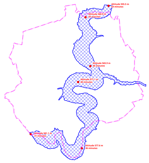
Zone à risque d'inondation de la Ville de Fribourg - Barrage de Rossens (ORCOC)
Zones à risque d'inondation en cas de catastrophe liée au barrage de Rossens.
Simple
- Alternate title
-
Barrage Rossens inondation
- Date (Publication)
- 2023-08-02
- Credit
-
Les données sont fournies par l'Organe communal de conduite en cas de catastrophe (ORCOC) de la Ville de Fribourg.
Custodian
- Topic category
-
- E Planning cadastre
- R Intelligence military
Extent
Extent
- Description
-
Fribourg
N
S
E
W
))

- Maintenance and update frequency
- As needed
- GEMET
-
-
catastrophe
-
plan catastrophe
-
barrage
-
plan
-
Resource constraints
- Use limitation
-
Réservée aux services internes de la Ville de Fribourg
- Language
- Français
- Subtopic Category
- E2 Cadastre, Land Registry
- Distribution format
-
-
nan
-
Digital transfer options
- OnLine resource
-
Guichet intranet de la Ville de Fribourg
Accès privé
- Reference system identifier
- CH1903+/MN95
Metadata
- Metadata identifier
- 435ff6c1-a779-4b60-8b82-741e0b0a7219
- Language
- Français
- Language
- Deutsch
Point of contact
- Metadata linkage
-
https://www.geocat.ch/geonetwork/srv/api/records/435ff6c1-a779-4b60-8b82-741e0b0a7219
- Date info (Creation)
- 2023-07-28T13:04:38.66Z
- Date info (Revision)
- 2026-04-13T09:38:10.407628Z
Metadata standard
- Title
-
eCH-0271