geocat.ch
Pixelkarte Liechtenstein 1:10'000 (1943/1947)
Pixel map Liechtenstein 1:10,000 (1943/1947)
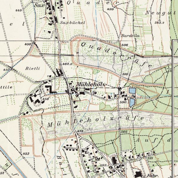
Farbige Landeskarte Liechtensteins im Massstab 1:10'000. Das historische Kartenwerk besteht aus sechs Blättern mit den Nachführungsständen 1943 und 1947. Die nördl. Landeshälfte ist mit zwei Blättern abgedeckt, die südliche mit vier. Weil sich diese vier zu einem grossen Teil überlappen, werden von den Blätter 6 und 7 standardmässig nur die ergänzenden Ausschnitte abgegeben.
Coloured national map of Liechtenstein at a scale of 1:10,000. The historical map series consists of six sheets with the updates 1943 and 1947. The northern half of the country is covered by two sheets, the southern half by four. As these four sheets overlap to a large extent, only the supplementary sections of sheets 6 and 7 are provided as standard.
Simple
-
Date (Création)Data (Creazione)Date (Creation)Datum (Erstellung)
- 1947-01-01
-
IdentifiantIdentificatoreIdentifierKennung
- https://metadata.geo.llv.li/40a7d8a1-a648-44e3-9a9a-5ac950fb8faa
-
ButScopoPurposeZweck
-
Historische Karte, historische Entwicklung
Historical map, historical development
-
ÉtatStatoStatusBearbeitungsstatus
-
ObsolèteObsoletoObsoleteVeraltet
responsable de la publication
Editore
Publisher
Herausgeber
-
Heures de serviceOrario di servizioHours of serviceBetriebszeiten
-
8:00-11:30 und 13:30-17:00
-
Type de représentation spatialeTipo di rappresentazione spazialeSpatial representation typeRäumliche Darstellungsart
-
grilleRasterGridRaster, Gitter
Résolution spatiale
Risoluzione spaziale
Spatial resolution
Räumliche Auflösung
-
Distance de résolutionDistanza di risoluzioneSpatial resolutionDistanz
- 0.5 m
-
Catégorie de thèmeCategoria ISOTopic categoryThematik
-
-
A Imagerie, cartes de base et occupation du solA Mappe di base con immagini della copertura terrestreA Imagery base maps earth coverA Oberflächenbeschreibung
-
Étendue
Estensione
Extent
Ausdehnung
Étendue
Estensione
Extent
Ausdehnung
-
DescriptionDescrizioneDescriptionBeschreibung
-
Liechtenstein
Liechtenstein
Liechtenstein
Liechtenstein
))

-
Fréquence de mise à jourFrequenza di aggiornamentoMaintenance and update frequencyWartungsintervall
-
InconnueSconosciutoUnknownUnbekannt
- geocat.ch
-
-
carte historique
carta storica
historic map
-
carte nationale
carta nazionale
national map
-
INSPIRE
INSPIRE
INSPIRE
-
OpenData
OpenData
OpenData
-
- GEMET
-
-
évolution historique
evoluzione storica
historical evolution
-
- GEMET - INSPIRE themes, version 1.0
-
-
Occupation des terres
Copertura del suolo
Land cover
-
- Räumlicher Anwendungsbereich
-
-
Nationales
Nazionali
National
-
- geocat.ch
-
-
Topografie
topographie
topografia
topography
-
- GEMET
-
-
Karte
cartogramme
mappa
map chart
-
Contraintes sur la ressource
Vincoli sulle risorse
Resource constraints
Ressourcenbeschränkungen
-
Limitation d'utilisationLimitazione d'usoUse limitationNutzungsbeschränkung
-
No Conditions Apply
-
Contraintes d'accèsVincoli di accessoAccess constraintsZugriffsbeschränkungen
-
Autres restrictionsAltre restrizioniOther restrictionsAndere Beschränkungen
-
Contraintes d'utilisationVincoli d'usoUse constraintsNutzungseinschränkungen
-
Autres restrictionsAltre restrizioniOther restrictionsAndere Beschränkungen
-
Autres contraintesAltri vincoliOther constraintsAndere Einschränkungen
- No limitations to public accessNo limitations to public accessNo limitations to public accessNo limitations to public access
Contraintes sur la ressource
Vincoli sulle risorse
Resource constraints
Ressourcenbeschränkungen
-
Contraintes d'accèsVincoli di accessoAccess constraintsZugriffsbeschränkungen
-
Autres restrictionsAltre restrizioniOther restrictionsAndere Beschränkungen
-
Contraintes d'utilisationVincoli d'usoUse constraintsNutzungseinschränkungen
-
Autres restrictionsAltre restrizioniOther restrictionsAndere Beschränkungen
-
Autres contraintesAltri vincoliOther constraintsAndere Einschränkungen
- No conditions to access and useNo conditions to access and useNo conditions to access and useNo conditions to access and use
-
Autres contraintesAltri vincoliOther constraintsAndere Einschränkungen
- Opendata BY: Freie Nutzung. Quellenangabe ist Pflicht.Opendata BY: Utilisation libre. Obligation d’indiquer la source.Opendata BY: Libero utilizzo. Indicazione della fonte obbligatoria.Opendata BY: Open use. Must provide the source.
-
LangueLinguaLanguageSprache
- Deutsch
-
Encodage de caractèresCodifica dei caratteriCharacter encodingZeichenkodierung
-
Utf8UTF8UTF8Utf8
-
Catégorie de sous-thèmeCategoria di sottotemaSubtopic CategoryThematische Unterkategorien
-
A1 Cartes de base, modèles de paysageA1 Mappe di base, modelli paesaggisticiA1 Base Maps, Landscape ModelsA1 Basiskarten, Landschaftsmodelle
-
Description de l'attributDescrizione dell'attributoAttribute descriptionBeschreibung des Attributs
- RGB-Farbwert
-
Format de distributionFormato (codifica)Distribution formatAbgabeformat
-
-
Tagged Image File Format (TIFF) Compressed LZW
-
Point de contact
Punto di contatto
Point of contact
Ansprechpartner
-
Heures de serviceOrario di servizioHours of serviceBetriebszeiten
-
8:00-11:30 und 13:30-17:00
Options de transfert numérique
Opzioni di trasferimento digitale
Digital transfer options
Optionen für die digitale Übertragung
-
Unités de distributionUnità di distribuzioneUnits of distributionVerteilungseinheiten
-
1 Kartenblatt
Options de transfert numérique
Opzioni di trasferimento digitale
Digital transfer options
Optionen für die digitale Übertragung
-
Unités de distributionUnità di distribuzioneUnits of distributionVerteilungseinheiten
-
1 Kartenblatt
-
Ressource en ligneRisorsa onlineOnLine resourceOnline
-
li.abi.pk10_1943
OGC WMS Service der Liechtensteinen LandesverwaltungOGC-WMS Service of the National Administration
Options de transfert numérique
Opzioni di trasferimento digitale
Digital transfer options
Optionen für die digitale Übertragung
-
Unités de distributionUnità di distribuzioneUnits of distributionVerteilungseinheiten
-
1 Kartenblatt
-
Ressource en ligneRisorsa onlineOnLine resourceOnline
-
Download als GeoTiff über das Geodatenportal
Download als GeoTiff über das GeodatenportalDownload as GeoTiff via the geodata portal
-
NiveauLivelloHierarchy levelBezugsebene
-
Jeu de donnéesSet di datiDatasetDatenbestand
Rapport sur la qualité
Rapporto sulla qualità
Report
Qualitätsbericht
Result
Risultato
Result
Ergebnis
-
TitreTitoloTitleTitel
-
VERORDNUNG (EG) Nr. 1089/2010 DER KOMMISSION vom 23. November 2010 zur Durchführung der Richtlinie 2007/2/EG des Europäischen Parlaments und des Rates hinsichtlich der Interoperabilität von Geodatensätzen und -diensten
-
Date (Création)Data (Creazione)Date (Creation)Datum (Erstellung)
- 2010-08-18
-
ExplicationSpiegazioneExplanationErläuterung
-
nicht geprüft
-
Degré de conformitéGrado di conformitàPassKonformitätsgrad
- false
-
Généralités sur la provenanceInformazioni generali sulla provenienzaStatementErklärung
-
Auswertung aus photogrammetrischer Befliegung
-
NiveauLivelloHierarchy levelBezugsebene
-
Jeu de donnéesSet di datiDatasetDatenbestand
-
Nombre de dimensionsNumero di dimensioniNumber of dimensionsAnzahl der Dimensionen
- 2
-
Géométrie de la celluleGeometria della cellaCell geometryZellgeometrie
-
SurfaceAreaAreaFläche
-
Disponibilité des paramètres de transformationDisponibilità dei parametri di trasformazioneTransformation parameter availabilityVerfügbarkeit der Transformationsparameter
- 1
-
Nom du système de référenceNome del sistema di riferimentoReference system identifierName des Referenzsystems
- http://www.opengis.net/def/crs/EPSG/0/2056
-
Fréquence de mise à jourFrequenza di aggiornamentoMaintenance and update frequencyWartungsintervall
-
Comme nécessaireSecondo necessitàAs neededBei Bedarf
Metadata
-
Identifiant des métadonnéesIdentificativo della schedaMetadata identifierIdentifikator des Metadatensatzes
- 40a7d8a1-a648-44e3-9a9a-5ac950fb8faa
-
LangueLinguaLanguageSprache
- Deutsch
-
Encodage de caractèresCodifica dei caratteriCharacter encodingZeichenkodierung
-
Utf8UTF8UTF8Utf8
-
LangueLinguaLanguageSprache
- Français
-
Encodage de caractèresCodifica dei caratteriCharacter encodingZeichenkodierung
-
Utf8UTF8UTF8Utf8
-
LangueLinguaLanguageSprache
- Italiano
-
Encodage de caractèresCodifica dei caratteriCharacter encodingZeichenkodierung
-
Utf8UTF8UTF8Utf8
-
LangueLinguaLanguageSprache
- English
-
Encodage de caractèresCodifica dei caratteriCharacter encodingZeichenkodierung
-
Utf8UTF8UTF8Utf8
Point de contact
Punto di contatto
Point of contact
Ansprechpartner
-
Heures de serviceOrario di servizioHours of serviceBetriebszeiten
-
8:00-11:30 und 13:30-17:00
Type de ressource
Tipo di risorsa
Type of resource
Anwendungsbereich der Metadaten
-
Domaine d'application de la ressourceAmbito di applicazione della risorsaResource scopeDomäne der Ressourcenanwendung
-
Jeu de donnéesSet di datiDatasetDatenbestand
-
Informations de date (Création)Informazioni sulla data (Creazione)Date info (Creation)Datumsangaben (Erstellung)
- 2010-06-09T09:58:47Z
-
Informations de date (Révision)Informazioni sulla data (Revisione)Date info (Revision)Datumsangaben (Aktualisierung)
- 2026-04-13T09:17:26.303038Z
Norme des métadonnées
Standard dei metadati
Metadata standard
Metadatenstandard
-
TitreTitoloTitleTitel
-
eCH-0271