geocat.ch
Organische Böden
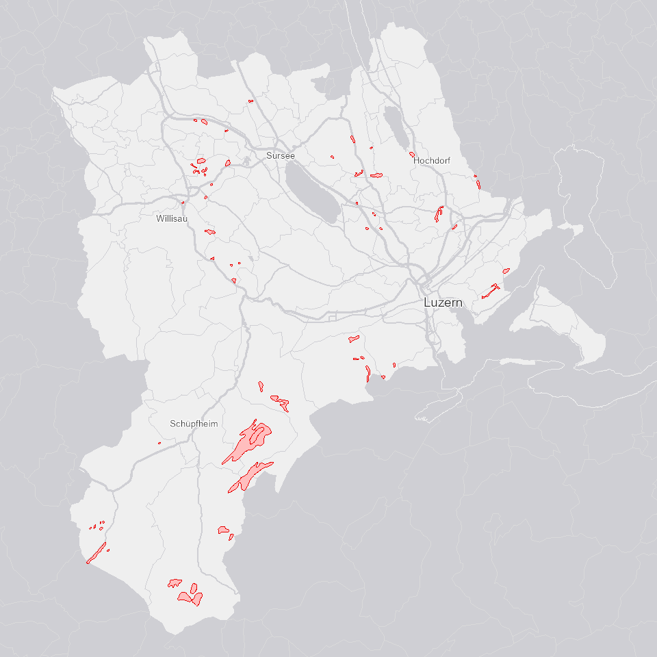
Böden mit hohem organischem Anteil im Oberboden: Flach- und Hochmoore, anmoorige Böden, Torfböden
Simple
- Alternate title
-
BODORGBO_DS
- Date (Creation)
- 1997-01-01
- Presentation form
- Digital map
- Purpose
-
Zeigt Böden im Kt. Luzern mit hohem organischem Anteil im Oberboden: Flach- und Hochmoore, anmoorige Böden, Torfböden
- Status
- On going
Publisher
Owner
- Spatial representation type
- Vector
Spatial resolution
Equivalent scale
- Denominator
- 50000
- Topic category
-
- F Geoscientific information
Extent
Extent
- Description
-
Kanton Luzern
))
- Maintenance and update frequency
- As needed
- Theme
-
-
Boden
-
Moor
-
Umweltbeobachtung
-
opendata.swiss
-
Resource constraints
- Access constraints
- none
- Use constraints
- Copyright
Resource constraints
- Use limitation
-
öffentlich zugängliche Geobasisdaten
Resource constraints
- Access constraints
- none
- Use constraints
- none
Resource constraints
- Use limitation
-
Freie Nutzung. Quellenangabe ist Pflicht
- Language
- Deutsch
- Character encoding
- UTF-8
- Included with dataset
- false
- Title
-
BODORGBO_V1_PY
- Date (Publication)
- 2017-06-19
- Name
-
BODORGBO_V1_PY
- Scope
-
Flächen
- Version
-
V1
- Date
- 2025-09-03
Property description
- Property name
- Flächen
- Definition
-
Organische Böden
- Abstract
- false
Elements
- Member name
- INSEL
- Definition
-
Organischer Boden
- Cardinalities
-
1
- Type name
-
Long Integer
- Codelist
-
Code Label Definition Code Label Definition Value type 0
nein
0
nein
1
ja
1
ja
100
nein (Inselpolygon)
100
nein (Inselpolygon)
- Distribution format
-
-
ESRI Geodatabase (.gdb)
-
ESRI Shapefile (.shp)
-
OGC GeoPackage (.gpkg)
-
Point of contact
Digital transfer options
- OnLine resource
-
Datenshop
Produktansicht Geodatenshop
- Statement
-
Grundlagen: Landeskarte 1:50'000 (LK50)
- Geometric object type
- polygon
- Reference system identifier
- EPSG:2056
- Maintenance and update frequency
- Not planned
Metadata
- Metadata identifier
- 400989ad-9ad6-4847-bd76-bc90e581f307
- Language
- Deutsch
- Character encoding
- UTF-8
Point of contact
Type of resource
- Resource scope
- Dataset
- Metadata linkage
-
https://www.geocat.ch/geonetwork/srv/api/records/400989ad-9ad6-4847-bd76-bc90e581f307
- Date info (Creation)
- 2017-06-19
- Date info (Revision)
- 2026-09-19T03:21:32.188493Z
Metadata standard
- Title
-
ISO19115.3-2018.che
)))