geocat.ch
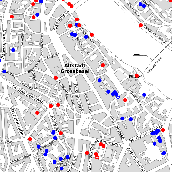
Kunst im öffentlichen Raum
Überblick über die öffentlichen Kunstwerke im Eigentum des Kantons Basel-Stadt. Es wird unterschieden zwischen Kunst im öffentlichen Raum (KiöR), die sich auf der Allmend befindet, und Kunst und Bau (KuB), die in Gebäuden oder auf den Parzellen von öffentlichen Gebäuden zu finden sind.
Simple
- Date (Creation)
- 2018-06-05
- Status
- Completed
Owner
- Spatial representation type
- Vector
- Topic category
-
- M Society
Extent
Extent
- Description
-
Canton of Basel-Stadt (BS)
))

- Maintenance and update frequency
- As needed
- GEMET
-
-
handicraft
-
- GEMET
-
-
art
-
- GEMET
-
-
public
-
Resource constraints
- Other constraints
-
Die Geodaten sind öffentlich zugänglich. (Zugangsberechtigungsstufe [A] = öffentlich)
- Other constraints
-
Es gelten die Nutzungsbedingungen für Geodaten des Kantons Basel-Stadt. ( http://www.geo.bs.ch/agb)
- Language
- Deutsch
- Character encoding
- UTF8
- Basic Geodata
- true
- Basic Geodata ID
-
107-BS
- Basic Geodata Legal Level
- Cantonal
- Distribution format
-
-
ESRI Shapefile (SHP)
-
INTERLIS 2 (XTF)
-
ESRI File Geodatabase FileGDB (GDB)
-
OGC Geopackage (GPKG)
-
Distributor
- Hours of service
-
Mo - Do: 8:00 bis 12:00, 13:30 bis 16:30, Fr: 8:00 bis 12:00, 13:30 bis 16:00
Digital transfer options
- OnLine resource
-
MapBS
Öffentliches Auskunftssystem des Kantons Basel-Stadt
Digital transfer options
- OnLine resource
-
WMS BS
Die derzeit im WMS BS verfügbaren Datenebenen entsprechen, bis auf wenige Ausnahmen, den Geodaten, welche auch in MapBS dargestellt sind. Der WMS BS ist kostenlos nutzbar und bietet Zugriff auf öffentliche sowie beschränkt öffentliche Geodaten, wobei gegebenenfalls Benutzername und Passwort benötigt werden (Zugangsdaten von MapBS).
Digital transfer options
- OnLine resource
-
WFS BS
Die derzeit im WFS BS verfügbaren Datenebenen entsprechen, bis auf wenige Ausnahmen, den Geodaten, welche auch in MapBS dargestellt sind. Der WFS BS ist kostenlos nutzbar und bietet Zugriff auf öffentliche sowie beschränkt öffentliche Geodaten, wobei gegebenenfalls Benutzername und Passwort benötigt werden (Zugangsdaten von MapBS).
Digital transfer options
- OnLine resource
-
Modellbeschreibung
Modellrepository
- Reference system identifier
- CH1903+ / LV95/EPSG: 2056
Metadata
- Metadata identifier
- 3b3367af-7263-49c1-a23a-99ec8626e9e6
- Language
- Deutsch
- Character encoding
- UTF8
- Language
- Français
- Character encoding
- UTF8
- Language
- Italiano
- Character encoding
- UTF8
- Language
- English
- Character encoding
- UTF8
Custodian
Type of resource
- Resource scope
- Dataset
- Metadata linkage
-
https://www.geocat.ch/geonetwork/srv/api/records/3b3367af-7263-49c1-a23a-99ec8626e9e6
- Date info (Creation)
- 2018-05-17T07:38:19Z
- Date info (Revision)
- 2026-04-13T09:29:14.88878Z
Metadata standard
- Title
-
eCH-0271