geocat.ch
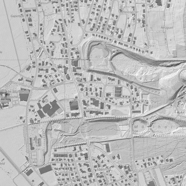
Digitales Terrainmodell (DTM) 2015
Digital Elevation Model (DTM 2015)
Digitales Terrainmodell über ganz Liechtenstein als Grid 0.5m, ohne Bruchkanten. Erstellt am 8. April 2015 (Talgebiet) und am 26. August 2015 (Berggebiet nach Schneefreiheit) von der Firma TopScan GmbH mit Laserscannermessung aus einer Cessna 402 B und einer mittl. Flughöhe von 800 m. Die Höhengenauigkeit (einfache Standardabweichung) des Terrainmodells beträgt ±0.2 m, die Punktdichte 4 Punkte pro Quadratmeter. Die Gemeinden des Landes haben sich an den Herstellungskosten beteiligt (keine Nutzungsgebühr bei Bezug).
Simple
-
Date (Création)Data (Creazione)Date (Creation)Datum (Erstellung)
- 2016-02-17
-
IdentifiantIdentificatoreIdentifierKennung
- https://metadata.geo.llv.li/3a1af678-01fa-4069-bc83-d17627725ef4
-
ButScopoPurposeZweck
-
Basisdaten, Höheninformation für einen präzise Beschreibung des Geländes.
-
ÉtatStatoStatusBearbeitungsstatus
-
TerminéCompletatoCompletedAbgeschlossen
Point de contact
Punto di contatto
Point of contact
Ansprechpartner
-
Heures de serviceOrario di servizioHours of serviceBetriebszeiten
-
8:00-11:30 und 13:30-17:00
-
Type de représentation spatialeTipo di rappresentazione spazialeSpatial representation typeRäumliche Darstellungsart
-
vecteurVettorialeVectorVektor
-
Catégorie de thèmeCategoria ISOTopic categoryThematik
-
-
C ÉlévationC AltitudineC ElevationC Höhenangaben
-
C ÉlévationC AltitudineC ElevationC Höhenangaben
-
Étendue
Estensione
Extent
Ausdehnung
Étendue
Estensione
Extent
Ausdehnung
-
DescriptionDescrizioneDescriptionBeschreibung
-
Liechtenstein
Liechtenstein
Liechtenstein
Liechtenstein
))

-
Fréquence de mise à jourFrequenza di aggiornamentoMaintenance and update frequencyWartungsintervall
-
InconnueSconosciutoUnknownUnbekannt
Format de la ressource
Formato della risorsa
Resource format
Format der Ressource
-
TitreTitoloTitleTitel
-
Erdas Imagine (IMG)
-
DateDataDateDatum
-
ÉditionEdizioneEditionAusgabe
-
unknown
Format de la ressource
Formato della risorsa
Resource format
Format der Ressource
-
TitreTitoloTitleTitel
-
ASPRS LASer (LAS)
-
DateDataDateDatum
- geocat.ch
-
-
INSPIRE
INSPIRE
INSPIRE
-
modèle numérique de terrain MNT
modello digitale del terreno DTM
digital terrain model DTM
-
LIDAR (Light Detection And Ranging)
LIDAR (Light Detection And Ranging)
LIDAR (Light Detection And Ranging)
-
représentation du terrain
rappresentazione del terreno
terrain representation
-
- GEMET - INSPIRE themes, version 1.0
-
-
Altitude
Elevazione
Elevation
-
- GEMET
-
-
altitude
altitudine
altitude
-
- Räumlicher Anwendungsbereich
-
-
Nationales
Nazionali
National
-
Contraintes sur la ressource
Vincoli sulle risorse
Resource constraints
Ressourcenbeschränkungen
-
Contraintes d'accèsVincoli di accessoAccess constraintsZugriffsbeschränkungen
-
Autres restrictionsAltre restrizioniOther restrictionsAndere Beschränkungen
-
Autres contraintesAltri vincoliOther constraintsAndere Einschränkungen
- no limitations to public access
-
PaysPaeseCountryStaat
-
LILILILI
-
Type de législationTipo di legislazioneLegislation TypeGesetzestyp
-
OrdonnanceOrdinanzaOrdinanceVerordnung
-
Niveau de la disposition légaleLivello della disposizione legaleLegislation LevelEbene der gesetzlichen Bestimmung
-
nationalnationalnationalnational
-
TitreTitoloTitleTitel
-
Verordnung über die Gebühren für die Nutzung der Geodateninfrastruktur Liechtenstein
-
Autre titreAltri nomi o acronimiAlternate titleAlternativtitel
-
GDI-Gebührenverordnung (GDI-GebV)
-
Date (Création)Data (Creazione)Date (Creation)Datum (Erstellung)
- 2011-08-30
Contraintes sur la ressource
Vincoli sulle risorse
Resource constraints
Ressourcenbeschränkungen
-
Limitation d'utilisationLimitazione d'usoUse limitationNutzungsbeschränkung
-
Zugangs- und Nutzungsbedingungen
-
Contraintes d'utilisationVincoli d'usoUse constraintsNutzungseinschränkungen
-
Autres restrictionsAltre restrizioniOther restrictionsAndere Beschränkungen
-
Autres contraintesAltri vincoliOther constraintsAndere Einschränkungen
-
lizenzfplichtig
-
LangueLinguaLanguageSprache
- Deutsch
-
Encodage de caractèresCodifica dei caratteriCharacter encodingZeichenkodierung
-
Utf8UTF8UTF8Utf8
-
Livré avec jeu de donnéesFornito con set di datiIncluded with datasetMit Datensatz geliefert
- 0
-
TitreTitoloTitleTitel
-
Digitales Höhenmodell (DHM)
-
Date (Révision)Data (Revisione)Date (Revision)Datum (Aktualisierung)
- 2016-02-17
-
Format de distributionFormato (codifica)Distribution formatAbgabeformat
-
-
GRID ASCII (XYZ)
-
GeoTIFF (GEOTIFF)
-
ESRI Arcinfo ASCII GRID (ASC)
-
AutoCAD DXF (DXF)
-
Point de contact
Punto di contatto
Point of contact
Ansprechpartner
-
Heures de serviceOrario di servizioHours of serviceBetriebszeiten
-
8:00-11:30 und 13:30-17:00
Options de transfert numérique
Opzioni di trasferimento digitale
Digital transfer options
Optionen für die digitale Übertragung
-
Ressource en ligneRisorsa onlineOnLine resourceOnline
-
Geodatenportal
Geodatenportal der Liecht. Landesverwaltung
Options de transfert numérique
Opzioni di trasferimento digitale
Digital transfer options
Optionen für die digitale Übertragung
-
Ressource en ligneRisorsa onlineOnLine resourceOnline
-
EL
INSPIRE View ServiceINSPIRE View ServiceINSPIRE View ServiceINSPIRE View Service
Options de transfert numérique
Opzioni di trasferimento digitale
Digital transfer options
Optionen für die digitale Übertragung
-
Ressource en ligneRisorsa onlineOnLine resourceOnline
-
INSPIRE Download Service (ATOM)
GML DownloadGML DownloadGML DownloadGML Download
Options de transfert numérique
Opzioni di trasferimento digitale
Digital transfer options
Optionen für die digitale Übertragung
-
Ressource en ligneRisorsa onlineOnLine resourceOnline
-
EL.GridCoverage
INSPIRE OGS WCS ServiceINSPIRE OGS WCS ServiceINSPIRE OGS WCS ServiceINSPIRE OGS WCS Service
-
NiveauLivelloHierarchy levelBezugsebene
-
Jeu de donnéesSet di datiDatasetDatenbestand
-
AutreAltroOtherSonstiges
-
alle Ebenen
Rapport sur la qualité
Rapporto sulla qualità
Report
Qualitätsbericht
Result
Risultato
Result
Ergebnis
-
TitreTitoloTitleTitel
-
Commission Regulation (EU) No 1089/2010 of 23 November 2010 implementing Directive 2007/2/EC of the European Parliament and of the Council as regards interoperability of spatial data sets and services
Commission Regulation (EU) No 1089/2010 of 23 November 2010 implementing Directive 2007/2/EC of the European Parliament and of the Council as regards interoperability of spatial data sets and services
Commission Regulation (EU) No 1089/2010 of 23 November 2010 implementing Directive 2007/2/EC of the European Parliament and of the Council as regards interoperability of spatial data sets and services
Commission Regulation (EU) No 1089/2010 of 23 November 2010 implementing Directive 2007/2/EC of the European Parliament and of the Council as regards interoperability of spatial data sets and services
-
Date (Publication)Data (Pubblicazione)Date (Publication)Datum (Publikation)
- 2010-12-08
-
ExplicationSpiegazioneExplanationErläuterung
-
INSPIRE Konformität
-
Degré de conformitéGrado di conformitàPassKonformitätsgrad
- true
-
Généralités sur la provenanceInformazioni generali sulla provenienzaStatementErklärung
-
Lascerscanning
-
NiveauLivelloHierarchy levelBezugsebene
-
Jeu de donnéesSet di datiDatasetDatenbestand
-
AutreAltroOtherSonstiges
-
alle Ebenen
-
Nom du système de référenceNome del sistema di riferimentoReference system identifierName des Referenzsystems
- http://www.opengis.net/def/crs/EPSG/0/2056
-
Nom du système de référenceNome del sistema di riferimentoReference system identifierName des Referenzsystems
- http://www.opengis.net/def/crs/EPSG/0/21782
-
Nom du système de référenceNome del sistema di riferimentoReference system identifierName des Referenzsystems
- http://www.opengis.net/def/crs/EPSG/0/4936
-
Fréquence de mise à jourFrequenza di aggiornamentoMaintenance and update frequencyWartungsintervall
-
Comme nécessaireSecondo necessitàAs neededBei Bedarf
Metadata
-
Identifiant des métadonnéesIdentificativo della schedaMetadata identifierIdentifikator des Metadatensatzes
- 3a1af678-01fa-4069-bc83-d17627725ef4
-
LangueLinguaLanguageSprache
- Deutsch
-
Encodage de caractèresCodifica dei caratteriCharacter encodingZeichenkodierung
-
Utf8UTF8UTF8Utf8
-
LangueLinguaLanguageSprache
- Français
-
Encodage de caractèresCodifica dei caratteriCharacter encodingZeichenkodierung
-
Utf8UTF8UTF8Utf8
-
LangueLinguaLanguageSprache
- Italiano
-
Encodage de caractèresCodifica dei caratteriCharacter encodingZeichenkodierung
-
Utf8UTF8UTF8Utf8
-
LangueLinguaLanguageSprache
- English
-
Encodage de caractèresCodifica dei caratteriCharacter encodingZeichenkodierung
-
Utf8UTF8UTF8Utf8
Point de contact
Punto di contatto
Point of contact
Ansprechpartner
-
Heures de serviceOrario di servizioHours of serviceBetriebszeiten
-
8:00-11:30 und 13:30-17:00
Type de ressource
Tipo di risorsa
Type of resource
Anwendungsbereich der Metadaten
-
Domaine d'application de la ressourceAmbito di applicazione della risorsaResource scopeDomäne der Ressourcenanwendung
-
Jeu de donnéesSet di datiDatasetDatenbestand
-
Informations de date (Création)Informazioni sulla data (Creazione)Date info (Creation)Datumsangaben (Erstellung)
- 2016-08-03T14:22:56Z
-
Informations de date (Révision)Informazioni sulla data (Revisione)Date info (Revision)Datumsangaben (Aktualisierung)
- 2026-05-05T12:36:17.041048Z
Norme des métadonnées
Standard dei metadati
Metadata standard
Metadatenstandard
-
TitreTitoloTitleTitel
-
eCH-0271