 geocat.ch
Moorschutzverordnung
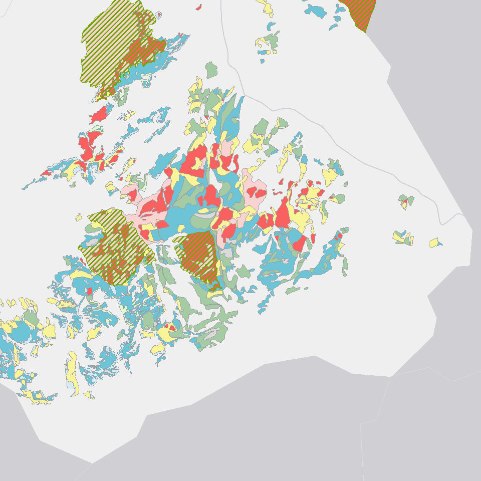
Zeigt die gemäß Verordnung geschützten Moore des Kantons Luzern.
Simple
- Alternate title
-
MSVXXXXX_COL
- Date (Creation)
- 2017-06-19
- Presentation form
- Digital map
- Purpose
-
Die Verordnung zum Schutz der Moore (SRL 712c) hat zum Zweck, die Moore zu erhalten und die Regeneration beeinträchtigter Moore zu fördern. Die geschützten Moore werden in Bewirtschaftungs- und Pufferzonen eingeteilt. Die Schutzbestimmungen der einzelnen Zonen sind in der Moorschutzverordnung (SRL 712c) geregelt.Moore im Kanton LuzernMoore gehören zu den traditionellen Landschaftselementen des Kantons Luzern. Während der letzten Jahrhunderte gerieten sie durch Entwässerung und Torfabbau stark unter Druck. Heute beträgt die von Mooren bedeckte Fläche noch rund zehn Prozent der ursprünglichen Ausdehnung. Wegen ihrer wichtigen Funktion als Lebensraum und Vernetzungselement sind die verbliebenen Moore in der ganzen Schweiz gesetzlich geschützt. Als Wasser- und Kohlenstoffdioxid (CO2)-Speicher gewinnen Moorflächen zusätzlich an Bedeutung.
- Status
- On going
Publisher
Owner
- Spatial representation type
- Vector
- Topic category
-
- L Environment
Extent
Extent
- Description
-
Kanton Luzern
))
- Maintenance and update frequency
- As needed
- geocat.ch
-
-
opendata.swiss
-
Biodiversität
-
Eigentumsbeschränkung/ÖREB
-
Landschaftsschutz
-
Landwirtschaftliche Nutzung
-
Lebensraum
-
Moor
-
Naturschutz
-
Nutzungsplanung
-
Raumplanung
-
Resource constraints
- Access constraints
- none
- Use constraints
- Copyright
Resource constraints
- Use limitation
-
öffentlich zugängliche Geobasisdaten
Resource constraints
- Access constraints
- none
- Use constraints
- none
Resource constraints
- Use limitation
-
Freie Nutzung. Quellenangabe ist Pflicht
Associated resource
- Association Type
- Reference to a master resource of which this one is a part
- Metadata Reference
Associated resource
- Association Type
- Reference to a master resource of which this one is a part
- Metadata Reference
- Distribution format
-
-
ESRI Geodatabase (.gdb)
-
ESRI Shapefile (.shp)
-
OGC GeoPackage (.gpkg)
-
Point of contact
Digital transfer options
- OnLine resource
-
Datenshop
Produktansicht Geodatenshop
- Statement
-
unbekannt
- Reference system identifier
- EPSG:2056
- Maintenance and update frequency
- Not planned
Metadata
- Metadata identifier
- 347c99de-9b46-42aa-aa0b-092943c6216f
- Language
- Deutsch
- Character encoding
- UTF-8
Point of contact
Type of resource
- Resource scope
- Dataset
- Metadata linkage
-
https://www.geocat.ch/geonetwork/srv/api/records/347c99de-9b46-42aa-aa0b-092943c6216f
- Date info (Creation)
- 2017-06-19
- Date info (Revision)
- 2026-06-19T03:32:08.477162Z
Metadata standard
- Title
-
ISO19115.3-2018.che
)))