geocat.ch
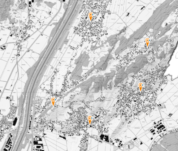
Notfalltreffpunkte - Anlaufstellen im Ereignisfall
Beim Notfalltreffpunkt erhalten Sie im Ereignisfall Informationen und Unterstützung. Die Behörden informieren über Radio / Fernsehen und App / Internet (Alertswiss), wenn die Notfalltreffpunkte in Betrieb sind.
Simple
-
Autre titreAltri nomi o acronimiAlternate titleAlternativtitel
-
Anlaufstelle im Ereignisfall in den Gemeinden Balzers, Eschen-Nendeln, Gamprin-Bendern, Mauren-Schaanwald, Planken, Ruggell, Schaan, Schellenberg, Triesen, Triesenberg und Vaduz.
-
Date (Publication)Data (Pubblicazione)Date (Publication)Datum (Publikation)
- 2022-12-31
-
IdentifiantIdentificatoreIdentifierKennung
- https://metadata.geo.llv.li/171c88e5-2a81-48de-9292-3c642b68e56d
-
ButScopoPurposeZweck
-
Notfallvorsorge
-
ÉtatStatoStatusBearbeitungsstatus
-
ContinuIn corsoOn goingKontinuierliche Aktualisierung
Propriétaire
Proprietario
Owner
Eigentümer
-
Heures de serviceOrario di servizioHours of serviceBetriebszeiten
-
8:00-11:30 und 13:30-17:00
-
Type de représentation spatialeTipo di rappresentazione spazialeSpatial representation typeRäumliche Darstellungsart
-
vecteurVettorialeVectorVektor
Résolution spatiale
Risoluzione spaziale
Spatial resolution
Räumliche Auflösung
Fraction représentative
Frazione rappresentativa
Equivalent scale
Vergleichsmassstab
-
DénominateurDenominatoreDenominatorMassstabszahl
- 500
-
Catégorie de thèmeCategoria ISOTopic categoryThematik
-
-
N SantéN SaluteN HealthN Gesundheit
-
Étendue
Estensione
Extent
Ausdehnung
Étendue
Estensione
Extent
Ausdehnung
-
DescriptionDescrizioneDescriptionBeschreibung
-
Liechtenstein
Liechtenstein
Liechtenstein
Liechtenstein
))

-
Fréquence de mise à jourFrequenza di aggiornamentoMaintenance and update frequencyWartungsintervall
-
ContinueContinuaContinualKontinuierlich
Point de contact
Punto di contatto
Point of contact
Ansprechpartner
-
Heures de serviceOrario di servizioHours of serviceBetriebszeiten
-
8:00-11:30 und 13:30-17:00
Format de la ressource
Formato della risorsa
Resource format
Format der Ressource
-
TitreTitoloTitleTitel
-
INTERLIS 2 (XTF)
-
DateDataDateDatum
- GEMET
-
-
agriculture
agricoltura
agriculture
-
utilisation du sol
uso del suolo
soil use
-
utilisation du sol
uso del suolo
soil use
-
- GEMET
-
-
plan d'urgence
piano di emergenza
emergency plan
-
- GEMET - INSPIRE themes, version 1.0
-
-
Santé et sécurité des personnes
Salute umana e sicurezza
Human health and safety
-
- geocat.ch
-
-
lieu de rencontre
luogo di ritrovo
meeting point
-
Contraintes sur la ressource
Vincoli sulle risorse
Resource constraints
Ressourcenbeschränkungen
-
Contraintes d'accèsVincoli di accessoAccess constraintsZugriffsbeschränkungen
-
Autres restrictionsAltre restrizioniOther restrictionsAndere Beschränkungen
-
Autres contraintesAltri vincoliOther constraintsAndere Einschränkungen
- No limitations to public accessNo limitations to public accessNo limitations to public accessNo limitations to public access
-
LangueLinguaLanguageSprache
- Deutsch
-
Encodage de caractèresCodifica dei caratteriCharacter encodingZeichenkodierung
-
Utf8UTF8UTF8Utf8
-
Format de distributionFormato (codifica)Distribution formatAbgabeformat
-
-
INTERLIS 1 (ITF)
-
Distributeur
Distributore
Distributor
Verteiler
-
Heures de serviceOrario di servizioHours of serviceBetriebszeiten
-
8:00-11:30 und 13:30-17:00
-
TaxesTasseFeesGebühren
-
Aufwand
Options de transfert numérique
Opzioni di trasferimento digitale
Digital transfer options
Optionen für die digitale Übertragung
Options de transfert numérique
Opzioni di trasferimento digitale
Digital transfer options
Optionen für die digitale Übertragung
-
Ressource en ligneRisorsa onlineOnLine resourceOnline
-
undefined
Options de transfert numérique
Opzioni di trasferimento digitale
Digital transfer options
Optionen für die digitale Übertragung
-
Ressource en ligneRisorsa onlineOnLine resourceOnline
-
OGC WMS Service der Liechtensteinen Landesverwaltung
OGC WMS Service der Liechtensteinen Landesverwaltung
-
Niveau de topologieLivello di topologiaTopology levelTopologieebene
-
Topologie de réseau complèteGrafo planare completoFull planar graphVollständige Netzwerktopologie
-
Type d’objet géométriqueTipo di oggetto geometricoGeometric object typeTyp des geometrischen Objekts
-
PolygoneSuperficieSurfacesurface
-
Nombre d’objets géométriquesNumero di oggetti geometriciGeometric object countAnzahl geometrischer Objekte
- 100
-
Nom du système de référenceNome del sistema di riferimentoReference system identifierName des Referenzsystems
- EPSG:2056
Metadata
-
Identifiant des métadonnéesIdentificativo della schedaMetadata identifierIdentifikator des Metadatensatzes
- 171c88e5-2a81-48de-9292-3c642b68e56d
-
LangueLinguaLanguageSprache
- Deutsch
-
Encodage de caractèresCodifica dei caratteriCharacter encodingZeichenkodierung
-
Utf8UTF8UTF8Utf8
-
LangueLinguaLanguageSprache
- Français
-
Encodage de caractèresCodifica dei caratteriCharacter encodingZeichenkodierung
-
Utf8UTF8UTF8Utf8
-
LangueLinguaLanguageSprache
- Italiano
-
Encodage de caractèresCodifica dei caratteriCharacter encodingZeichenkodierung
-
Utf8UTF8UTF8Utf8
-
LangueLinguaLanguageSprache
- English
-
Encodage de caractèresCodifica dei caratteriCharacter encodingZeichenkodierung
-
Utf8UTF8UTF8Utf8
Point de contact
Punto di contatto
Point of contact
Ansprechpartner
-
Heures de serviceOrario di servizioHours of serviceBetriebszeiten
-
8:00-11:30 und 13:30-17:00
Type de ressource
Tipo di risorsa
Type of resource
Anwendungsbereich der Metadaten
-
Domaine d'application de la ressourceAmbito di applicazione della risorsaResource scopeDomäne der Ressourcenanwendung
-
Jeu de donnéesSet di datiDatasetDatenbestand
-
Informations de date (Création)Informazioni sulla data (Creazione)Date info (Creation)Datumsangaben (Erstellung)
- 2023-04-18T06:47:20.517Z
-
Informations de date (Révision)Informazioni sulla data (Revisione)Date info (Revision)Datumsangaben (Aktualisierung)
- 2026-04-13T09:31:49.650138Z
Norme des métadonnées
Standard dei metadati
Metadata standard
Metadatenstandard
-
TitreTitoloTitleTitel
-
eCH-0271