geocat.ch
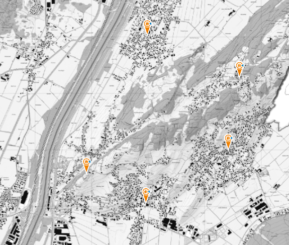
Notfalltreffpunkte - Anlaufstellen im Ereignisfall
Beim Notfalltreffpunkt erhalten Sie im Ereignisfall Informationen und Unterstützung. Die Behörden informieren über Radio / Fernsehen und App / Internet (Alertswiss), wenn die Notfalltreffpunkte in Betrieb sind.
Simple
- Alternate title
-
Anlaufstelle im Ereignisfall in den Gemeinden Balzers, Eschen-Nendeln, Gamprin-Bendern, Mauren-Schaanwald, Planken, Ruggell, Schaan, Schellenberg, Triesen, Triesenberg und Vaduz.
- Date (Publication)
- 2022-12-31
- Identifier
- https://metadata.geo.llv.li/171c88e5-2a81-48de-9292-3c642b68e56d
- Purpose
-
Notfallvorsorge
- Status
- On going
Owner
- Hours of service
-
8:00-11:30 und 13:30-17:00
- Spatial representation type
- Vector
Spatial resolution
Equivalent scale
- Denominator
- 500
- Topic category
-
- N Health
Extent
Extent
- Description
-
Liechtenstein
))

- Maintenance and update frequency
- Continual
Point of contact
- Hours of service
-
8:00-11:30 und 13:30-17:00
Resource format
- Title
-
INTERLIS 2 (XTF)
- Date
- GEMET
-
-
agriculture
-
soil use
-
soil use
-
- GEMET
-
-
emergency plan
-
- GEMET - INSPIRE themes, version 1.0
-
-
Human health and safety
-
- geocat.ch
-
-
meeting point
-
Resource constraints
- Access constraints
- Other restrictions
- Other constraints
- No limitations to public access
- Language
- Deutsch
- Character encoding
- UTF8
- Distribution format
-
-
INTERLIS 1 (ITF)
-
Distributor
- Hours of service
-
8:00-11:30 und 13:30-17:00
- Fees
-
Aufwand
Digital transfer options
Digital transfer options
- OnLine resource
-
undefined
Digital transfer options
- OnLine resource
-
OGC WMS Service der Liechtensteinen Landesverwaltung
OGC WMS Service der Liechtensteinen Landesverwaltung
- Topology level
- Full planar graph
- Geometric object type
- Surface
- Geometric object count
- 100
- Reference system identifier
- EPSG:2056
Metadata
- Metadata identifier
- 171c88e5-2a81-48de-9292-3c642b68e56d
- Language
- Deutsch
- Character encoding
- UTF8
- Language
- Français
- Character encoding
- UTF8
- Language
- Italiano
- Character encoding
- UTF8
- Language
- English
- Character encoding
- UTF8
Point of contact
- Hours of service
-
8:00-11:30 und 13:30-17:00
Type of resource
- Resource scope
- Dataset
- Metadata linkage
-
https://www.geocat.ch/geonetwork/srv/api/records/171c88e5-2a81-48de-9292-3c642b68e56d
- Date info (Creation)
- 2023-04-18T06:47:20.517Z
- Date info (Revision)
- 2026-04-13T09:31:49.650138Z
Metadata standard
- Title
-
eCH-0271