geocat.ch
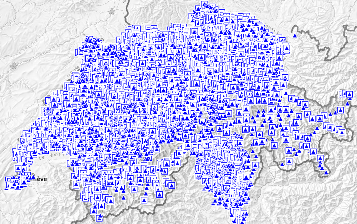
Planimetric control Points LFP2 (Cadastral surveying)
Les points de mensuration constituent la base de toutes les données à référence spatiale. Ces points fixes (points fixes planimétriques (PFP) et points fixes altimétriques (PFA)) sont utilisés pour tous les travaux de mensuration nécessitant une détermination fiable et précise. Par point fixe planimétrique, on entend un point matérialisé de façon durable à l'aide d'une borne ou d'une cheville (parfois située dans un regard) dont les coordonnées et éventuellement l'altitude sont connues. Les points fixes planimétriques de catégorie 2 (PFP2) servent à densifier le réseau de points national et constituent la base de la mensuration officielle.Les cantons sont compétents pour les points fixes de catégorie 2. Les données se basent sur le modèle « Service de données sur les points fixes 2.0 » de la CGC (modèle de données KGKCGC_FPDS2_V1_1, version 1.1).
Simple
- Alternate title
-
Planimetric control points LFP2
- Date (Creation)
- 2010-02-09
- Date (Revision)
- 2023-03-15
- Identifier
- ch.swisstopo.fixpunkte-lfp2
Point of contact
GeoMeta
- Spatial representation type
- Vector
- Topic category
-
- B Location
Extent
Extent
- Description
-
Switzerland
))

- Maintenance and update frequency
- Daily
- Maintenance note
-
Cantons are responsible for the second class (LFP2). They are updated periodically or on an ongoing basis.
- geocat.ch
-
-
cadastral surveying
-
fixpoint
-
- GEMET - INSPIRE themes, version 1.0
-
-
Coordinate reference systems
-
- geocat.ch
-
-
FSDI Federal Spatial Data Infrastructure
-
- Language
- Français
- Character encoding
- UTF8
- Language
- Deutsch
- Character encoding
- UTF8
- Language
- Italiano
- Character encoding
- UTF8
- Basic Geodata
- true
- Basic Geodata ID
-
54.1
- Basic Geodata Legal Level
- Federal
- Included with dataset
- false
- Title
-
Datenmodell der amtlichen Vermessung "Bund" (DMAV)
- Alternate title
-
DMAV FixpunkteAVKategorie2 V1.0
- Date (Publication)
- 2023-06-13
- Website
- Distribution format
-
-
INTERLIS 2 (XTF)
-
OGC Geopackage (GPKG)
-
ESRI Shapefile (SHP)
-
OGC Web Feature Service (WFS)
-
OGC Web Map Service (WMS)
-
Digital transfer options
- OnLine resource
-
Aperçu map.geo.admin.ch
Preview map.geo.admin.ch
Digital transfer options
- OnLine resource
-
ch.swisstopo.fixpunkte-lfp2
WMS-FSDI service, layer "Planimetric control points LFP2"
Digital transfer options
- OnLine resource
-
Le service de données sur les points fixes (FPDS)
Geodetic points (FPDS)
Digital transfer options
- OnLine resource
-
Ordonnance du DDPS sur la mensuration officielle (OMO-DDPS)
Classified Compilation
Digital transfer options
- OnLine resource
-
Distribution des données
Digital transfer options
- OnLine resource
-
Portail thématique
Thematic Portal
Digital transfer options
- OnLine resource
-
RESTful API de geo.admin.ch
RESTful API from geo.admin.ch
- Maintenance and update frequency
- As needed
Metadata
- Metadata identifier
- 12ee04c7-b38d-4809-b417-ce304df6c7cc
- Language
- Français
- Character encoding
- UTF8
- Language
- Deutsch
- Character encoding
- UTF8
- Language
- Italiano
- Character encoding
- UTF8
- Language
- English
- Character encoding
- UTF8
- Language
- Rumantsch
- Character encoding
- UTF8
Point of contact
Type of resource
- Resource scope
- Dataset
- Metadata linkage
-
https://www.geocat.ch/geonetwork/srv/api/records/12ee04c7-b38d-4809-b417-ce304df6c7cc
- Date info (Creation)
- 2010-02-25T12:03:46Z
- Date info (Revision)
- 2026-04-13T09:23:17.207667Z
Metadata standard
- Title
-
eCH-0271